
Wallis
Descripción
Mapa

Senderos en región
Enlaces
Datos
Informes
Guías y mapas
Hospedaje
Organizaciones
Operadores turísticos
GPS
Otro
Libros

Stanfords
United Kingdom
2019
United Kingdom
2019
- Haute-Savoie a Pied - 54 circuits dont 8 adaptés à la marche nordique
- But don`t be fooled: if Haute-Savoie is home to the Mecca of mountaineering, it is also a hiker`s paradise! Beyond the GR® trails (the prestigious GR® 5 and GR® Tour du Mont Blanc), discover the diversity of the landscapes of a department with dynamic demography and economy. Pure lake waters, freshness of deep forests, distant horizons of... Leer más

Stanfords
United Kingdom
United Kingdom
- Futuna - Alofi IGN 4902
- The islands of Futuna and Alofi (the Hoorn Islands) in the Pacific Ocean, part of the French COM (collectivité d`outre-mer) of Wallis and Futuna, on a detailed survey map at 1:25,000 from the IGN, France’s topographic survey organization. Leer más

Stanfords
United Kingdom
United Kingdom
- Wallis IGN Map
- The island of Wallis (‘Uvea) in the Pacific Ocean, part of the French COM (collectivité d`outre-mer) of Wallis and Futuna, on a detailed survey map at 1:25,000 from the IGN, France’s topographic survey organization. Leer más

The Book Depository
United Kingdom
2021
United Kingdom
2021
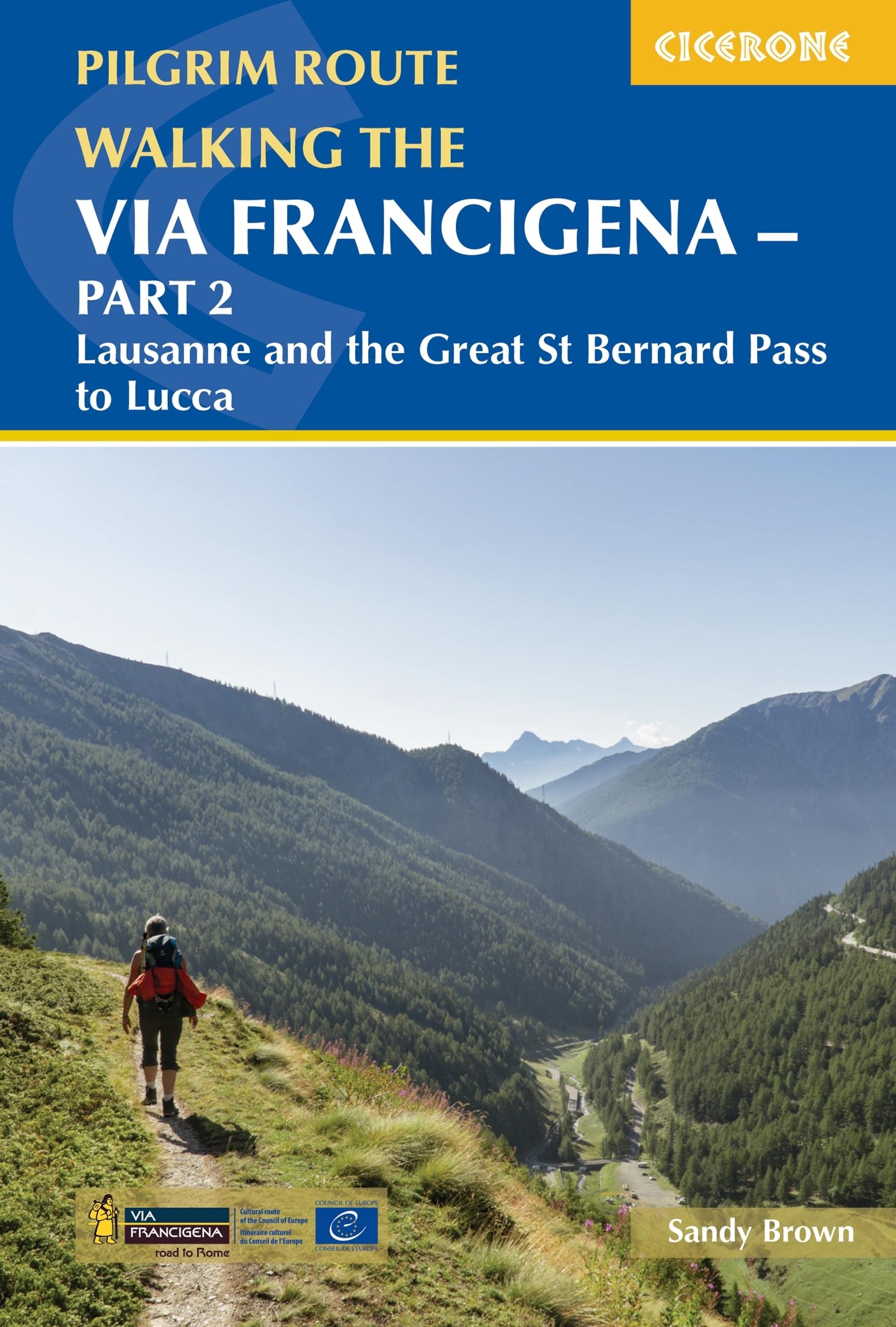
- Walking the Via Francigena Pilgrim Route - Part 2
- Lausanne and the Great St Bernard Pass to Lucca Leer más
- Also available from:
- De Zwerver, Netherlands
De Zwerver
Netherlands
2021
Netherlands
2021
- Wandelgids - Pelgrimsroute Via Francigena part 2 | Cicerone
- Lausanne and the Great St Bernard Pass to Lucca Leer más

- Also available from:
- De Zwerver, Netherlands

Stanfords
United Kingdom
2020
United Kingdom
2020
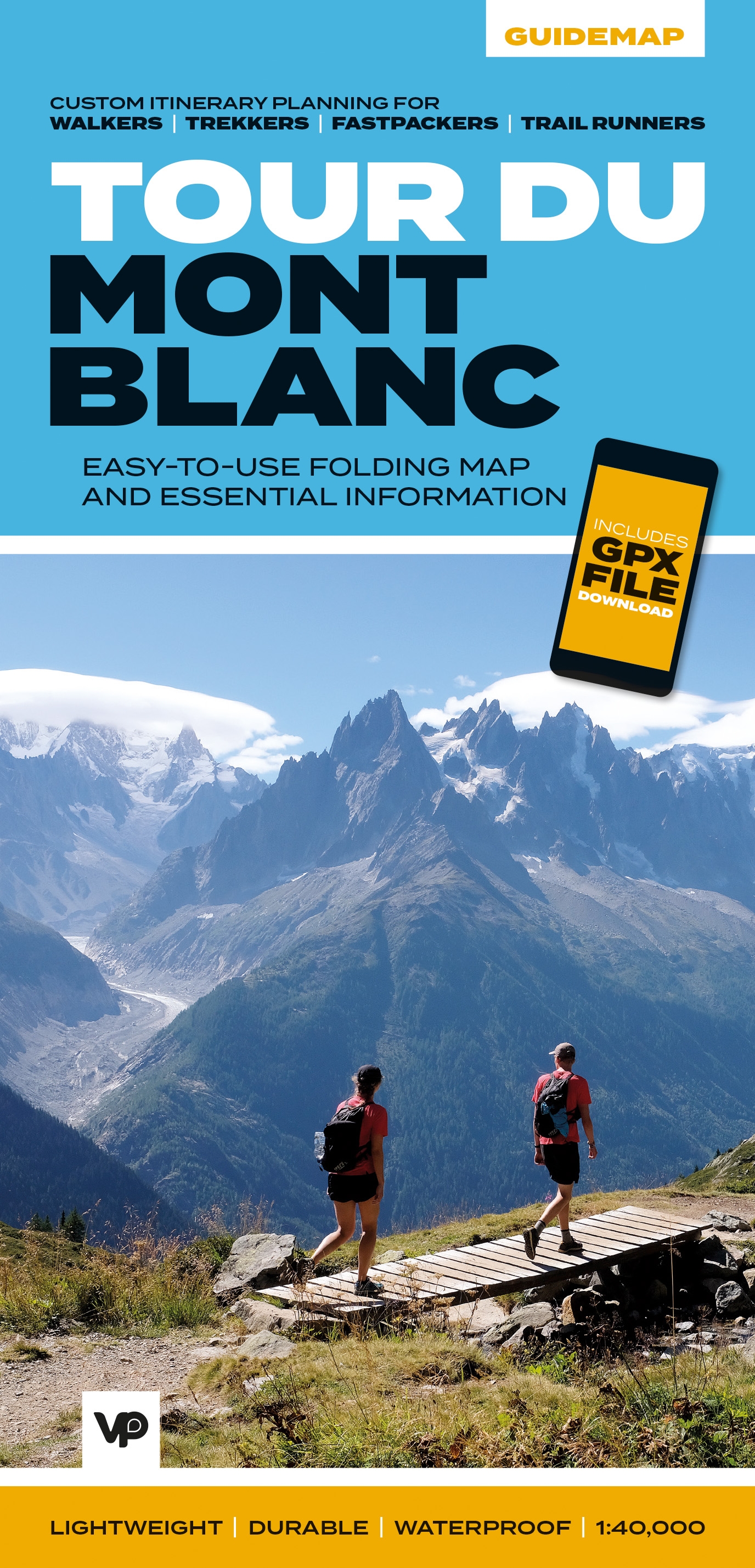
- Tour du Mont Blanc - Easy-to-use Folding Map and Essential Information
- The white dome of Mont Blanc looms over France, Italy and Switzerland, and it is no wonder that the 169-kilometre Tour du Mont Blanc (TMB) has captured the public imagination to become one of Europe`s most popular long-distance trails. The TMB appeals to people who have different levels of experience and travel at all speeds, and this... Leer más
- Also available from:
- The Book Depository, United Kingdom
- De Zwerver, Netherlands

The Book Depository
United Kingdom
2020
United Kingdom
2020
- Tour du Mont Blanc
- Easy-to-use folding map and essential information, with custom itinerary planning for walkers, trekkers, fastpackers and trail runners Leer más
De Zwerver
Netherlands
2020
Netherlands
2020
- Wandelkaart Tour du Mont Blanc Guidemap | Vertebrate Publishing
- Easy-to-use folding map and essential information, with custom itinerary planning for walkers, trekkers, fast packers and trail runners Leer más

- Also available from:
- De Zwerver, Netherlands

The Book Depository
United Kingdom
2015
United Kingdom
2015
- The Way of St Francis
- Via di Francesco: From Florence to Assisi and Rome Leer más
- Also available from:
- De Zwerver, Netherlands

De Zwerver
Netherlands
2019
Netherlands
2019
- Wandelgids - Pelgrimsroute The Way of St Francis - Via Francigena | Cicerone
- Guidebook to walking the Way of St Francis, Via di Francesco. 550km pilgrimage from Florence, through Assisi to Rome through Central Italy visiting key sites from the saint's life. Described in 28 stages, the guide to the month-long route includes detailed maps, profiles and information about all the shrines, churches and towns along the way. Leer más


- Also available from:
- De Zwerver, Netherlands

The Book Depository
United Kingdom
2022
United Kingdom
2022
- Trekking Chamonix to Zermatt
- The classic Walker's Haute Route Leer más
- Also available from:
- De Zwerver, Netherlands
De Zwerver
Netherlands
2022
Netherlands
2022
- Wandelgids Chamonix to Zermatt | Cicerone
- The classic Walker's Haute Route Leer más

Stanfords
United Kingdom
2019
United Kingdom
2019
- Tour du Mont Blanc: The World`s most famous trek - everything you need to know to plan and walk it
- The world`s most famous trek: everything you need to know to plan and walk the Tour du Mont Blanc which starts near Chamonix. An epic journey around the mighty Mont Blanc, the highest peak in the Alps. 174km; 7-12 days; 9700m of altitude gain; 14 mountain passes; 3 countries, France, Italy and Switzerland. Unspoilt and remote high mountain... Leer más
- Also available from:
- The Book Depository, United Kingdom
- De Zwerver, Netherlands

The Book Depository
United Kingdom
2019
United Kingdom
2019
- Tour du Mont Blanc
- The World's most famous trek - everything you need to know to plan and walk it Leer más
De Zwerver
Netherlands
2019
Netherlands
2019
- Wandelgids Tour Du Mont Blanc | Knife Edge Outdoor
- The World's most famous trek - everything you need to know to plan and walk it Leer más

The Book Depository
United Kingdom
2021
United Kingdom
2021
- Walking in Zermatt and Saas-Fee
- 50 routes in the Valais: Mattertal and Saastal Leer más
- Also available from:
- De Zwerver, Netherlands
De Zwerver
Netherlands
2021
Netherlands
2021
- Wandelgids Walking in Zermatt and Saas-Fee | Cicerone
- Guidebook describing 50 varied walks in the Valais region in the heart of the Swiss Alps. The graded day walks based around the popular resort towns of Zermatt and Saas-Fee explore the Mattertal and Saastal valleys and the surrounding mountains. Ranging from 4 to 18km, the easily accessible routes make use of the area`s extensive network of... Leer más

Stanfords
United Kingdom
2019
United Kingdom
2019
- Walkers`s Haute Route: Chamonix to Zermatt: The epic journey between Mont Blanc and the Matterhorn
- An incredible trek between the two most famous mountain towns in the Alps. Travelling from Chamonix in France to Zermatt in Switzerland, you will start at Mont Blanc and finish at the Matterhorn. On the way, pass the largest collection of snowy 4000m summits in the Alps: Mont Blanc, Grand Combin, the Weisshorn, the Zinalrothorn, the Dom, the... Leer más
- Also available from:
- The Book Depository, United Kingdom
- De Zwerver, Netherlands

The Book Depository
United Kingdom
2019
United Kingdom
2019
- Walkers's Haute Route: Chamonix to Zermatt
- The epic journey between Mont Blanc and the Matterhorn Leer más

De Zwerver
Netherlands
2019
Netherlands
2019
- Wandelgids Walker's Haute Route: Chamonix to Zermatt | Knife Edge Outdoor
- The epic journey between Mont Blanc and the Matterhorn Leer más

The Book Depository
United Kingdom
2020
United Kingdom
2020
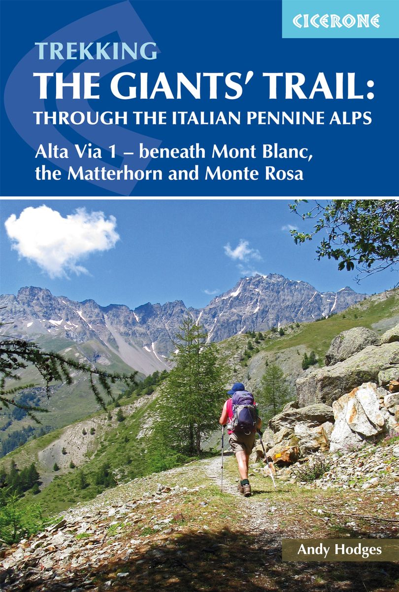
- Trekking the Giants' Trail: Alta Via 1 through the Italian Pennine Alps
- Beneath Mont Blanc, the Matterhorn and Monte Rosa Leer más
- Also available from:
- De Zwerver, Netherlands
De Zwerver
Netherlands
2020
Netherlands
2020
- Wandelgids The Giants' Trail: Alta Via 1 Through the Italian Pennine Alps | Cicerone
- Beneath Mont Blanc, the Matterhorn and Monte Rosa Leer más
Mapas

Stanfords
United Kingdom
United Kingdom
- Siena - Volterra - Massa Marittima - Roccastrada Kompass 2462
- Siena - Volterra - Massa Marittima - Rocca Strada map at 1:50,000 from Kompass, printed on durable, waterproof and tear-resistant synthetic paper. Coverage includes Colle di Va d’Elsa, Casole d’Elsa, Metallifere hills, etc. Contours are at 40m intervals, with a 2-km UTM grid. Extensive overprint includes GEA - Grande Escursione Appenninica,... Leer más

Stanfords
United Kingdom
United Kingdom
- Valais Central Supertrail Map
- The new Supertrail Maps show the best singletrails in Europe’s hottest mountain bike spots. These unique topographic maps make the knowledge of locals available to other mountain bikers. Consistent difficulty rating and useful additional information prevent the user from critical situations on the trails. The best singletrails in the best... Leer más

Stanfords
United Kingdom
2015
United Kingdom
2015
- Mont-Blanc - Annecy Didier Richard 02
- Mont Blanc Massif and the adjoining region of the French Alps at 1:60,000 on a contoured and GPS compatible map from Didier Richard with a base derived from IGN’s topographic survey, highlighting both local hiking routes and the GR network of long-distance paths, gîtes and mountain refuges, interesting natural and cultural sites, etc. The map... Leer más

Stanfords
United Kingdom
United Kingdom
- Val Brembana - Valsassina - Le Grigne: Lecco - Bergamo 50K IGC Map No. 22
- Val Brembana - Valsassina - Le Grigne area including Lecco and Bergamo in a series contoured hiking maps at 1:50,000 with local trails, long-distance footpaths, mountain accommodation, etc. from the Turin based Istituto Geografico Centrale.Maps in this series have contours at 50m intervals, enhanced by shading and graphic relief. An overprint... Leer más

Stanfords
United Kingdom
United Kingdom
- Chamonix-Mont-Blanc - Massif du Mont-Blanc IGN 3630OT
- Map No. 3630OT, Chamonix - Massif du Mont Blanc area of the French Alps, single-sided version on paper in the TOP25 edition of IGN’s excellent, detailed topographic survey of France at 1:25,000, with an overprint highlighting hiking paths, long-distance GR routes, campsites and other tourist information, plus a GPS compatible UTM grid. The map... Leer más

Stanfords
United Kingdom
United Kingdom
- Massif du Mont Blanc IGN Wall Map
- Massif du Mont Blanc presented on an encapsulated waterproof wall map, size 100 x 131cm (39.5” x 51.5”approx), with cartography of IGN’s excellent TOP25 series reduced slightly to 1:28,000, plus an additional enlargement for the glaciers between the Aiguille du Midi and the peak of Mont Blanc. The map combines sections from the two TOP25 Mont... Leer más

Stanfords
United Kingdom
United Kingdom
- Pilgrim Routes in the Florentine Countryside: Western Part
- Pilgrim Routes in the Florentine Countryside: Western Part at 1:50,000 is one of two maps from Edizioni Multigraphics highlighting old routes towards Rome, in this title: Via Sanese and Via Pisana, plus a section of Via Francigena.The map covers an area between Florence and Siena and highlights the course of two routes between these cities: Via... Leer más

Stanfords
United Kingdom
United Kingdom
- Cinque Terre - Golfo del Tigullio: La Spezia - Sestri Levante - Rapallo - Genoa 50K IGC Map No. 23
- Cinque Terre - Golfo del Tigullio area of the Italian Riviera from genoa to la Spezia including Sestri Levante and Rapallo in a series contoured hiking maps at 1:50,000 with local trails, long-distance footpaths, mountain accommodation, etc. from the Turin based Istituto Geografico Centrale.Maps in this series have contours at 50m intervals,... Leer más

Stanfords
United Kingdom
United Kingdom
- Val d`Arbia, Ombrone and Orcia
- The valleys of Arbia, Ombrone and Orcia in Tuscany directly south of Siena on a detailed contoured map at 1:50,000 from Litografia Artistica Cartografica highlighting the course of La Via Francigena and other waymarked local trails.The map covers an area from Siena southwards to Castel del Piano including several nature reserves. Topography is... Leer más

Stanfords
United Kingdom
United Kingdom
- Lake Trasimeno - Val d`Orcia - Montepulciano - Monte Amiata Kompass 2463
- Lake Trasimeno - Val d`Orcia - Montepulciano - Monte Amiata area on a double-sided map at 1:50,000 from Kompass, printed on durable, waterproof and tear-resistant synthetic paper. Coverage includes Val di Chiana, Cortona, Montalcino, Asciano, Arcidosso, Fabro, Magione, etc. Contours are at 40m intervals, with a 2-km UTM grid. Extensive... Leer más

Stanfords
United Kingdom
United Kingdom
- Tour of the Matterhorn / Cervino L`Escursionista Editore Map-Guide
- Tour of the Matternhorn (Il Cervino) & Gran Balconata del Cervino long-distance hiking routes presented on a waterproof and tear-restant, double-sided, contoured and GPS compatible map published jointly by L’Escursionista Editore and Editrek, with a separate guide booklet for each route.On one side is a map at 1:50,000 showing the Tour of the... Leer más

Stanfords
United Kingdom
United Kingdom
- Montreux
- Montreux - Col du Pillon area at 1:50,000 in a series from Hallwag covering Switzerland’s popular hiking regions on light, waterproof and tear-resistant maps highlighting long-distance paths: the nine national routes plus special regional routes, as well as other local hiking trails.Cartography is similar to that used both in Hallwag’s hiking... Leer más

Stanfords
United Kingdom
United Kingdom
- Valais / Wallis Swisstopo 105
- Swiss topographic survey at 1:100,000 from Swisstopo, highly regarded for it superb use of graphic relief and hill shading, presenting an almost 3-D picture of the country`s mountainous terrain. Coverage is available either as small size standard sheets – Nos 26 to 48, each covering 70 x 48 km / 43 x 30 miles approx, or as larger size maps -... Leer más

Stanfords
United Kingdom
United Kingdom
- Lanzo - Viù - Chialamberto - Locana 25K IGC Map No. 110
- Lanzo - Viù - Chialamberto - Locana – Cirié – Basse Valli di Lanzo area at 1:25,000 in a series of contoured, GPS compatible walking maps from the Turin based Istituto Geografico Centrale, highlighting hiking trails including long-distance routes, ski routes and alpine accommodation. Maps in this series have contours at 25m intervals, enhanced... Leer más

Stanfords
United Kingdom
United Kingdom
- Cervino - Monte Rosa - Valtourenche - Valle di Champorcher L`Escursionista Editore
- Cervino/Matterhorn - Monte Rosa - Valtourenche - Gressoney - Valle di Champorcher area of the Italian Alps on a contoured and GPS compatible map at 1:50,000 from L’Escursionista Editore, with an accompanying booklet providing English language descriptions of five hiking tours.The map has contours at 25m intervals with relief shading and spot... Leer más