
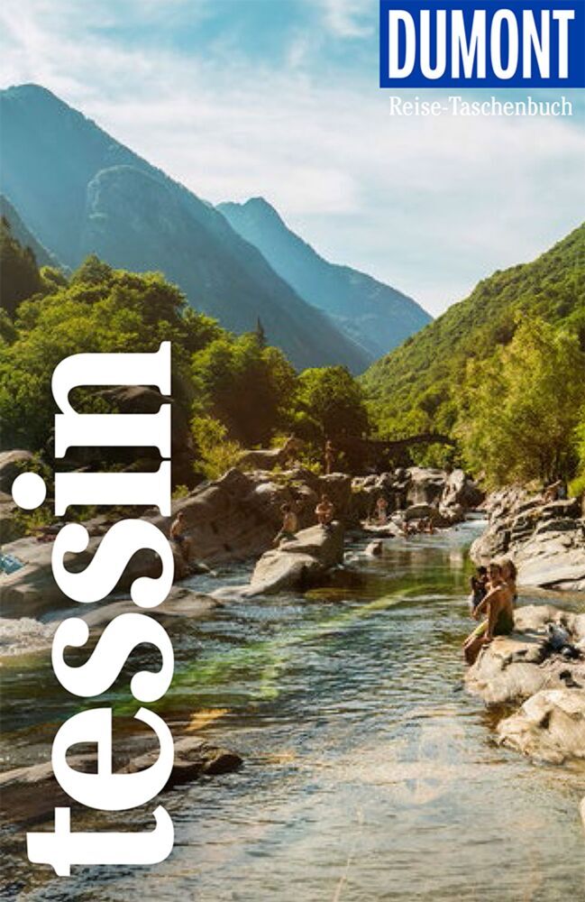
Ticino
Descripción
Mapa

Senderos en región
Enlaces
Datos
Informes
Guías y mapas
Hospedaje
Organizaciones
Operadores turísticos
GPS
Otro
Libros

- Also available from:
- De Zwerver, Netherlands

The Book Depository
United Kingdom
2023
United Kingdom
2023
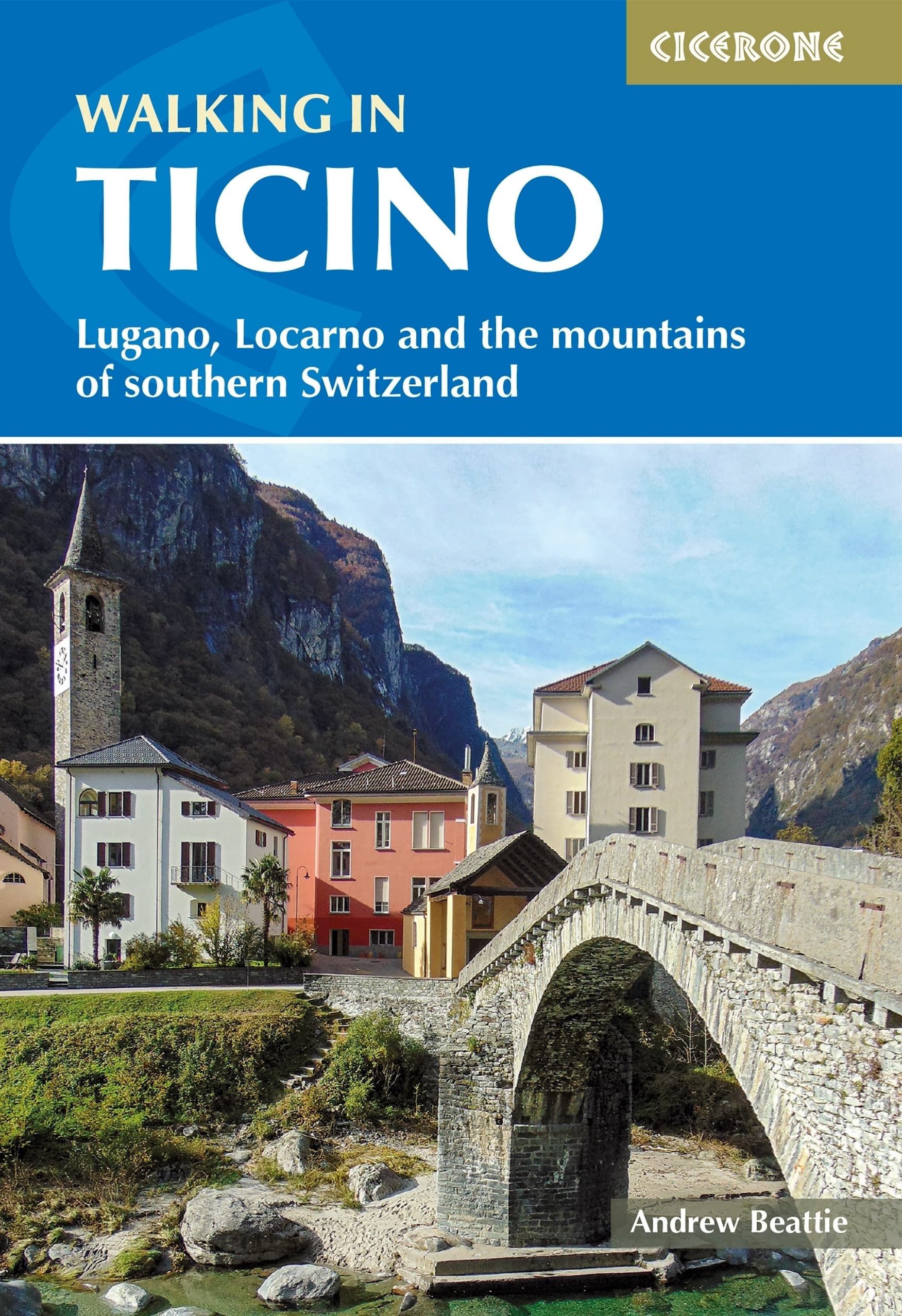
- Walking in Ticino
- Lugano, Locarno and the mountains of southern Switzerland Leer más
- Also available from:
- De Zwerver, Netherlands
De Zwerver
Netherlands
2023
Netherlands
2023
- Wandelgids Walking in Ticino | Cicerone
- Lugano, Locarno and the mountains of southern Switzerland Leer más

Bol.com
Netherlands
Netherlands
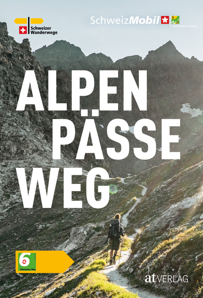
- Wanderland Schweiz 02. Trans Swiss Trail
- Das Wanderland Schweiz besteht aus 6 nationalen Routen und 51 mehrtägigenHighlights. Die Routen basieren auf dem bestehenden Wanderwegnetz und integrierenteilweise bereits bestehende Angebote wie beispielsweise Via Alpina, Jura Höhenweg,Via Jacobi oder Rheintaler Höhenweg.Alle 9 Führer sind mit Farbfotos, Karten und Höhenprofilen farbig reich... Leer más
- Also available from:
- Bol.com, Belgium
Bol.com
Belgium
Belgium
- Wanderland Schweiz 02. Trans Swiss Trail
- Das Wanderland Schweiz besteht aus 6 nationalen Routen und 51 mehrtägigenHighlights. Die Routen basieren auf dem bestehenden Wanderwegnetz und integrierenteilweise bereits bestehende Angebote wie beispielsweise Via Alpina, Jura Höhenweg,Via Jacobi oder Rheintaler Höhenweg.Alle 9 Führer sind mit Farbfotos, Karten und Höhenprofilen farbig reich... Leer más
Bol.com
Netherlands
2015
Netherlands
2015
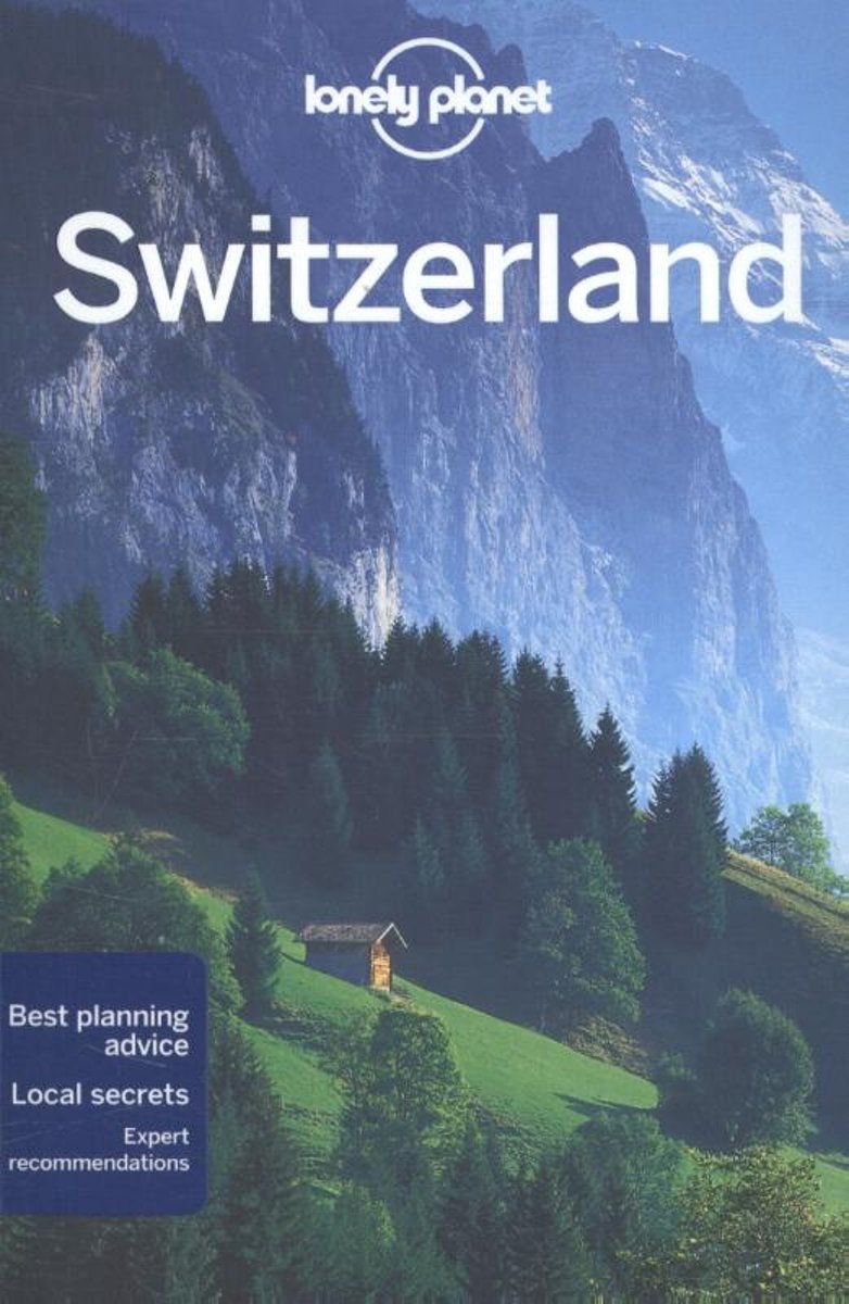
- Lonely Planet Switzerland
- Lonely Planet: The world's leading travel guide publisher Lonely Planet Switzerland is your passport to the most relevant, up-to-date advice on what to see and skip, and what hidden discoveries await you. Ski through fresh powder in the Swiss Alps, listen to cowbells while enjoying a picnic in a mountain meadow, or feast on fondue in Gruyeres;... Leer más
- Also available from:
- Bol.com, Belgium
Bol.com
Belgium
2015
Belgium
2015
- Lonely Planet Switzerland
- Lonely Planet: The world's leading travel guide publisher Lonely Planet Switzerland is your passport to the most relevant, up-to-date advice on what to see and skip, and what hidden discoveries await you. Ski through fresh powder in the Swiss Alps, listen to cowbells while enjoying a picnic in a mountain meadow, or feast on fondue in Gruyeres;... Leer más


Stanfords
United Kingdom
2017
United Kingdom
2017
- The Swiss Alpine Pass Route - via Alpina Route 1: Trekking East to West Across Switzerland
- This guidebook presents the stunning Alpine Pass Route, now fully waymarked as Via Alpina 1. The 360km trail traverses Switzerland from east to west, from Sargans near the Liechtenstein border to Montreux on Lac Leman (Lake Geneva). Crossing sixteen Alpine passes, it showcases some of the country`s most breathtaking mountain landscapes,... Leer más
- Also available from:
- Bol.com, Netherlands
- Bol.com, Belgium

Bol.com
Netherlands
2017
Netherlands
2017
- The Swiss alpine pass route - Via Alpina route 1
- This guidebook presents the stunning Alpine Pass Route, now fully waymarked as Via Alpina 1. The 360km trail traverses Switzerland from east to west, from Sargans near the Liechtenstein border to Montreux on Lac Léman (Lake Geneva). Crossing sixteen Alpine passes, it showcases some of the country's most breathtaking mountain landscapes,... Leer más
Bol.com
Belgium
2017
Belgium
2017
- The Swiss alpine pass route - Via Alpina route 1
- This guidebook presents the stunning Alpine Pass Route, now fully waymarked as Via Alpina 1. The 360km trail traverses Switzerland from east to west, from Sargans near the Liechtenstein border to Montreux on Lac Léman (Lake Geneva). Crossing sixteen Alpine passes, it showcases some of the country's most breathtaking mountain landscapes,... Leer más
Bol.com
Netherlands
Netherlands
- Fodor's Switzerland
- Written by locals, Fodor's travel guides have been offering expert advice for all tastes and budgets for 80 years. Switzerland, Europe's mountain playground, is a classic tourist draw. Fodor's Switzerland is the perfect guide for travelers seeking to ascend the slopes of the Alps and feel on top of the world. When they come down from the... Leer más
- Also available from:
- Bol.com, Belgium
Bol.com
Belgium
Belgium
- Fodor's Switzerland
- Written by locals, Fodor's travel guides have been offering expert advice for all tastes and budgets for 80 years. Switzerland, Europe's mountain playground, is a classic tourist draw. Fodor's Switzerland is the perfect guide for travelers seeking to ascend the slopes of the Alps and feel on top of the world. When they come down from the... Leer más
De Zwerver
Netherlands
2009
Netherlands
2009
- Klimgids - Klettersteiggids Alpinführer Walliser Alpen 4/5 | SAC Schweizer Alpenclub
- Vom Theodulpass zum Simplon. 1. Auflage. Leer más
Bol.com
Netherlands
Netherlands
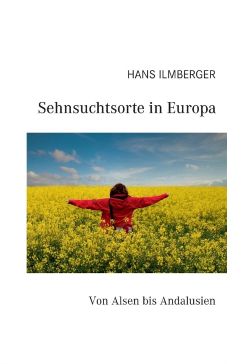
- Sehnsuchtsorte in Europa
- Dieser Reisebericht ist anders. Er fuhrt Sie quer durch Europa, zu ausgewahlten Orten, die fur den Autor und seine Frau seit langem zu Sehnsuchtsorten geworden sind. Die Reise beginnt in der malerischen danischen Sudsee und endet am sudlichsten Punkt Andalusiens, sie fuhrt vom winterlichen Rugen zu Weltstadten wie London und Paris und von dort... Leer más
- Also available from:
- Bol.com, Belgium
Bol.com
Belgium
Belgium
- Sehnsuchtsorte in Europa
- Dieser Reisebericht ist anders. Er fuhrt Sie quer durch Europa, zu ausgewahlten Orten, die fur den Autor und seine Frau seit langem zu Sehnsuchtsorten geworden sind. Die Reise beginnt in der malerischen danischen Sudsee und endet am sudlichsten Punkt Andalusiens, sie fuhrt vom winterlichen Rugen zu Weltstadten wie London und Paris und von dort... Leer más
De Zwerver
Netherlands
2022
Netherlands
2022
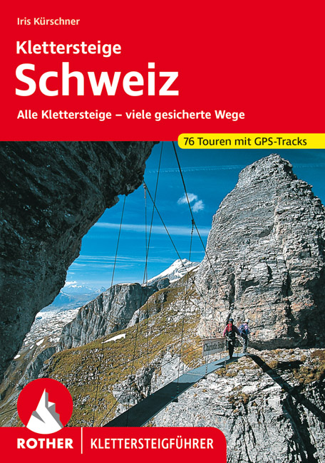
- Klimgids - Klettersteiggids Klettersteige Schweiz | Rother Bergverlag
- Alle 42 Klettersteige sowie die 24 schönsten gesicherten Wege, darunter eine 5-Tages-Tour Rother Wanderführer. 4., erweiterte und aktualisierte Auflage. Leer más
Mapas

Stanfords
United Kingdom
United Kingdom
- Foreste Casentinesi NP Monti Editore 20
- Map No. 20, Foreste Casentinesi: Campigna, Camaldoli, Chiusi dell Verna, in series of contoured, GPS compatible hiking maps at 1:25,000 from the Istituto Geografico Adriatico, covering mainly the spine of the Apennines along the borders of Tuscany, Emilia-Romagna, Umbria and the Marches.Map in this series have contours at 25m intervals with... Leer más

Stanfords
United Kingdom
United Kingdom
- Monti Sibillini National Park Edizioni Multigraphic 60/61
- Monti Sibillini National Park at 1:25,000 on a double-sided contoured map from Edizioni Multigraphic highlighting local waymarked hiking routes including the GAS – Grand Anello dei Sibilini, the circular tour around the mountains.The map has contours at 25m intervals with colouring for woodlands. Waymarked routes are highlighted and annotated... Leer más

Stanfords
United Kingdom
United Kingdom
- Alta Valle del Metauro: Valle del Candigliano, Monte Nerone, Monte Catria
- Map No. 122, Alta Valle del Metauro: Valle del Candigliano, Monte Nerone, Monte Catria, in a series of GPS compatible hiking maps at 1:50,000 from the Istituto Geografico Adriatico, covering parts of central Italy: eastern Tuscany, with northern Umbria and the Marches, plus the south-eastern of part of Emilia-Romagna.The maps have contours at... Leer más
Stanfords
United Kingdom
United Kingdom
- Colline di Rimini
- Map No. 124, Colline di Rimini, in a series of GPS compatible hiking maps at 1:50,000 from the Istituto Geografico Adriatico, covering parts of central Italy: eastern Tuscany, with northern Umbria and the Marches, plus the south-eastern of part of Emilia-Romagna. This title covers the holiday resorts on the Adriatic coast around Rimini,... Leer más

Stanfords
United Kingdom
United Kingdom
- Alpe della Luna 17
- Map No. 16, Monte Carpegna - Sasso di Simone, in series of contoured, GPS compatible hiking maps at 1:25,000 from the Istituto Geografico Adriatico, covering mainly the spine of the Apennines along the borders of Tuscany, Emilia-Romagna, Umbria and the Marches.Map in this series have contours at 25m intervals with additional shading and... Leer más

Stanfords
United Kingdom
United Kingdom
- Alpe di San Benedetto 21
- Map No. 21, Alpe di San Benedetto: Passo del Muraglione – San Godenzo – Dicomano, in series of contoured, GPS compatible hiking maps at 1:25,000 from the Istituto Geografico Adriatico, covering mainly the spine of the Apennines along the borders of Tuscany, Emilia-Romagna, Umbria and the Marches.Map in this series have contours at 25m intervals... Leer más
Stanfords
United Kingdom
United Kingdom
- Alta Valle del Santerno 23
- Map No. 22, Alta Valle del Lamone: Alto Appennino Faentino – Anello di Marradi, in series of contoured, GPS compatible hiking maps at 1:25,000 from the Istituto Geografico Adriatico, covering mainly the spine of the Apennines along the borders of Tuscany, Emilia-Romagna, Umbria and the Marches.Map in this series have contours at 25m intervals... Leer más

Stanfords
United Kingdom
United Kingdom
- Ticino Swisstopo 107
- Swiss canton of Ticino on a Swiss topographic survey map at 1:100,000. Coverage extends south to Lake Lugano, most of Lake Maggiore, and most of Lake Como with the town of Como.Maps in the Swiss topographic survey at 1:100,000 from Swisstopo are highly regarded for their superb use of graphic relief and hill shading, presenting an almost 3-D... Leer más

Stanfords
United Kingdom
United Kingdom
- Alta Valle del Lamone 22
- Map No. 22, Alta Valle del Lamone: Alto Appennino Faentino – Anello di Marradi, in series of contoured, GPS compatible hiking maps at 1:25,000 from the Istituto Geografico Adriatico, covering mainly the spine of the Apennines along the borders of Tuscany, Emilia-Romagna, Umbria and the Marches.Map in this series have contours at 25m intervals... Leer más
Stanfords
United Kingdom
United Kingdom
- Colline di Forlí
- Map No. 127, Colline di Forlí, in a series of GPS compatible hiking maps at 1:50,000 from the Istituto Geografico Adriatico, covering parts of central Italy: eastern Tuscany, with northern Umbria and the Marches, plus the south-eastern of part of Emilia-Romagna.The maps have contours at 50m intervals with additional shading and numerous spot... Leer más
Stanfords
United Kingdom
United Kingdom
- Appennino Tosco-Romagnolo East
- Map No. 135, Appennino Tosco-Romagnolo East, in a series of GPS compatible hiking maps at 1:50,000 from the Istituto Geografico Adriatico, covering parts of central Italy: eastern Tuscany, with northern Umbria and the Marches, plus the south-eastern of part of Emilia-Romagna.The maps have contours at 50m intervals with additional shading and... Leer más
Stanfords
United Kingdom
United Kingdom
- Monte Fumaiolo - Monte Comero 18
- Map No. 18, Monte Fumaiolo - Alto Tevere, in series of contoured, GPS compatible hiking maps at 1:25,000 from the Istituto Geografico Adriatico, covering mainly the spine of the Apennines along the borders of Tuscany, Emilia-Romagna, Umbria and the Marches.Map in this series have contours at 25m intervals with additional shading and numerous... Leer más

Stanfords
United Kingdom
United Kingdom
- Chasseral
- Chasseral - Bieler See area of the Swiss Jura at 1:50,000 in a series from Hallwag covering Switzerland’s popular hiking regions on light, waterproof and tear-resistant maps highlighting long-distance paths: the nine national routes plus special regional routes, as well as other local hiking trails.Cartography is similar to that used both in... Leer más
Stanfords
United Kingdom
United Kingdom
- Alta Val Tiberina
- Map No. 125, Alta Val Tiberina, in a series of GPS compatible hiking maps at 1:50,000 from the Istituto Geografico Adriatico, covering parts of central Italy: eastern Tuscany, with northern Umbria and the Marches, plus the south-eastern of part of Emilia-Romagna.The maps have contours at 50m intervals with additional shading and numerous spot... Leer más
Stanfords
United Kingdom
United Kingdom
- Bagno di Romagna Monti Editore 19
- Map No. 19, Bagno di Romagna, in series of contoured, GPS compatible hiking maps at 1:25,000 from the Istituto Geografico Adriatico, covering mainly the spine of the Apennines along the borders of Tuscany, Emilia-Romagna, Umbria and the Marches.The maps have contours at 25m intervals with additional shading and numerous Map in this series have... Leer más