
Allalinhorn
Descripción
- Altitud 4027.00 m
Enlaces
Datos
Informes
Guías y mapas
Hospedaje
Organizaciones
Operadores turísticos
GPS
Otro
Libros
Bol.com
Netherlands
Netherlands
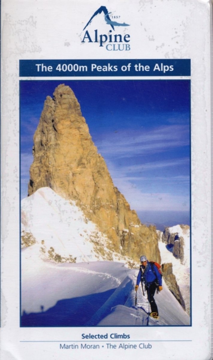
- The 4000m Peaks of the Alps - Selected Climbs
- The 4000m Peaks of the Alps provides a practical companion guide to the Alpine 4000ers with detailed description of every worthwhile route from Facile (F) to Difficile (sup) (D+/TD-). As well as the 50 major mountains, every significant subsidiary top is visited by one or more route. In total over 230 routes are described, ranging from... Leer más
- Also available from:
- Bol.com, Belgium
Bol.com
Belgium
Belgium
- The 4000m Peaks of the Alps - Selected Climbs
- The 4000m Peaks of the Alps provides a practical companion guide to the Alpine 4000ers with detailed description of every worthwhile route from Facile (F) to Difficile (sup) (D+/TD-). As well as the 50 major mountains, every significant subsidiary top is visited by one or more route. In total over 230 routes are described, ranging from... Leer más
Mapas

Stanfords
United Kingdom
United Kingdom
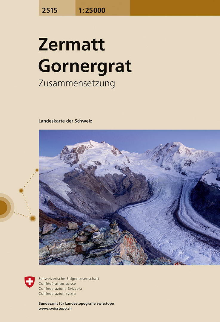
- Zermatt - Gornergrat Swisstopo 2515
- Map No. 2515, Zermatt - Gornergrat, in the topographic survey of Switzerland at 1:25,000 from Swisstopo, covering the upper part of the Mattertal with Täsch and Zermatt and extending south across the peaks (Monte Rosa/Dufourspitze, Breithorn, Theodulpass, Matterhorn and Dents d’Hérens) to Breuil-Cervinia in Italy. Peaks on both sides of the... Leer más
- Also available from:
- De Zwerver, Netherlands
De Zwerver
Netherlands
Netherlands
- Wandelkaart - Topografische kaart 2515 Zermatt - Gornergrat | Swisstopo
- Map No. 2515, Zermatt - Gornergrat, in the topographic survey of Switzerland at 1:25,000 from Swisstopo, covering the upper part of the Mattertal with T Leer más

Stanfords
United Kingdom
United Kingdom
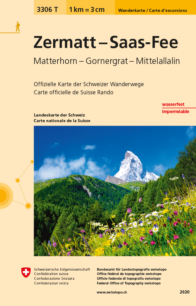
- Zermatt - Saas-Fee - Matterhorn - Gornergrat - Mittelallalin Swisstopo Hiking 3306T
- Zermatt - Saas Fee - Matterhorn - Gornergrat - Mischabel area at 1:33,333 on light, waterproof and tear-resistant map No. 3306T published by Swisstopo in cooperation with the Swiss Hiking Federation. Cartography is the same as in Swisstopo’s 50K hiking maps, simply enlarged to 1:33,333 for extra clarity but without additional information.... Leer más
- Also available from:
- De Zwerver, Netherlands
De Zwerver
Netherlands
Netherlands
- Wandelkaart - Topografische kaart 3306T Zermatt - Saas - Fee | Swisstopo
- Een nieuwe serie van de Zwitserse topografische dienst: eindelijk goede wandelkaarten met ingetekende wandelroutes op scheur- en watervast papier. Vooralsnog zijn ze uitgebracht van de populaire wandelgebieden en niet landelijk dekkend (zie overzicht) Op een gedetailleerde schaal van 1:33.333 met als ondergrond de onovertroffen topografische... Leer más