
Großvenediger
Descripción
- Altitud 3662.00 m
Third highest mountain in Austria.
Enlaces
Datos
Informes
Guías y mapas
Hospedaje
Organizaciones
Operadores turísticos
GPS
Otro
Libros
De Zwerver
Netherlands
2022
Netherlands
2022
- Wandelgids Hohe Tauern - NP nord | Rother Bergverlag
- Uitstekende wandelgids met een groot aantal dagtochten in dal en hooggebergte. Met praktische informatie en beperkt kaartmateriaal! Wandelingen in verschillende zwaarte weergegeven in rood/blauw/zwart. Die Hohen Tauern sind eine der bekanntesten Hochgebirgsregionen der Ostalpen - mit riesigen Gletschern und zwei der berühmtesten Berge... Leer más
De Zwerver
Netherlands
2021
Netherlands
2021
- Wandelgids Osttirol Nord | Rother Bergverlag
- Uitstekende wandelgids met een groot aantal dagtochten in dal en hooggebergte. Met praktische informatie en beperkt kaartmateriaal! Wandelingen in verschillende zwaarte weergegeven in rood/blauw/zwart. Das »Sonnenland« Osttirol liegt - fast zur Hälfte höher als 2000 m - südlich der höchsten Alpenkette Österreichs, der Hohen Tauern. Es ist von... Leer más
De Zwerver
Netherlands
2007
Netherlands
2007
- Wandelgids Erlebnis Wandern! Trekking Hohe Tauern | Tyrolia
- Der Nationalpark Hohe Tauern bildet das größte Naturschutzgebiet Mitteleuropas. Er stellt Österreichs höchste Berggipfel, die einmalige Natur- sowie eine jahrhundertealte Kulturlandschaft unter besonderen Schutz. Die in diesem Buch erstmals vorgestellte, völlig neu konzipierte Trekkingtour eröffnet dem Wanderer die Möglichkeit, die... Leer más
Mapas

Stanfords
United Kingdom
2013
United Kingdom
2013
- Grossvenediger - Hohe Tauern NP - Matrei - Felber - Tauern - Oberpinzgau K+F Outdoor Map 12
- Grossvenediger - Hohe Tauern NP - Matrei - Felber - Tauern - Oberpinzgau area of the Tyrol at 1:35,000 on a GPS compatible, double-sided map from Kümmerly+Frey printed on sturdy, waterproof and tear-resistant synthetic paper; contoured, with hiking, cycling and ski routes, accommodation facilities, locations for other recreational activities,... Leer más

Stanfords
United Kingdom
United Kingdom
- Grossvenediger - Oberpinzgau F&B WK121
- Grossvenediger - Oberpinzgau area of the Austrian Alps presented at 1:50,000 in a series of contoured and GPS compatible outdoor leisure map from Freytag & Berndt with hiking and cycling routes, mountain huts, campsites and youth hostels, local bus stops, plus other tourist information.To see the list of currently available titles in this... Leer más
- Also available from:
- The Book Depository, United Kingdom

The Book Depository
United Kingdom
United Kingdom
- Grossvenediger - Oberpinzgau Hiking + Leisure Map 1:50 000
- Grossvenediger - Oberpinzgau area of the Austrian Alps presented at 1:50,000 in a series of contoured and GPS compatible outdoor leisure map from Freytag & Berndt with hiking and cycling routes, mountain huts, campsites and youth hostels, local bus stops, plus other tourist information.To see the list of currently available titles in this... Leer más

Stanfords
United Kingdom
United Kingdom
- Matrei - Deferggen - Virgental F&B WK123
- Matrei - Deferggen - Virgental area of the Austrian Alps presented at 1:50,000 in a series of contoured and GPS compatible outdoor leisure map from Freytag & Berndt with hiking and cycling routes, mountain huts, campsites and youth hostels, local bus stops, plus other tourist information.To see the list of currently available titles in this... Leer más
- Also available from:
- The Book Depository, United Kingdom

The Book Depository
United Kingdom
United Kingdom
- Matrei - Defereggen - Virgental Hiking + Leisure Map 1:50 000
- Matrei - Deferggen - Virgental area of the Austrian Alps presented at 1:50,000 in a series of contoured and GPS compatible outdoor leisure map from Freytag & Berndt with hiking and cycling routes, mountain huts, campsites and youth hostels, local bus stops, plus other tourist information.To see the list of currently available titles in this... Leer más

Stanfords
United Kingdom
United Kingdom
- Pongau - Hochkönig - Saalfelden F&B WK103
- Pongau - Hochkönig - Saalfelden area of the Austrian Alps presented at 1:50,000 in a series of contoured and GPS compatible outdoor leisure map from Freytag & Berndt with hiking and cycling routes, mountain huts, campsites and youth hostels, local bus stops, plus other tourist information.To see the list of currently available titles in this... Leer más
- Also available from:
- The Book Depository, United Kingdom

The Book Depository
United Kingdom
United Kingdom
Bol.com
Netherlands
Netherlands
- Kompass WK50 Nationalpark Hohe Tauern
- Deze 3-deilge set Kompass wandelkaarten, schaal 1:50 000, is ideaal om uw route uit te stippelen en om onderweg te gebruiken naast de bekende bestemmingen, worden ook de minder bekende vermeld openbaar vervoer bij begin- of eindpunt van een route aangegeven eenvoudige wandelingen tot pittige (berg)tochten, voor getrainde en ongetrainde... Leer más
- Also available from:
- Bol.com, Belgium
Bol.com
Belgium
Belgium
- Kompass WK50 Nationalpark Hohe Tauern
- Deze 3-deilge set Kompass wandelkaarten, schaal 1:50 000, is ideaal om uw route uit te stippelen en om onderweg te gebruiken naast de bekende bestemmingen, worden ook de minder bekende vermeld openbaar vervoer bij begin- of eindpunt van een route aangegeven eenvoudige wandelingen tot pittige (berg)tochten, voor getrainde en ongetrainde... Leer más
Bol.com
Netherlands
Netherlands
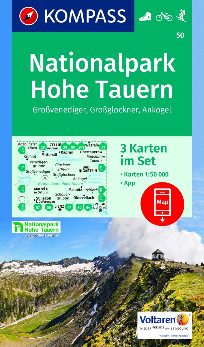
- Nationalpark Hohe Tauern, Großvenediger, Großglockner, Ankogel 1:50 000
- KOMPASS-Wanderkarten enthalten alles Wissenswerte für Wanderer wie aktuelle Wanderwege mit Markierungen, empfehlenswerte Radrouten und wichtige touristische Informationen.Der topographische Inhalt wird bei aller Detailgenauigkeit leicht lesbar und anschaulich dargestellt.Dieses Kartenset besteht aus: . Kartenblatt Mitte: Großglockner.... Leer más
- Also available from:
- Bol.com, Belgium
Bol.com
Belgium
Belgium
- Nationalpark Hohe Tauern, Großvenediger, Großglockner, Ankogel 1:50 000
- KOMPASS-Wanderkarten enthalten alles Wissenswerte für Wanderer wie aktuelle Wanderwege mit Markierungen, empfehlenswerte Radrouten und wichtige touristische Informationen.Der topographische Inhalt wird bei aller Detailgenauigkeit leicht lesbar und anschaulich dargestellt.Dieses Kartenset besteht aus: . Kartenblatt Mitte: Großglockner.... Leer más