
Stanfords
United Kingdom
- World Physical / Le Monde Physique IGN Wall Map
- Physical world map for the Francophiles, 127 x 83 cm (4ft 2”x 2ft 8” approx.), with lovely bright but not too bold colours, vivid relief shading and all the place names in French. The Arctic and the Antarctic are shown on two circular insets.Central Pacific, from Alaska/Siberia to New Zealand, is repeated on both sides of the map for better... Leer más
Stanfords
United Kingdom
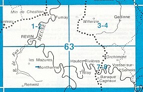
- Vresse-sur-Semois
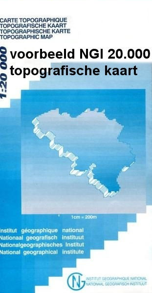
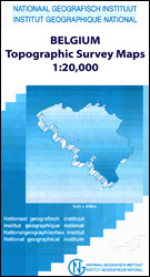
- Topographical survey of Belgium at 1:20,000 from Nationaal Geografisch Instituut / Institut Géographique National, the country’s national survey organization. Each 20K map covers one quarter of the corresponding 1:50,000 map (with adjustments in the border and coastal areas). The maps provide all the information expected of topographic mapping... Leer más

Stanfords
United Kingdom
- Barcelona - Zaragoza - Castellón de la Plana 500K CNIG Regional Map No. 7
- The Mediterranean coast of Spain between Barcelona and Castellón de la Plana, extending west to Zaragoza and Teruel, at 1:500,000 in a series of regional road maps from the country’s civilian survey organization IGN-CNIG (Instituto Geográfico Nacional - Centro Nacional de Información Geográfica), vividly presenting the topography by altitude... Leer más

Stanfords
United Kingdom
- Europe Children`s Placemat
- This is a colourful and resistant placemat by Little Wigwam, featuring a political map of Europe with capitals and major cities. All the information is up-to-date and includes Serbia, Kosovo and Montenegro. The seas are named, lines of longitude and latitude are shown at 15 degree intervals, the Arctic Circle is marked and the mat features a... Leer más

Stanfords
United Kingdom
Stanfords
United Kingdom
- Vise - St-Martens-Voeren
- Topographical survey of Belgium at 1:20,000 from Nationaal Geografisch Instituut / Institut Géographique National, the country’s national survey organization. Each 20K map covers one quarter of the corresponding 1:50,000 map (with adjustments in the border and coastal areas). The maps provide all the information expected of topographic mapping... Leer más

Stanfords
United Kingdom
- Vilvoorde NGI Topo 23/7-8
- Topographical survey of Belgium at 1:20,000 from Nationaal Geografisch Instituut / Institut Géographique National, the country’s national survey organization. Each 20K map covers one quarter of the corresponding 1:50,000 map (with adjustments in the border and coastal areas). The maps provide all the information expected of topographic mapping... Leer más
Stanfords
United Kingdom
- Dalhem - Herve
- Topographical survey of Belgium at 1:20,000 from Nationaal Geografisch Instituut / Institut Géographique National, the country’s national survey organization. Each 20K map covers one quarter of the corresponding 1:50,000 map (with adjustments in the border and coastal areas). The maps provide all the information expected of topographic mapping... Leer más

Stanfords
United Kingdom
- Durban MapStudio Pocket Map
- Central Durban at 1:12,500 on an indexed street plan from the South African map publishers, Map Studio, with on the reverse a road map of the city’s environs at 1:100,000, plus a plan of the uShaka Marine World. Also included is a list of renamed streets giving both the old and the new names, plus on the plan itself newly assigned street names... Leer más

Stanfords
United Kingdom
- Quievrain - Boussu
- Topographical survey of Belgium at 1:20,000 from Nationaal Geografisch Instituut / Institut Géographique National, the country’s national survey organization. Each 20K map covers one quarter of the corresponding 1:50,000 map (with adjustments in the border and coastal areas). The maps provide all the information expected of topographic mapping... Leer más
Stanfords
United Kingdom
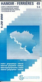
- Hamoir - Ferrieres
- Topographical survey of Belgium at 1:20,000 from Nationaal Geografisch Instituut / Institut Géographique National, the country’s national survey organization. Each 20K map covers one quarter of the corresponding 1:50,000 map (with adjustments in the border and coastal areas). The maps provide all the information expected of topographic mapping... Leer más
Stanfords
United Kingdom
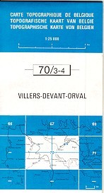
- Villers devant Orval
- Topographical survey of Belgium at 1:20,000 from Nationaal Geografisch Instituut / Institut Géographique National, the country’s national survey organization. Each 20K map covers one quarter of the corresponding 1:50,000 map (with adjustments in the border and coastal areas). The maps provide all the information expected of topographic mapping... Leer más

Stanfords
United Kingdom
- World Map Placemat
- This is a fantastic colourful and resistant placemat by Little Wigwam, featuring a political world map. Kids will love it and have fun locating remote places or guessing capitals of the world. The Mercator projection map shows the continents in different bright colours, all countries and seas and oceans are named, as well as most capitals,... Leer más
Stanfords
United Kingdom
- Burg-Reuland - Gross-Bohlscheid
- Topographical survey of Belgium at 1:20,000 from Nationaal Geografisch Instituut / Institut Géographique National, the country’s national survey organization. Each 20K map covers one quarter of the corresponding 1:50,000 map (with adjustments in the border and coastal areas). The maps provide all the information expected of topographic mapping... Leer más

Stanfords
United Kingdom
- Kieldrecht- Doel
- Topographical survey of Belgium at 1:20,000 from Nationaal Geografisch Instituut / Institut Géographique National, the country’s national survey organization. Each 20K map covers one quarter of the corresponding 1:50,000 map (with adjustments in the border and coastal areas). The maps provide all the information expected of topographic mapping... Leer más