Stanfords
United Kingdom
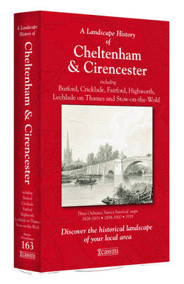
- Cheltenham and Cirencester 1828-1919 (3-map set)
- Map No. 163, Cheltenham and Cirencester 1828-1919 (3-map set), in the Cassini Historical Series of old Ordnance Survey mapping of England and Wales at 1:50,000 in a format designed to offer a convenient comparison with the present day coverage from the OS, and most locations in three different editions. Old historical maps have been combined so... Leer más

Stanfords
United Kingdom
- Buxton and Matlock 1837-1923 (3-map set)
- Map No. 119, Buxton and Matlock 1921-1923, in the Cassini Historical Series of old Ordnance Survey mapping of England and Wales at 1:50,000 in a format designed to offer a convenient comparison with the present day coverage from the OS, and most locations in three different editions. Old historical maps have been combined so that the sheet... Leer más

Stanfords
United Kingdom
- Milton Keynes Official City Atlas 2015 SUPERCEDED
- Street atlas of Milton Keynes at 1:10,000, with a very detailed enlargement of the central area, plus additional town centre plans of Olney, Newport Pagnell and Woburn Sands. The atlas is accompanied by a leisure guide to Milton Keynes and district with mapping at 1:100,000 plus lists with descriptions and contact details of cultural... Leer más
Stanfords
United Kingdom
- Bala and Lake Vyrnwy / Y Bala a Llyn Efyrnwy 1921-1922
- Map No. 125, Bala and Lake Vyrnwy / Y Bala a Llyn Efyrnwy 1921-1922, in the Cassini Historical Series of old Ordnance Survey mapping of England and Wales at 1:50,000 in a format designed to offer a convenient comparison with the present day coverage from the OS, and most locations in three different editions. Old historical maps have been... Leer más
Stanfords
United Kingdom
- North East Norfolk 1838
- Map No. 133, North East Norfolk 1838, in the Cassini Historical Series of old Ordnance Survey mapping of England and Wales at 1:50,000 in a format designed to offer a convenient comparison with the present day coverage from the OS, and most locations in three different editions. Old historical maps have been combined so that the sheet lines... Leer más
Stanfords
United Kingdom
- Aberystwyth and Machynlleth 1901-1903
- Map No. 135, Aberystwyth and Machynlleth 1901-1903, in the Cassini Historical Series of old Ordnance Survey mapping of England and Wales at 1:50,000 in a format designed to offer a convenient comparison with the present day coverage from the OS, and most locations in three different editions. Old historical maps have been combined so that the... Leer más

Stanfords
United Kingdom
- Leeds Past and Present
- Leeds in the Cassini Past and Present map series which covers town and cities of England and Wales and offers a unique way of tracing their history and expansion by showing four different periods of their development using Ordnance Survey mapping from the mid-19th century, the late 19th century, the 1920s and the present day. Coverage includes... Leer más
Stanfords
United Kingdom
- Leeds and Bradford 1925
- Map No. 104, Leeds and Bradford 1925, in the Cassini Historical Series of old Ordnance Survey mapping of England and Wales at 1:50,000 in a format designed to offer a convenient comparison with the present day coverage from the OS, and most locations in three different editions. Old historical maps have been combined so that the sheet lines... Leer más
Stanfords
United Kingdom
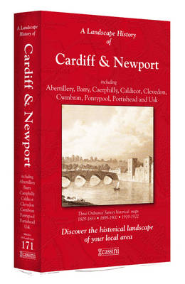
- Cardiff and Newport / Caerdydd & Casnewydd 1813-1922 (3-map set)
- Map No. 171, Cardiff and Newport / Caerdydd & Casnewydd 1813-1922 (3-map set), in the Cassini Historical Series of old Ordnance Survey mapping of England and Wales at 1:50,000 in a format designed to offer a convenient comparison with the present day coverage from the OS, and most locations in three different editions. Old historical maps have... Leer más
Stanfords
United Kingdom
- Stafford and Telford 1833-1921 (3-map set)
- Map No. 127, Stafford and Telford 1833-1921 (3-map set), in the Cassini Historical Series of old Ordnance Survey mapping of England and Wales at 1:50,000 in a format designed to offer a convenient comparison with the present day coverage from the OS, and most locations in three different editions. Old historical maps have been combined so that... Leer más
Stanfords
United Kingdom
- Eastbourne and Hastings 1898
- Map No. 199, Eastbourne and Hastings 1898, in the Cassini Historical Series of old Ordnance Survey mapping of England and Wales at 1:50,000 in a format designed to offer a convenient comparison with the present day coverage from the OS, and most locations in three different editions. Old historical maps have been combined so that the sheet... Leer más
Stanfords
United Kingdom
- Cambridge and Newmarket 1805-1836
- Map No. 154, Cambridge and Newmarket 1805-1836, in the Cassini Historical Series of old Ordnance Survey mapping of England and Wales at 1:50,000 in a format designed to offer a convenient comparison with the present day coverage from the OS, and most locations in three different editions. Old historical maps have been combined so that the sheet... Leer más
Stanfords
United Kingdom
- Carlisle and Solway Firth 1868-1925 (3-map set)
- Map No. 85, Carlisle and Solway Firth 1868-1925 (3-map set), in the Cassini Historical Series of old Ordnance Survey mapping of England and Wales at 1:50,000 in a format designed to offer a convenient comparison with the present day coverage from the OS, and most locations in three different editions. Old historical maps have been combined so... Leer más
Stanfords
United Kingdom
- Cardiff and Caerphilly Past and Present
- Cardiff and Caerphilly in the Cassini Past and Present map series which covers town and cities of England and Wales and offers a unique way of tracing their history and expansion by showing four different periods of their development using Ordnance Survey mapping from the mid-19th century, the late 19th century, the 1920s and the present day.... Leer más
Stanfords
United Kingdom
- Scunthorpe and Gainsborough 1923-1924
- Map No. 112, Scunthorpe and Gainsborough 1923-1924, in the Cassini Historical Series of old Ordnance Survey mapping of England and Wales at 1:50,000 in a format designed to offer a convenient comparison with the present day coverage from the OS, and most locations in three different editions. Old historical maps have been combined so that the... Leer más