
Pennsylvania
Descripción
Pennsylvania probably has the largest trail system of the eastern states. The terrain is varied and includes high plains and mountain ridges.
Of the Appalachian Trail, 230 miles are within this state.
Many longer and shorter trails can be found in Pennsylvania. The Mason-Dixon Trail (190 miles), the Mid State Trail (319 miles), the Baker Trail (140 miles), the Horse Shoe Trail (134 miles), the Tuscarora Trail (252 miles), the Great Allegheny Passage (318 miles) and the Highlands Trail.
Some of the American long distance trails pass through Pennsylvania: the North Country Trail, East Coast Greenway, Eastern Continental Trail and the Great Eastern Trail.
There are many smaller state forests. A large one is the Allegheny National Forest, located on the hilly Allegheny Plateau.
Mapa

Senderos en estado
Enlaces
Datos
Informes
Guías y mapas
Hospedaje
Organizaciones
Operadores turísticos
GPS
Otro
Libros

United Kingdom
- The Broon`s Days Oot!
- The much-acclaimed The Broons Days Oot! is a cracking guide to Scotland. Now expanded with new information throughout, the new book includes new sections on the Scottish islands, Scotland`s whisky trails, cycling in Scotland, walking, arts and other festivals, and gala days. Ideal for the glovebox, the backpack, and the holiday cottage, this... Leer más

United Kingdom
2019
- Insight Guides Great Breaks Devon & Cornwall (Travel Guide with Free eBook)
- Explore the best of Devon and Cornwall with this indispensably practical Insight Great Breaks Guide. From making sure you don`t miss out on must-see attractions like the Eden Project, Exeter, Tresco Gardens, Dartmoor and Torquay, to discovering hidden gems, including Tintagel, the easy-to-follow, ready-made walking routes will save you time,... Leer más

United Kingdom
2015
- Paxos: Car Tours and Walks
- Paxos is the Sunflower Landscapes guide to exploring the best walking and touring possibilities on the island. The guide covers a range of routes including walks in Gaios, Bogdanatika, Loggos, Lakka and Antixpaxos. A double-sided, fold-out touring map at the back of the book gives an overview of the island and the location of each walk.... Leer más

United Kingdom
- Frommer`s Vienna Day by Day
- Vienna, Austria is so rich with cultural treasures, so replete with sights and wonders, that visitors are often bewildered by the task of planning a visit. Which of nearly 100 museums to visit? Which of countless theatres and concert halls? With an endless number of celebrated restaurants, cafes, lively taverns, bakeries serving famous... Leer más

United Kingdom
- DK Eyewitness Travel Guide Spain
- Your journey starts here. Featuring DK`s much-loved maps and illustrations, walks and information, plus all new, full-colour photography, this 100% updated guide to Spain brings you the best of this sensational country in a brand-new, lightweight format.What`s inside?- full-colour photography, hand-drawnillustrations, and maps throughout-... Leer más

United Kingdom
- DK Eyewitness Top 10 Crete 14/5/20
- Picturesque Venetian ports, snow-capped mountains, awe-inspiring Minoan ruins, golden sands and glistening waters - Crete is an island paradise quite unlike any other. Your DK Eyewitness Top 10 travel guide ensures you`ll find your way around Crete with absolute ease.Our newly updated Top 10 travel guide breaks down the best of Crete into... Leer más
United Kingdom
- Blur Ridge Parkway Southern Section
- The northern section of the Blue Ridge Parkway and the surrounding area of the Appalachian Mountains on a double-sided map at 1:135,000 approx. from Outdoor Paths Publishing highlighting facilities along the route. The map covers the first part of the Parkway, from Milepost 0 to 123.Topography of the area is shown by relief shading based on the... Leer más
United Kingdom
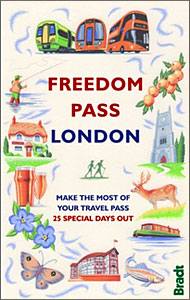
- Freedom Pass London
- Since its creation over 40 years ago, London`s Freedom Pass concessionary travel scheme has continued to grow in popularity and there are now over 1 million registered holders. Whether a fruit picker or forager, a rambler or angler, or simply someone who enjoys the quirky charm of a local pub, Bradt`s new Freedom Pass is the perfect read to... Leer más

United Kingdom
- Rick Steves Pocket Prague (Second Edition)
- Make the most of every day and every dollar with Rick Steves! This colourful, compact guidebook is perfect for spending a week or less in Prague:City walks and tours: Five detailed self-guided walks, including a walk from the Old Town Square to the Charles Bridge and tours of The Jewish Quarter and Prague Castle- Rick`s strategic advice on... Leer más

United Kingdom
2015
- Azores: Car Tours and Walks
- The Azores in the Sunflower Landscapes guide series; exploring the best walking and touring possibilities in the region or area. Detailed information about touring by hired car or public transport, as well as on foot, is provided, helping walkers to navigate and plan day-trips. Shorter strolls are also included as an alternative for each main... Leer más

United Kingdom
- Costa Rica Eyewitness
- Welcome to Costa Rica - unmatched in beauty and biodiversityWhether you want to experience incredible wildlife, scuba dive in crystal-clear waters or savour a cup of world-famous coffee, your DK Eyewitness travel guide makes sure you experience all that Costa Rica has to offer. Inside you`ll find a detailed guide to the country`s animals,... Leer más

United Kingdom
- Rick Steves Pocket Amsterdam (Third Edition)
- Make the most of every day and every dollar with Rick Steves! This colourful, compact guidebook is perfect for spending a week or less in Amsterdam:City walks and tours: Six detailed tours and walks showcase Amsterdam`s essential sights, including the Rijksmuseum, Van Gogh Museum, and the Anne Frank House, plus neighbourhood walks through the... Leer más

United Kingdom
- Middlesex and West London - Waterside Walks
- Waterside Walks in Middlesex and West London by David and Rosemary Hall presents a selection of twenty circular walks that take in some part of a local waterway. These include the rivers Thames and Colne, the Staines Reservoirs, Dollis Brook and the Grand Union Canal. The twenty routes in this book are all between 3 to 7 miles. Each walk is... Leer más

United Kingdom
- Tokyo Style Guide
- Tokyo Style Guide is an indispensable companion for those looking for a unique insight into the city of Tokyo.While Tokyo pulsates like no other city, its true heart can be easily overlooked. It is found where the locals live, wander, shop, are entertained, eat and drink. Tokyo Style Guide offers style-savvy visitors a starting point for... Leer más

United Kingdom
- Barry Loser and the Trouble With Pets
- The eleventh book in this Roald Dahl Funny Prize-winning series. Perfect for fans of `Diary of a Wimpy Kid`, `Dog Man`, Tom Gates and Pamela Butchart. As far back as Barry can remember, he`s always wanted a sausage dog. They`re like two of his favourite things (sausages and dogs) squidged together! Who cares if they bark the whole time, do poos... Leer más
Mapas

United Kingdom
- Khadachakra
- Khadachakra, sheet no. 2981-15, in the topographic survey of Nepal at 1:50,000 published by the Nepali Government in the late 1990s and early 2000s and produced from remote sensing data by Finnish cartographers as part of that country’s international aid program. The maps cover 15’ x 15’ quadrangles.IMPORTANT – PLEASE NOTE BEFORE ORDERING:... Leer más
United Kingdom
- Mt. Pumori
- Mt Pumori, sheet no. 2886-16, in the topographic survey of Nepal at 1:50,000 published by the Nepali Government in the late 1990s and early 2000s and produced from remote sensing data by Finnish cartographers as part of that country’s international aid program. The maps cover 15’ x 15’ quadrangles.IMPORTANT – PLEASE NOTE BEFORE ORDERING:... Leer más
United Kingdom
- Phugau Ghomion
- Phugau Ghomion, sheet no. 2884-02, in the topographic survey of Nepal at 1:50,000 published by the Nepali Government in the late 1990s and early 2000s and produced from remote sensing data by Finnish cartographers as part of that country’s international aid program. The maps cover 15’ x 15’ quadrangles.IMPORTANT – PLEASE NOTE BEFORE ORDERING:... Leer más
United Kingdom
- Muktinath
- Koban, sheet no. 2883-07, in the topographic survey of Nepal at 1:50,000 published by the Nepali Government in the late 1990s and early 2000s and produced from remote sensing data by Finnish cartographers as part of that country’s international aid program. The maps cover 15’ x 15’ quadrangles.IMPORTANT – PLEASE NOTE BEFORE ORDERING:... Leer más
United Kingdom
- Ghandruk
- Ghandruk, sheet no. 2883-12, in the topographic survey of Nepal at 1:50,000 published by the Nepali Government in the late 1990s and early 2000s and produced from remote sensing data by Finnish cartographers as part of that country’s international aid program. The maps cover 15’ x 15’ quadrangles.IMPORTANT – PLEASE NOTE BEFORE ORDERING:... Leer más
United Kingdom
- Apsuwa Khoka - Bala
- Apsuwa Khoka – Bala, sheet no. 2787-05, in the topographic survey of Nepal at 1:50,000 published by the Nepali Government in the late 1990s and early 2000s and produced from remote sensing data by Finnish cartographers as part of that country’s international aid program. The maps cover 15’ x 15’ quadrangles.IMPORTANT – PLEASE NOTE BEFORE... Leer más
United Kingdom
- Dho
- Dho, sheet no. 2983-13, in the topographic survey of Nepal at 1:50,000 published by the Nepali Government in the late 1990s and early 2000s and produced from remote sensing data by Finnish cartographers as part of that country’s international aid program. The maps cover 15’ x 15’ quadrangles.IMPORTANT – PLEASE NOTE BEFORE ORDERING:... Leer más
United Kingdom
- Lamabagar
- Lamabagar, sheet no. 2786-01, in the topographic survey of Nepal at 1:50,000 published by the Nepali Government in the late 1990s and early 2000s and produced from remote sensing data by Finnish cartographers as part of that country’s international aid program. The maps cover 15’ x 15’ quadrangles.IMPORTANT – PLEASE NOTE BEFORE ORDERING:... Leer más
United Kingdom
- Nepal/India Border: Latitude 27°15’ - 27°30’
- The quadrangle on the Nepal/India border latitude 27°15’ - 27°30’, sheet no. 2788-09, in the topographic survey of Nepal at 1:50,000 published by the Nepali Government in the late 1990s and early 2000s and produced from remote sensing data by Finnish cartographers as part of that country’s international aid program. The maps cover 15’ x 15’... Leer más
United Kingdom
- Gamgadhi
- Gamgadji, sheet no. 2982-05, in the topographic survey of Nepal at 1:50,000 published by the Nepali Government in the late 1990s and early 2000s and produced from remote sensing data by Finnish cartographers as part of that country’s international aid program. The maps cover 15’ x 15’ quadrangles.IMPORTANT – PLEASE NOTE BEFORE ORDERING:... Leer más
United Kingdom
- Langtang Lirung
- Langtang Lirung, sheet no. 2885-11, in the topographic survey of Nepal at 1:50,000 published by the Nepali Government in the late 1990s and early 2000s and produced from remote sensing data by Finnish cartographers as part of that country’s international aid program. The maps cover 15’ x 15’ quadrangles.IMPORTANT – PLEASE NOTE BEFORE ORDERING:... Leer más
United Kingdom
- Talkot
- Talkot, sheet no. 2981-06, in the topographic survey of Nepal at 1:50,000 published by the Nepali Government in the late 1990s and early 2000s and produced from remote sensing data by Finnish cartographers as part of that country’s international aid program. The maps cover 15’ x 15’ quadrangles.IMPORTANT – PLEASE NOTE BEFORE ORDERING:... Leer más
United Kingdom
- Mt. Cho Oyu - Pasan Lhamu Chuli
- Mt Cho Oyu - Pasan lhamu Chuli, sheet no. 2886-15, in the topographic survey of Nepal at 1:50,000 published by the Nepali Government in the late 1990s and early 2000s and produced from remote sensing data by Finnish cartographers as part of that country’s international aid program. The maps cover 15’ x 15’ quadrangles.IMPORTANT – PLEASE NOTE... Leer más
United Kingdom
- Bagarchhap
- Bagarchhap, sheet no. 2884-06, in the topographic survey of Nepal at 1:50,000 published by the Nepali Government in the late 1990s and early 2000s and produced from remote sensing data by Finnish cartographers as part of that country’s international aid program. The maps cover 15’ x 15’ quadrangles.IMPORTANT – PLEASE NOTE BEFORE ORDERING:... Leer más
United Kingdom
- Nepal Survey 1:25,000 Sheet 2883 11B (Tatopani)
- Koban, sheet no. 2883-07, in the topographic survey of Nepal at 1:50,000 published by the Nepali Government in the late 1990s and early 2000s and produced from remote sensing data by Finnish cartographers as part of that country’s international aid program. The maps cover 15’ x 15’ quadrangles.IMPORTANT – PLEASE NOTE BEFORE ORDERING:... Leer más