
San Isabel National Forest
Descripción
Senderos en región
Enlaces
Datos
Informes
Guías y mapas
Hospedaje
Organizaciones
Operadores turísticos
GPS
Otro
Libros

Stanfords
United Kingdom
United Kingdom
- Waldviertel North - Gmund - Heidenreichstein - Waidhofen & Raabs a.d.T. - Trebon F&B WK075
- Waldviertel North - Gmünd - Heidenreichstein - Waidhofen a.d.T. - Raabs a.d.T. – Trebon area of eastern Austria presented at 1:50,000 in a series of contoured and GPS compatible outdoor leisure map from Freytag & Berndt with hiking and cycling routes, mountain huts, campsites and youth hostels, local bus stops, plus other tourist information.To... Leer más


The Book Depository
United Kingdom
United Kingdom
- Uphill Both Ways
- Hiking toward Happiness on the Colorado Trail Leer más

The Book Depository
United Kingdom
United Kingdom
- What We Owe to Ourselves
- a 500-mile hike on the Colorado Trail Leer más


The Book Depository
United Kingdom
United Kingdom
- Colorado Trail [map Pack Bundle]
- Topographic Map Guides; Trails Illustrated Maps Leer más

The Book Depository
United Kingdom
United Kingdom
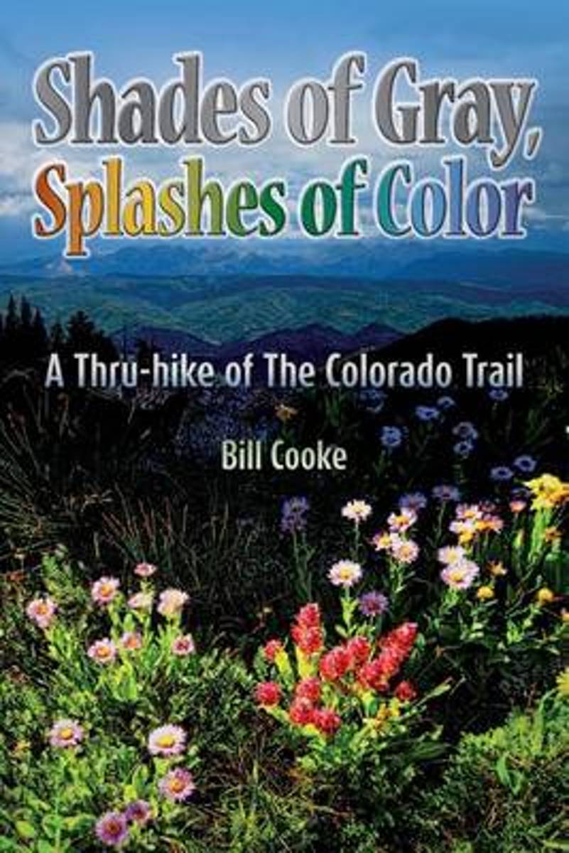
- Shades of Gray, Splashes of Color
- A Thru-hike of The Colorado Trail Leer más
- Also available from:
- Bol.com, Netherlands
- Bol.com, Belgium
Bol.com
Netherlands
Netherlands
- Shades of Gray, Splashes of Color
- The Colorado Trail wends its way through the Rocky Mountains of the Centennial State, traversing a landscape as changing and diverse as the swirling afternoon clouds presaging the daily summer thunderstorms. Shades of Gray, Splashes of Color narrates Bill Cookes 2011 hike of this 486-mile trail, the length of which was a personal high for him... Leer más
Bol.com
Belgium
Belgium
- Shades of Gray, Splashes of Color
- The Colorado Trail wends its way through the Rocky Mountains of the Centennial State, traversing a landscape as changing and diverse as the swirling afternoon clouds presaging the daily summer thunderstorms. Shades of Gray, Splashes of Color narrates Bill Cookes 2011 hike of this 486-mile trail, the length of which was a personal high for him... Leer más
Bol.com
Netherlands
Netherlands
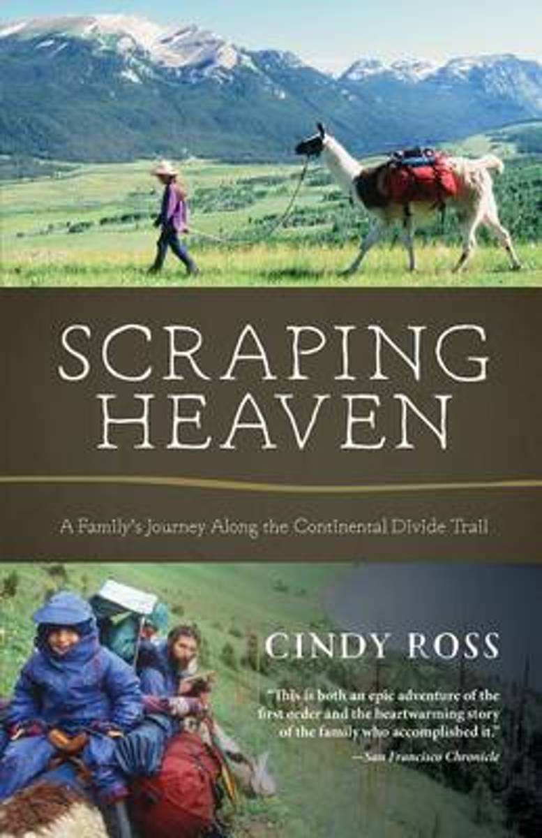
- Scraping Heaven
- More than 3,000 miles of trail by foot and mountain bikes with llamas and toddlers . . .What could go wrong? Scraping Heaven is the story of a family's adventurous trek over the rooftop of North America, a warm and heartfelt account with a powerful message for parents, long-distance hikers, and outdoor adventurers alike. The Continental Divide... Leer más
- Also available from:
- Bol.com, Belgium
Bol.com
Belgium
Belgium
- Scraping Heaven
- More than 3,000 miles of trail by foot and mountain bikes with llamas and toddlers . . .What could go wrong? Scraping Heaven is the story of a family's adventurous trek over the rooftop of North America, a warm and heartfelt account with a powerful message for parents, long-distance hikers, and outdoor adventurers alike. The Continental Divide... Leer más
Bol.com
Netherlands
Netherlands
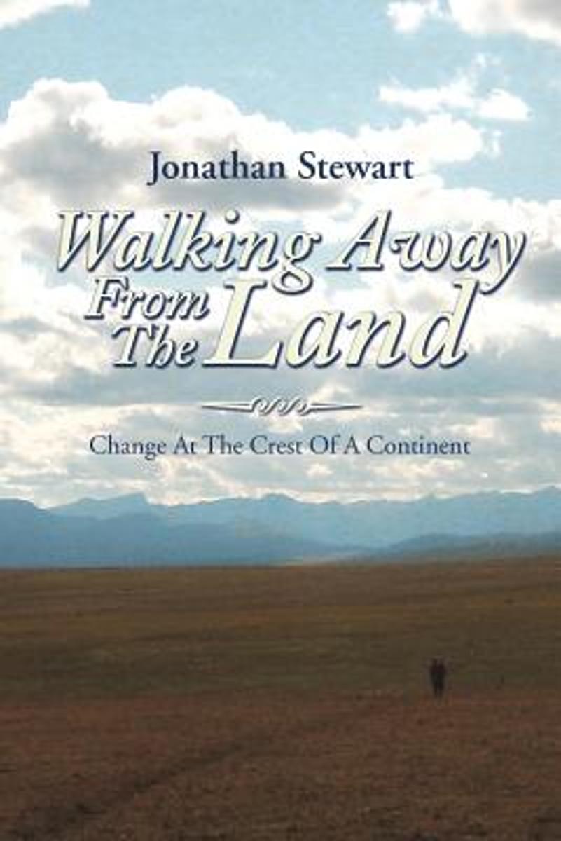
- Walking Away from the Land
- Walking Away from the Land focuses on the rapid cultural and climatic changes occurring at the crest of the North American continent. They are challenging the survival of our forests, grasslands, native wildlife, and our very civilization. This book details a three-summer Odyssey hiking the length of the Continental Divide Trail from the... Leer más
- Also available from:
- Bol.com, Belgium
Bol.com
Belgium
Belgium
- Walking Away from the Land
- Walking Away from the Land focuses on the rapid cultural and climatic changes occurring at the crest of the North American continent. They are challenging the survival of our forests, grasslands, native wildlife, and our very civilization. This book details a three-summer Odyssey hiking the length of the Continental Divide Trail from the... Leer más
Bol.com
Netherlands
Netherlands
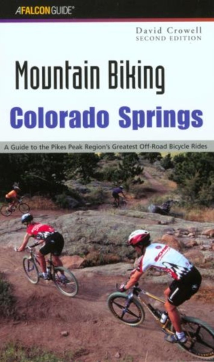
- Mountain Biking Colorado Springs
- Mountain bikers, beginner to expert, all share a common need--a place to ride. Mountain Biking Colorado Springs gives fat-tire enthusiasts the skinny on where to ride. Here are 50 of the best rides around Colorado Springs, Woodland Park, Canon City, San Isabel National Forest, and Wet Mountain Valley, ranging from easy road rides to smooth... Leer más
- Also available from:
- Bol.com, Belgium
Bol.com
Belgium
Belgium
- Mountain Biking Colorado Springs
- Mountain bikers, beginner to expert, all share a common need--a place to ride. Mountain Biking Colorado Springs gives fat-tire enthusiasts the skinny on where to ride. Here are 50 of the best rides around Colorado Springs, Woodland Park, Canon City, San Isabel National Forest, and Wet Mountain Valley, ranging from easy road rides to smooth... Leer más

- Also available from:
- Bol.com, Netherlands
- Bol.com, Belgium
Bol.com
Netherlands
Netherlands
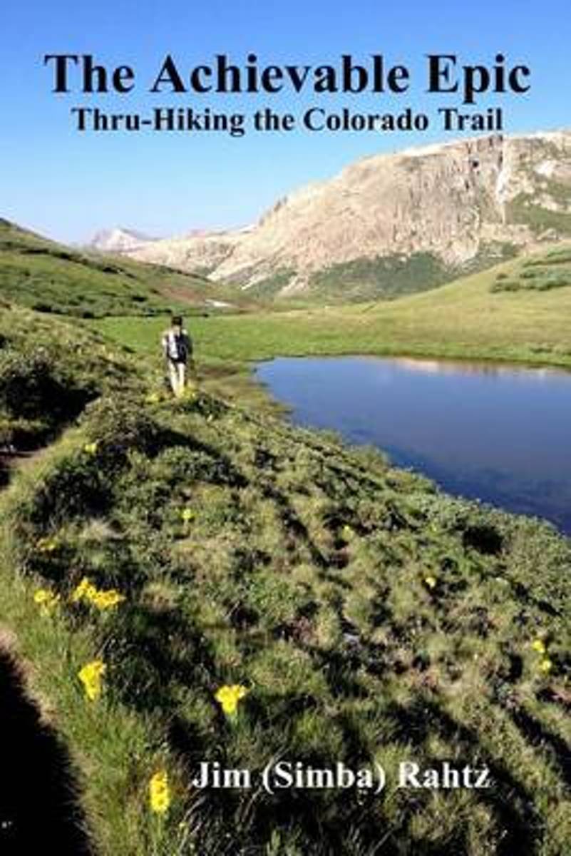
- The Achievable Epic
- Multiple Award Winner: 2015 Outdoor Writers of Ohio "Outstanding Media Achievement and Best Series of Photos."Inside many of us, there is a need, often suppressed, to accomplish something epic. For those that backpack, the dream is likely a thru-hike of the Appalachian Trail. Unfortunately, the reality is that spending six months on a hike is... Leer más
Bol.com
Belgium
Belgium
- The Achievable Epic
- Multiple Award Winner: 2015 Outdoor Writers of Ohio "Outstanding Media Achievement and Best Series of Photos."Inside many of us, there is a need, often suppressed, to accomplish something epic. For those that backpack, the dream is likely a thru-hike of the Appalachian Trail. Unfortunately, the reality is that spending six months on a hike is... Leer más

- Also available from:
- Bol.com, Netherlands
- Bol.com, Belgium
Bol.com
Netherlands
Netherlands
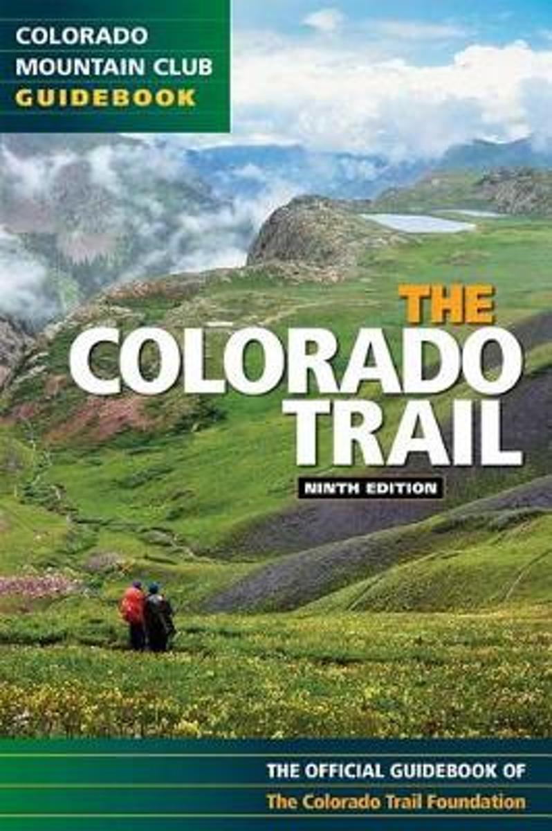
- The Colorado Trail
- Exploring all 468 miles of the Colorado Trail, this official guidebook is updated with the latest information on dozens of side trips, nearby towns, natural history, and safety considerations. Includes handy trip logs and full-color maps with GPS coordinates for each of the 28 segments. 86 color photos. Leer más
Bol.com
Belgium
Belgium
- The Colorado Trail
- Exploring all 468 miles of the Colorado Trail, this official guidebook is updated with the latest information on dozens of side trips, nearby towns, natural history, and safety considerations. Includes handy trip logs and full-color maps with GPS coordinates for each of the 28 segments. 86 color photos. Leer más
Mapas

Stanfords
United Kingdom
United Kingdom
- Banyoles - Besalu - Rocacorba
- Topographic survey of Catalonia at 1:25,000 from the Institut Cartogràfic i Geològic de Catalunya, an attractive alternative to Spain’s national topographic survey at this scale, offering a much larger area per sheet with extensive tourist information and vivid presentation of vegetation and land use.These large, detailed maps have contours at... Leer más
Stanfords
United Kingdom
United Kingdom
- Tortosa
- Topographic survey of Catalonia at 1:25,000 from the Institut Cartogràfic i Geològic de Catalunya, an attractive alternative to Spain’s national topographic survey at this scale, offering a much larger area per sheet with extensive tourist information and vivid presentation of vegetation and land use.These large, detailed maps have contours at... Leer más
Stanfords
United Kingdom
United Kingdom
- Muntanyes de Prades
- Topographic survey of Catalonia at 1:25,000 from the Institut Cartogràfic i Geològic de Catalunya, an attractive alternative to Spain’s national topographic survey at this scale, offering a much larger area per sheet with extensive tourist information and vivid presentation of vegetation and land use.These large, detailed maps have contours at... Leer más
Stanfords
United Kingdom
United Kingdom
- Montsec de Rúbies - Vall de Barcedana
- Topographic survey of Catalonia at 1:25,000 from the Institut Cartogràfic i Geològic de Catalunya, an attractive alternative to Spain’s national topographic survey at this scale, offering a much larger area per sheet with extensive tourist information and vivid presentation of vegetation and land use.These large, detailed maps have contours at... Leer más
Stanfords
United Kingdom
United Kingdom
- Cadí-Moixeró Natural Park West: la Seu d’Urgell - Vall de la Vansa
- Topographic survey of Catalonia at 1:25,000 from the Institut Cartogràfic i Geològic de Catalunya, an attractive alternative to Spain’s national topographic survey at this scale, offering a much larger area per sheet with extensive tourist information and vivid presentation of vegetation and land use.These large, detailed maps have contours at... Leer más
Stanfords
United Kingdom
United Kingdom
- Flix - Riba-roja d`Ebre
- Topographic survey of Catalonia at 1:25,000 from the Institut Cartogràfic i Geològic de Catalunya, an attractive alternative to Spain’s national topographic survey at this scale, offering a much larger area per sheet with extensive tourist information and vivid presentation of vegetation and land use.These large, detailed maps have contours at... Leer más

Stanfords
United Kingdom
United Kingdom
- Delta de l`Ebre Parc Natural
- Topographic survey of Catalonia at 1:25,000 from the Institut Cartogràfic i Geològic de Catalunya, an attractive alternative to Spain’s national topographic survey at this scale, offering a much larger area per sheet with extensive tourist information and vivid presentation of vegetation and land use.These large, detailed maps have contours at... Leer más
Stanfords
United Kingdom
United Kingdom
- Manresa - Pla de Bages
- Topographic survey of Catalonia at 1:25,000 from the Institut Cartogràfic i Geològic de Catalunya, an attractive alternative to Spain’s national topographic survey at this scale, offering a much larger area per sheet with extensive tourist information and vivid presentation of vegetation and land use.These large, detailed maps have contours at... Leer más

Stanfords
United Kingdom
United Kingdom
- Falset
- Topographic survey of Catalonia at 1:25,000 from the Institut Cartogràfic i Geològic de Catalunya, an attractive alternative to Spain’s national topographic survey at this scale, offering a much larger area per sheet with extensive tourist information and vivid presentation of vegetation and land use.These large, detailed maps have contours at... Leer más
Stanfords
United Kingdom
United Kingdom
- Vall de Núria – Ulldeter
- Topographic survey of Catalonia at 1:25,000 from the Institut Cartogràfic i Geològic de Catalunya, an attractive alternative to Spain’s national topographic survey at this scale, offering a much larger area per sheet with extensive tourist information and vivid presentation of vegetation and land use.These large, detailed maps have contours at... Leer más
Stanfords
United Kingdom
United Kingdom
- Olot - Garrotxa NP Volcanic Zone
- Topographic survey of Catalonia at 1:25,000 from the Institut Cartogràfic i Geològic de Catalunya, an attractive alternative to Spain’s national topographic survey at this scale, offering a much larger area per sheet with extensive tourist information and vivid presentation of vegetation and land use.These large, detailed maps have contours at... Leer más
Stanfords
United Kingdom
United Kingdom
- Cadí-Moixeró Natural Park East: el Moixeró - Túnel del Cadí
- Topographic survey of Catalonia at 1:25,000 from the Institut Cartogràfic i Geològic de Catalunya, an attractive alternative to Spain’s national topographic survey at this scale, offering a much larger area per sheet with extensive tourist information and vivid presentation of vegetation and land use.These large, detailed maps have contours at... Leer más

Stanfords
United Kingdom
United Kingdom
- Figueres - Aiguamolls dels Empordà Natural Park
- Topographic survey of Catalonia at 1:25,000 from the Institut Cartogràfic i Geològic de Catalunya, an attractive alternative to Spain’s national topographic survey at this scale, offering a much larger area per sheet with extensive tourist information and vivid presentation of vegetation and land use.These large, detailed maps have contours at... Leer más
Stanfords
United Kingdom
United Kingdom
- Lleida - Pla de Raimat
- Topographic survey of Catalonia at 1:25,000 from the Institut Cartogràfic i Geològic de Catalunya, an attractive alternative to Spain’s national topographic survey at this scale, offering a much larger area per sheet with extensive tourist information and vivid presentation of vegetation and land use.These large, detailed maps have contours at... Leer más
Stanfords
United Kingdom
United Kingdom
- Costa Brava Central: les Gavarres
- Topographic survey of Catalonia at 1:25,000 from the Institut Cartogràfic i Geològic de Catalunya, an attractive alternative to Spain’s national topographic survey at this scale, offering a much larger area per sheet with extensive tourist information and vivid presentation of vegetation and land use.These large, detailed maps have contours at... Leer más