
England
Descripción
Mapa


Senderos en estado
- A Dales Highway
- Allerdale RambleGPX
- Beacon WayGPX
- Borders Abbeys WayGPX
- Calderdale WayGPX
- Cheshire Ring Canal WalkGPX
- Cleveland WayGPX
- Coast to Coast WalkGPX
- Coleridge WayGPX
- Copper Trail
- Cotswold WayGPX
- Cumbria WayGPX
- Dales WayGPX
- Dartmoor WayGPX
- Downs LinkGPX
- E2GPX
- E8GPX
- Essex WayGPX
- Fen Rivers WayGPX
- Geopark WayGPX
- Greensand Ridge WalkGPX
- Greensand WayGPX
- Guernsey Coastal Path
- Hadrian's WallGPX
- Heart of England WayGPX
- Hereward WayGPX
- High Weald Landscape TrailGPX
- Icknield WayGPX
- Isle of Jersey Coastal Path
- Isle of Man Coastal PathGPX
- Isle of Wight Coastal PathGPX
- Lady Anne's WayGPX
- Lands End to John o'GroatsGPX
- Lea Valley WalkGPX
- Leland TrailGPX
- Liberty TrailGPX
- Limestone LinkGPX
- Limestone WayGPX
- Mendip WayGPX
- Minster WayGPX
- Monarch's WayGPX
- Nene WayGPX
- North Buckinghamshire WayGPX
- North Downs WayGPX
- North Sea TrailGPX
- Northumberland Coast PathGPX
- Offa's Dyke PathGPX
- Oxford Canal WalkGPX
- Oxfordshire WayGPX
- Peddars Way and Norfolk Coast PathGPX
- Pendle WayGPX
- Pennine BridlewayGPX
- Pennine WayGPX
- Quantock GreenwayGPX
- Reivers Way
- Ribble WayGPX
- RidgewayGPX
- Robin Hood WayGPX
- Saint Cuthbert's WayGPX
- Saint Oswald's Way
- Saints WayGPX
- Saxon Shore WayGPX
- Severn WayGPX
- Shakespeare's WayGPX
- Shropshire WayGPX
- Solent WayGPX
- South Downs WayGPX
- South West Coast PathGPX
- Staffordshire WayGPX
- Stour Valley PathGPX
- Suffolk Coast and Heaths Path
- Tamar Valley Discovery TrailGPX
- Tarka TrailGPX
- Teesdale WayGPX
- Thames PathGPX
- Trans Pennine TrailGPX
- Two Moors WayGPX
- Via FrancigenaGPX
- Viking WayGPX
- Wayfarer's WalkGPX
- WealdwayGPX
- Weavers WayGPX
- Windermere WayGPX
- Worcestershire WayGPX
- Wychavon WayGPX
- Yorkshire Wolds WayGPX
Enlaces
Datos
Informes
Guías y mapas
Hospedaje
Organizaciones
Operadores turísticos
GPS
Otro
Libros

Stanfords
United Kingdom
United Kingdom
- DK Eyewitness USA 7/5/20
- Spectacular scenery, vibrant cities and captivating culture - welcome to the USA.Whether you want to hike in breathtaking Yosemite National Park, take a road trip from coast to coast or sample southern soul food in the Deep South, your DK Eyewitness travel guide makes sure you experience all that the USA has to offer. A nation of sublime... Leer más

Stanfords
United Kingdom
United Kingdom
- Pilgrimage: The Great Pilgrim Routes of Britain and Europe
- Shortlisted for a 2018 Edward Stanford Travel Writing Award.Ten historic pilgrim routes of Western Europe, inspiration for today`s long distance walker. Pilgrimage in Europe is thriving on a massive scale. In 1990 the cathedral at Santiago de Compostela recorded less than 5000 pilgrims: today that figure is at least 200,000 a year. Author Derry... Leer más

Stanfords
United Kingdom
United Kingdom
- The National Trust Book of the Countryside
- Explore the British countryside with the National Trust. No organisation knows more about the British countryside than the National Trust, the custodians of some of our most beautiful stretches of land and coastline. Drawing on their expertise, this stunningly illustrated book is a comprehensive guide to the country`s natural heritage. Part One... Leer más

Stanfords
United Kingdom
2020
United Kingdom
2020
- Insight Guides Great Breaks Guernsey (Travel Guide with Free eBook)
- Insight Guides Great Breaks Guernsey Travel made easy. Ask local experts. Inspirational travel guide making the most of the British Isles through clearly laid-out walks and tours, now with free eBook. Explore the best of Guernsey with this unique travel guide, packed full of insider information and stunning images. From making sure you don`t... Leer más

Stanfords
United Kingdom
United Kingdom
- Moon Boston (Second Edition): Neighborhood Walks, Historic Highlights, Beloved Local Spots
- Stroll through history, catch a game at Fenway, or snag a seat at a famous oyster bar: the best of Beantown is yours with Moon Boston.*Navigate the Neighbourhoods: Follow one of our self-guided neighbourhood walks through Back Bay and Cambridge or along the Boston Harbor*Explore the City: Retrace the founders` footsteps on the Freedom Trail or... Leer más

Stanfords
United Kingdom
United Kingdom
- South Downs - 20 Country Walks For All The Family
- Batsford`s Walking Guides is an exciting new gift series of walking books, aimed at the weekend, family walker. These small-format, portable, hardback books have an attractive retro feel, with nostalgic line drawings and hand-drawn maps. Each of the 20 walks have been carefully selected to appeal to family walkers, most are circular and none... Leer más

Stanfords
United Kingdom
United Kingdom
- South Devon Coast - Plymouth to Lyme Regis - Classic Walks - South West Coast Path
- These attractive and cleverly structured guides will give walkers ten of the best short circular walks along each of the five sections of the 630-mile long South West Coast Path in a popular pocket-size format.With clear information, an overview and introduction for each walk, expertly written numbered directions, large scale Ordnance Survey... Leer más

Stanfords
United Kingdom
2019
United Kingdom
2019
- Pennine Way: Edale to Kirk Yetholm
- Britain`s best-known National Trail winds for 256 miles through three National Parks - the Peak District, Yorkshire Dales and Northumberland. This is the 5th edition. This superb footpath showcases Britain`s finest upland scenery, while touching the literary landscape of the Bronte family and Roman history along Hadrian`s Wall. *138 large-scale... Leer más

Stanfords
United Kingdom
United Kingdom
- West Sussex - Year Round Walks
- These 20 circular walks vary in length from 41/2 to 71/2 miles and are enjoyable all year round. The author has divided the routes into seasons to show each at its very best. There are walks over Harting Downs, The Trundle and the South Downs Way, all with superb views; through the majestic woodland of Northpark Copse and Eartham Wood; and... Leer más

Stanfords
United Kingdom
United Kingdom
- Walking The Invisible: Following in the Brontës` Footsteps
- Michael Stewart has been captivated by the Brontës since he was a child, and has travelled all over the north of England in search of their lives and landscapes. Now, he`d like to invite you into the world as they would have seen it. Following in the footsteps of the Brontës across meadow and moor, through village and town,... Leer más

Stanfords
United Kingdom
United Kingdom
- Essex - Pub Walks
- If you enjoy both walking and visiting country pubs this book is for you. It contains 20 circular routes varying in length from 2 to 61/2 miles. At the heart of each walk is a renowned local pub, all of which have been recommended for their good food and warm welcome.The routes include coastal and riverside walks, visits to attractive villages... Leer más

Stanfords
United Kingdom
United Kingdom
- Everybody Loves Porto
- Porto has the look of a city that’s had its ups and downs, but its beauty shines through in tile-covered buildings, unaltered shop fronts from decades past and the winding streets that tumble down to the sparkling Duoro river.But more than just elegant decay, it’s also a city in the ascendant, home to new, young businesses providing a fresh... Leer más

Stanfords
United Kingdom
United Kingdom
- A Journey Through South-East England: Broadstairs to Lewes
- A Journey Through South-East England:Broadstairs to Lewes follows Brian`s latest walking adventures through the South-East of England. Brian has previously walked over 1,000 miles for his last two walking companion guide books, Finding My Place and Walking My Patch. In this book, Brian shares the details of four complex walks: Broadstairs to... Leer más

Stanfords
United Kingdom
2015
United Kingdom
2015
- Dartmoor Walking
- John Earle’s Cicerone guide to Walking on Dartmoor explores one of England’s favourite National Park walking destinations as well as its surrounding areas. Dartmoor has been referred to as one of the last great wildernesses in the country, where it is possible to get further away from civilisation than anywhere else. Its wild, lonely and remote... Leer más
Stanfords
United Kingdom
United Kingdom
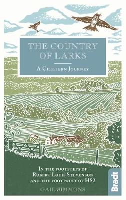
- Country of Larks: A Chiltern Journey: In the footsteps of Robert Louis Stevenson and the footprint of HS2
- Shortlisted for the 2020 Edward Stanford Travel Writing Award`s Lonely Planet Debut Travel Writer of the YearTravel writer and journalist Gail Simmons follows in the footsteps of Robert Louis Stevenson as she walks from High Wycombe in Buckinghamshire to Tring in Hertfordshire via Great Missenden and Wendover, tracing not only the changes in... Leer más
Mapas

Stanfords
United Kingdom
United Kingdom
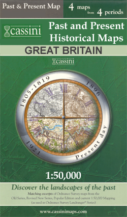
- Newbury and Wantage 1897-1900
- Map No. 174, Newbury and Wantage 1897-1900, in the Cassini Historical Series of old Ordnance Survey mapping of England and Wales at 1:50,000 in a format designed to offer a convenient comparison with the present day coverage from the OS, and most locations in three different editions. Old historical maps have been combined so that the sheet... Leer más
Stanfords
United Kingdom
United Kingdom
- Anglesey / Môn 1922
- Map No. 114, Anglesey / Môn 1942, in the Cassini Historical Series of old Ordnance Survey mapping of England and Wales at 1:50,000 in a format designed to offer a convenient comparison with the present day coverage from the OS, and most locations in three different editions. Old historical maps have been combined so that the sheet lines... Leer más
Stanfords
United Kingdom
United Kingdom
- Market Weighton 1824-1924 (3-map set)
- Map No. 106, Market Weighton 1824-1924 (3-map set), in the Cassini Historical Series of old Ordnance Survey mapping of England and Wales at 1:50,000 in a format designed to offer a convenient comparison with the present day coverage from the OS, and most locations in three different editions. Old historical maps have been combined so that the... Leer más
Stanfords
United Kingdom
United Kingdom
- Plymouth and Launceston 1809-1813
- Map No. 201, Plymouth and Launceston 1809-1813, in the Cassini Historical Series of old Ordnance Survey mapping of England and Wales at 1:50,000 in a format designed to offer a convenient comparison with the present day coverage from the OS, and most locations in three different editions. Old historical maps have been combined so that the sheet... Leer más
Stanfords
United Kingdom
United Kingdom
- Elan Valley and Builth Wells / Cwm Elan a Llanfair-ym-Muallt 1919-1923
- Map No. 147, Elan Valley and Builth Wells / Cwm Elan a Llanfair-ym-Muallt 1919-1923, in the Cassini Historical Series of old Ordnance Survey mapping of England and Wales at 1:50,000 in a format designed to offer a convenient comparison with the present day coverage from the OS, and most locations in three different editions. Old historical maps... Leer más
Stanfords
United Kingdom
United Kingdom
- The Black Mountains / Y Mynyddoedd Duon 1830-1833
- Map No. 161, The Black Mountains / Y Mynyddoedd Duon 1830-1833, in the Cassini Historical Series of old Ordnance Survey mapping of England and Wales at 1:50,000 in a format designed to offer a convenient comparison with the present day coverage from the OS, and most locations in three different editions. Old historical maps have been combined... Leer más
Stanfords
United Kingdom
United Kingdom
- Milton Keynes and Newport Pagnell Past and Present
- Milton Keynes and Newport Pagnell in the Cassini Past and Present map series which covers town and cities of England and Wales and offers a unique way of tracing their history and expansion by showing four different periods of their development using Ordnance Survey mapping from the mid-19th century, the late 19th century, the 1920s and the... Leer más
Stanfords
United Kingdom
United Kingdom
- Snowdon / Yr Wyddfa 1840-1922 (3-map set)
- Map No. 115, Snowdon / Yr Wyddfa 1840-1922 (3-map set), in the Cassini Historical Series of old Ordnance Survey mapping of England and Wales at 1:50,000 in a format designed to offer a convenient comparison with the present day coverage from the OS, and most locations in three different editions. Old historical maps have been combined so that... Leer más

Stanfords
United Kingdom
United Kingdom
- Yorkshire Dales Mountain Biking: Classic Pennine Trails
- Yorkshire Dales Mountain Biking features 26 rides between 10 and 43 kilometres in length in one of the UK`s most MTB-friendly national parks.The routes make the most of the Dales` superb network of stone-based trails, rideable in all seasons. Classic loops take in the best of Swaledale, a tour of Ingleborough, big days around Whernside and... Leer más
Stanfords
United Kingdom
United Kingdom
- Snowdon / Yr Wyddfa 1922
- Map No. 115, Snowdon / Yr Wyddfa 1922, in the Cassini Historical Series of old Ordnance Survey mapping of England and Wales at 1:50,000 in a format designed to offer a convenient comparison with the present day coverage from the OS, and most locations in three different editions. Old historical maps have been combined so that the sheet lines... Leer más
Stanfords
United Kingdom
United Kingdom
- Denbigh and Colwyn Bay / Dinbych a Bae Colwyn 1902-1903
- Map No. 116, Denbigh and Colwyn Bay / Dinbych a Bae Colwyn 1902-1903, in the Cassini Historical Series of old Ordnance Survey mapping of England and Wales at 1:50,000 in a format designed to offer a convenient comparison with the present day coverage from the OS, and most locations in three different editions. Old historical maps have been... Leer más
Stanfords
United Kingdom
United Kingdom
- Aberystwyth and Machynlleth 1833-1837
- Map No. 135, Aberystwyth and Machynlleth 1833-1837, in the Cassini Historical Series of old Ordnance Survey mapping of England and Wales at 1:50,000 in a format designed to offer a convenient comparison with the present day coverage from the OS, and most locations in three different editions. Old historical maps have been combined so that the... Leer más
Stanfords
United Kingdom
United Kingdom
- Malton & Pickering 1924-1925
- Map No. 100, Malton and Pickering 1924-1925, in the Cassini Historical Series of old Ordnance Survey mapping of England and Wales at 1:50,000 in a format designed to offer a convenient comparison with the present day coverage from the OS, and most locations in three different editions.Old historical maps have been combined so that the sheet... Leer más
Stanfords
United Kingdom
United Kingdom
- York and Selby 1824-1858
- Map No. 105, York and Selby 1840-1858, in the Cassini Historical Series of old Ordnance Survey mapping of England and Wales at 1:50,000 in a format designed to offer a convenient comparison with the present day coverage from the OS, and most locations in three different editions. Old historical maps have been combined so that the sheet lines... Leer más

Stanfords
United Kingdom
United Kingdom
- Wolverhampton Past and Present
- Wolverhampton in the Cassini Past and Present map series which covers town and cities of England and Wales and offers a unique way of tracing their history and expansion by showing four different periods of their development using Ordnance Survey mapping from the mid-19th century, the late 19th century, the 1920s and the present day. Coverage... Leer más