
Pennines
Descripción
The "Backbone of England" is a long, continues mountain range stretching from the Peak District in central England to the Cheviot Hills bordering with Scotland. Many long distance trails can be found here, and best known of course is the Pennine Way, the first National Trail, that runs the complete length of it.
The Pennines include many other sounding names, like the Pak District, the Yorkshire Dales, the Northumberland National Park. Much of the area is open and wild, which makes long distance hiking more strenuous than elsewhere in England.
Among the long distance trails here, the Coast to Coast Walk is one of the best known. There are many more, refer to the list below.
Senderos en región
Enlaces
Datos
Informes
Guías y mapas
Hospedaje
Organizaciones
Operadores turísticos
GPS
Otro
Libros

Stanfords
United Kingdom
2019
United Kingdom
2019
- Pennine Way: Edale to Kirk Yetholm
- Britain`s best-known National Trail winds for 256 miles through three National Parks - the Peak District, Yorkshire Dales and Northumberland. This is the 5th edition. This superb footpath showcases Britain`s finest upland scenery, while touching the literary landscape of the Bronte family and Roman history along Hadrian`s Wall. *138 large-scale... Leer más
Stanfords
United Kingdom
United Kingdom
- Yorkshire Dales and South Pennines Walks In a Box: The region`s best walks on pocketable cards, revised and updated
- The best Yorkshire Dales walks in one handy box. Immerse yourself in the Yorkshire Dales and South Pennines` wonderful landscape with this unique collection of walks on pocketable cards. In this boxed collection of walking cards you`ll find a happy mix of routes around the Yorkshire Dales and South Pennines. From child-friendly strolls to... Leer más

Stanfords
United Kingdom
United Kingdom
- Nevermind the Quantocks
- `Every one of us knows the moment when the simple act of putting one foot in front of another stops being a method of propulsion and becomes an adventure.` In this hilarious and heart-warming collection of essays, writer and broadcaster Stuart Maconie reflects on a life spent exploring the British countryside on foot. From the splendour of the... Leer más

Stanfords
United Kingdom
United Kingdom
- Walker`s Britain in a Box: Third Expanded Edition
- WALKS FOR EVERYONEMost are easy half-day circular routes, but a few are more challenging. Some are two-day walks on folding four-page cards, ideal for a short walking break.TRANSPARENT SLEEVE PROVIDEDIf it rains, read the card through the transparent plastic sleeve.CHARMING PLACES TO STAYWalks near charming places to stay, some offering onward... Leer más

Stanfords
United Kingdom
United Kingdom
- Teesdale & Weardale: Short Scenic Walks
- This brand-new title is one of three concurrent additions to the updated series of Paul Hannon`s `Short Scenic Walks` guidebooks. The principal feature is that all walks are less than five miles in length, offering a perfect half day`s stroll for families, casual walkers and all who want to enjoy a leisurely exploration of Britain`s outstanding... Leer más

Stanfords
United Kingdom
2020
United Kingdom
2020
- Hadrian`s Wall Path
- Trailblazer British Walking Guide, two-way edition with routes re-walked from Bowness-on-Solway to Wallsend (Newcastle) and Wallsend (Newcastle) to Bowness-on-Solway. All-in-one guide to walking Hadrian`s Wall Path National Trail. Hadrian`s Wall Path, 84 miles from end to end, follows the course of northern Europe`s largest surviving Roman... Leer más

Stanfords
United Kingdom
United Kingdom
- Cambridge, Newmarket & Saffron Walden OS Landranger Active Map 154 (waterproof)
- Parts of Cambridgeshire, Suffolk and Essex with Cambridge, Newmarket and Saffron Walden, including part of the E2 European Long-distance path, on a waterproof and tear-resistant OS Active version of map No. 154 from the Ordnance Survey’s Landranger series at 1:50,000, with contoured and GPS compatible topographic mapping plus tourist... Leer más

Stanfords
United Kingdom
United Kingdom
- Bury St Edmunds, Sudbury & Stowmarket OS Landranger Active Map 155 (waterproof)
- Suffolk around Bury St Edmunds, Sudbury and Stowmarket, including part of the E2 European Long-distance path, on a waterproof and tear-resistant OS Active version of map No. 155 from the Ordnance Survey’s Landranger series at 1:50,000, with contoured and GPS compatible topographic mapping plus tourist information.MOBILE DOWNLOADS: As well as... Leer más

Stanfords
United Kingdom
United Kingdom
- North York Moors Western OS Explorer Active Map OL26 (waterproof)
- The western part of the North York Moors National Park on a detailed topographic and GPS compatible map OL26, waterproof version, from the Ordnance Survey’s 1:25,000 Explorer series. Coverage extends from Ampleforth in the south northwards to Saltburn-by-the-Sea, and from Ingleby Arncliffe to Danby, Castleton and Hutton-le-Hole, and includes... Leer más

Stanfords
United Kingdom
United Kingdom
- Maidstone, Royal Tunbridge Wells, Sevenoaks & Tonbridge OS Landranger Active Map 188 (waterproof)
- Maidstone, Tunbridge Wells and the High Weald area, including a section of the North Downs Way / E2 European Long-distance Path, on a waterproof and tear-resistant OS Active version of map No. 188 from the Ordnance Survey’s Landranger series at 1:50,000, with contoured and GPS compatible topographic mapping plus tourist information.MOBILE... Leer más

Stanfords
United Kingdom
United Kingdom
- Cheltenham, Cirencester & Stow-on-the-Wold OS Landranger Active Map 163 (waterproof)
- Cheltenham and Cirencester area, including sections of the Thames Path, the Cotswold Way and the E2 European Long-distance Path, on a waterproof and tear-resistant OS Active version of map No. 163 from the Ordnance Survey’s Landranger series at 1:50,000, with contoured and GPS compatible topographic mapping plus tourist information.MOBILE... Leer más

Stanfords
United Kingdom
United Kingdom
- Ely, Wisbech & Downham Market OS Landranger Active Map 143 (waterproof)
- Cambridgeshire around Ely, Wisbech and Downham Market, including part of the E2 European Long-distance Path, on a waterproof and tear-resistant OS Active version of map No. 143 from the Ordnance Survey’s Landranger series at 1:50,000, with contoured and GPS compatible topographic mapping plus tourist information.MOBILE DOWNLOADS: As well as the... Leer más

Stanfords
United Kingdom
United Kingdom
- Oxford, Chipping Norton & Bicester OS Landranger Active Map 164 (waterproof)
- Oxford area, including sections of the Thames Path and the E2 European Long-distance Path, on a waterproof and tear-resistant OS Active version of map No. 164 from the Ordnance Survey’s Landranger series at 1:50,000, with contoured and GPS compatible topographic mapping plus tourist information.MOBILE DOWNLOADS: As well as the physical edition... Leer más

Stanfords
United Kingdom
United Kingdom
- Stratford-upon-Avon, Warwick & Banbury OS Landranger Active Map 151 (waterproof)
- The area between Stratford-upon-Avon, Warwick and Banbury, including the northern part of the Cotswold Hills and part of the Cotswold Way / E2 European Long-distance Path, on a waterproof and tear-resistant OS Active version of map No. 151 from the Ordnance Survey’s Landranger series at 1:50,000, with contoured and GPS compatible topographic... Leer más

Stanfords
United Kingdom
United Kingdom
- Ipswich, The Naze & Clacton-on-Sea OS Landranger Active Map 169 (waterproof)
- Ipswich with Harwich and The Naze area, including part of the E2 European Long-distance Path, on a waterproof and tear-resistant OS Active version of map No. 169 from the Ordnance Survey’s Landranger series at 1:50,000, with contoured and GPS compatible topographic mapping plus tourist information.MOBILE DOWNLOADS: As well as the physical... Leer más
Mapas

Stanfords
United Kingdom
United Kingdom
- Sheffield and Huddersfield 1903
- Map No. 110, Sheffield and Huddersfield 1903, in the Cassini Historical Series of old Ordnance Survey mapping of England and Wales at 1:50,000 in a format designed to offer a convenient comparison with the present day coverage from the OS, and most locations in three different editions. Old historical maps have been combined so that the sheet... Leer más
Stanfords
United Kingdom
United Kingdom
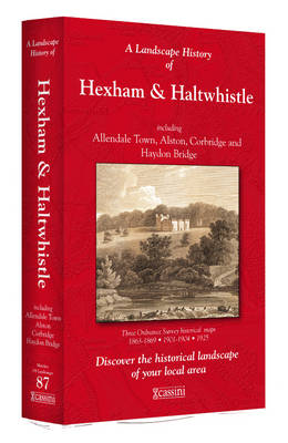
- Hexham and Haltwhistle 1863-1925 (3-map set)
- Map No. 87, Hexham and Haltwhistle 1983-1925 (3-map set), in the Cassini Historical Series of old Ordnance Survey mapping of England and Wales at 1:50,000 in a format designed to offer a convenient comparison with the present day coverage from the OS, and most locations in three different editions. Old historical maps have been combined so that... Leer más

Stanfords
United Kingdom
United Kingdom
- 2000 Plus England: 254 Summits over 2000ft.
- The 2000 Plus map of England showing summits over 2000ft (609.6m), together with markings for subsidiary tops and minor summits, combining them into 16 groups listed with full details and presented with mountain profiles.The main map at 1:250,000 shows the Pennines, with three insets at 1:350,000 covering the Peak District, Dartmoor and the... Leer más
Stanfords
United Kingdom
United Kingdom
- Sheffield and Huddersfield 1840-1841
- Map No. 110, Sheffield and Huddersfield 1840-1841, in the Cassini Historical Series of old Ordnance Survey mapping of England and Wales at 1:50,000 in a format designed to offer a convenient comparison with the present day coverage from the OS, and most locations in three different editions. Old historical maps have been combined so that the... Leer más
Stanfords
United Kingdom
United Kingdom
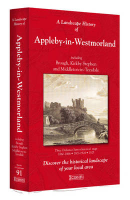
- Appleby-in-Westmorland 1860-1925 (3-map set)
- Map No. 91, Appleby-in-Westmorland 1860-1925 (3-map set), in the Cassini Historical Series of old Ordnance Survey mapping of England and Wales at 1:50,000 in a format designed to offer a convenient comparison with the present day coverage from the OS, and most locations in three different editions. Old historical maps have been combined so that... Leer más
Stanfords
United Kingdom
United Kingdom
- Sheffield and Huddersfield 1923-1925
- Map No. 110, Sheffield and Huddersfield 1923-1925, in the Cassini Historical Series of old Ordnance Survey mapping of England and Wales at 1:50,000 in a format designed to offer a convenient comparison with the present day coverage from the OS, and most locations in three different editions. Old historical maps have been combined so that the... Leer más
Stanfords
United Kingdom
United Kingdom
- Berwick-upon-Tweed 1901
- Map No. 75, Berwick-upon-Tweed 1901, in the Cassini Historical Series of old Ordnance Survey mapping of England and Wales at 1:50,000 in a format designed to offer a convenient comparison with the present day coverage from the OS, and most locations in three different editions. Old historical maps have been combined so that the sheet lines... Leer más
Stanfords
United Kingdom
United Kingdom
- Wensleydale and Upper Wharfedale 1852-1925 (3-map set)
- Map No. 98, Wensleydale and Upper Wharfedale 1852-1925 (3-map set), in the Cassini Historical Series of old Ordnance Survey mapping of England and Wales at 1:50,000 in a format designed to offer a convenient comparison with the present day coverage from the OS, and most locations in three different editions. Old historical maps have been... Leer más

Stanfords
United Kingdom
United Kingdom
- Transrhodopi - Long distance hiking and biking trail From Trigrad to Ivaylovgrad
- Western Rhodope Mountains at 1:100,000 on a contoured GPS compatible map from Domino extending from just west of the Pirin National Park to Asenovgrad in the north-east. The map is double-sided with a good overlap between the sides. Topography is shown by contours at 50m intervals with relief shading and spot heights, plus colouring for... Leer más

Stanfords
United Kingdom
United Kingdom
- Peak District - Dark Peak A-Z Adventure Atlas
- Peak District: Dark Peak Adventure Atlas at 1:25,000 in a series of handy A5 size Adventure Atlases from Geographers` A-Z Map Company with cartography from the Ordnance Survey’s Explorer series. Coverage includes Glossop, Hadfield, Stocksbridge, Chapel-en-le-Frith, Hope, Bamford, New Mills, Castleton, Bradwell, Hayfield, Tintwistle, Greenfield,... Leer más
Stanfords
United Kingdom
United Kingdom
- Berwick-upon-Tweed 1865-1869
- Map No. 75, Berwick-upon-Tweed 1865-1869, in the Cassini Historical Series of old Ordnance Survey mapping of England and Wales at 1:50,000 in a format designed to offer a convenient comparison with the present day coverage from the OS, and most locations in three different editions. Old historical maps have been combined so that the sheet lines... Leer más
Stanfords
United Kingdom
United Kingdom
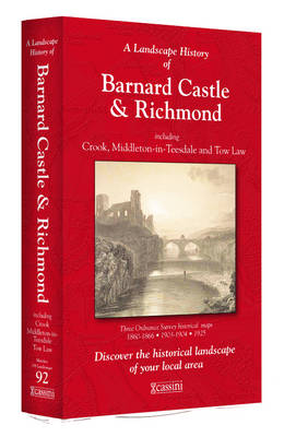
- Barnard Castle and Richmond 1860-1925 (3-map set)
- Map No. 92, Barnard Castle and Richmond 1860-1925 (3-map set), in the Cassini Historical Series of old Ordnance Survey mapping of England and Wales at 1:50,000 in a format designed to offer a convenient comparison with the present day coverage from the OS, and most locations in three different editions. Old historical maps have been combined so... Leer más
Stanfords
United Kingdom
United Kingdom
- Berwick-upon-Tweed 1926
- Map No. 75, Berwick-upon-Tweed 1926, in the Cassini Historical Series of old Ordnance Survey mapping of England and Wales at 1:50,000 in a format designed to offer a convenient comparison with the present day coverage from the OS, and most locations in three different editions. Old historical maps have been combined so that the sheet lines... Leer más
Stanfords
United Kingdom
United Kingdom
- Cheviot Hills and Kielder Water 1925-1926
- Map No. 80, Cheviot Hills and Kielder Water 1925-1926, in the Cassini Historical Series of old Ordnance Survey mapping of England and Wales at 1:50,000 in a format designed to offer a convenient comparison with the present day coverage from the OS, and most locations in three different editions. Old historical maps have been combined so that... Leer más
Stanfords
United Kingdom
United Kingdom
- Cheviot Hills and Kielder Water 1901
- Map No. 80, Cheviot Hills and Kielder Water 1901, in the Cassini Historical Series of old Ordnance Survey mapping of England and Wales at 1:50,000 in a format designed to offer a convenient comparison with the present day coverage from the OS, and most locations in three different editions. Old historical maps have been combined so that the... Leer más