
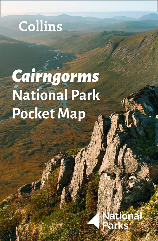
Cairngorms
Descripción
Mountain range in the eastern Highlands of Scotland. The highest of these mountains is named identical: Cairn Gorm, Blue Hill. Highest summit however is Ben Macdui, 1309 m. The mountain range is located between Aviemore and Braemar.
This area is good for walking, both beautiful and wild. The glens are pretty and sometimes spectacular. The mountains themselves can be climbed without technical problems, but require a good physical fitness.
Senderos en región
Enlaces
Datos
Informes
Guías y mapas
Hospedaje
Organizaciones
Operadores turísticos
GPS
Otro
Libros

Stanfords
United Kingdom
2015
United Kingdom
2015
- Glen Esk & Glen Tanar - Aboyne & Mount Keen OS Explorer Map OL54 (paper)
- Glen Esk and Glen Tanar area the Scottish Highlands on a detailed topographic and GPS compatible map OL54, paper version, from the Ordnance Survey’s 1:25,000 Explorer series. Coverage includes part of the Cairngorms National Park with a Munro peak of Mount Keen, the Forest of Birse, Aboyne, a section of the Deeside Way, etc.MOBILE DOWNLOADS:... Leer más
- Also available from:
- De Zwerver, Netherlands

Stanfords
United Kingdom
United Kingdom
- Glen Shee & Braemar - The Cairnwell & Glas Maol OS Explorer Active Map OL52 (waterproof)
- Glen Shee and Braemar area of the Scottish Highlands on a detailed topographic and GPS compatible map OL52, waterproof version, from the Ordnance Survey’s 1:25,000 Explorer series. Coverage includes part of the Cairngorms National Park, 12 Munro peaks including The Cairnwell, Glas Maol and An Socach, a section of the Cateran Trail, etc.MOBILE... Leer más
- Also available from:
- De Zwerver, Netherlands

Stanfords
United Kingdom
United Kingdom
- Loch Laggan & Creag Meagaidh - Corrieyairick Pass OS Explorer Map OL55 (paper)
- Loch Laggan and Creag Meagaidh area of the Scottish Highlands on a detailed topographic and GPS compatible map OL55, paper version, from the Ordnance Survey’s 1:25,000 Explorer series. Coverage includes a section of the Cairngorms National Park, the Corrieyairack Pass and Forest, six Munro peaks including Cael Charn and Carn Liath, Badenoch,... Leer más
- Also available from:
- De Zwerver, Netherlands
Stanfords
United Kingdom
2016
United Kingdom
2016
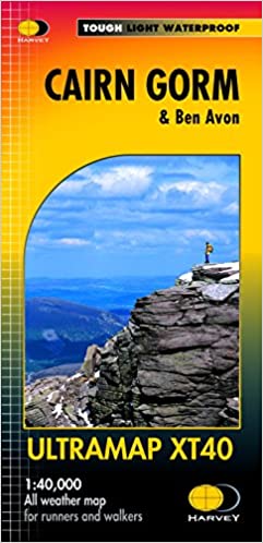
- Cairn Gorm & Ben Avon Harvey Ultramap XT40
- Cairn Gorm and Ben Avon area in the heart of the Scottish Highlands at 1:40,000 on a waterproof and tear-resistant, pocket-size Ultramap from Harvey Map Services with the same cartography as their Superwalker map of the area. The peak of Cairn Gorm is on the eastern side of the map, with coverage extending north to Glanmore and the outskirts of... Leer más
- Also available from:
- De Zwerver, Netherlands

Stanfords
United Kingdom
2015
United Kingdom
2015
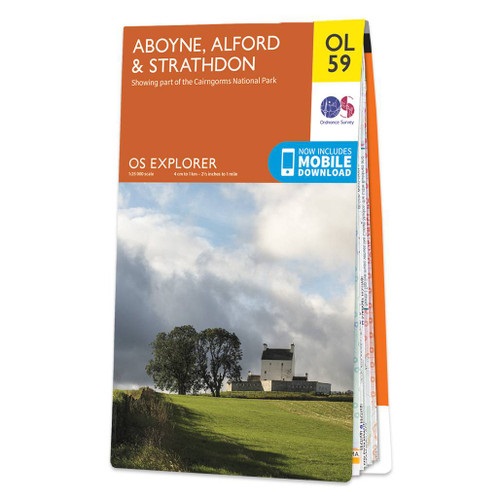
- Aboyne, Alford & Strathdon OS Explorer Map OL59 (paper)
- Aboyne, Alford and Strathdon area of the Scottish Highlands on a detailed topographic and GPS compatible map OL59, paper version, from the Ordnance Survey’s 1:25,000 Explorer series. Coverage includes part of the Cairngorms National Park, Ballater, Lochs Davan and Kinord, the Deeside Way, etc. MOBILE DOWNLOADS: this title and all the other OS... Leer más
- Also available from:
- De Zwerver, Netherlands

Stanfords
United Kingdom
2015
United Kingdom
2015
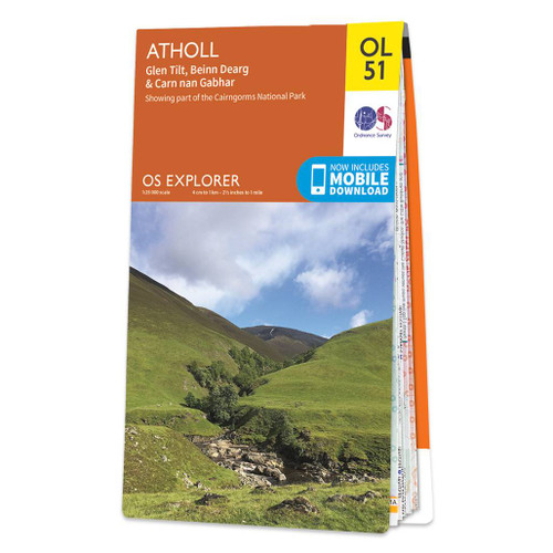
- Atholl - Glen Tilt, Beinn Dearg & Carn nan Gabhar OS Explorer Map OL51 (paper)
- Atholl area the Cairngorms National Park on a detailed topographic and GPS compatible map OL51, paper version, from the Ordnance Survey’s 1:25,000 Explorer series. Coverage includes the Forest of Atholl, Glen Tilt, Glen Garry, 10 Munro peaks including Beinn Dearg, Carn nan Gabhar, A’ Bhuidheanach Bheag, Carn na Caim, etc.MOBILE DOWNLOADS: this... Leer más
- Also available from:
- De Zwerver, Netherlands
De Zwerver
Netherlands
2015
Netherlands
2015

Stanfords
United Kingdom
United Kingdom
- Atholl - Glen Tilt, Beinn Dearg & Carn nan Gabhar OS Explorer Active Map OL51 (waterproof)
- Atholl area the Cairngorms National Park on a detailed topographic and GPS compatible map OL51, waterproof version, from the Ordnance Survey’s 1:25,000 Explorer series. Coverage includes the Grampian Mountains, the Forest of Atholl, Glen Tilt, Glen Garry, 10 Munro peaks including Beinn Dearg, Carn nan Gabhar, A’ Bhuidheanach Bheag, Carn na... Leer más

- Also available from:
- De Zwerver, Netherlands
De Zwerver
Netherlands
2022
Netherlands
2022
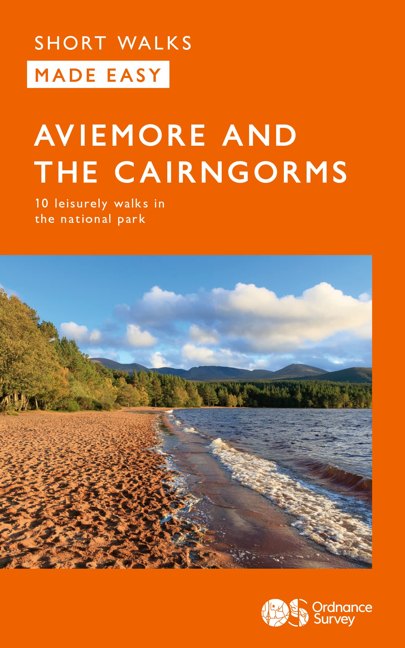
- Wandelgids Aviemore and the Cairngorms | Ordnance Survey
- Short Walks Made Easy Guide to Aviemore and the Cairngorms, featuring 10 outstanding walks designed for a range of abilities in the Cairngorms National Park. Focusing on: • 10 easy going selected walks • Accessible routes • Stunning scenery in quieter areas • Easy parking and public transport • Suitable for dogs • The stories behind each walk •... Leer más

Stanfords
United Kingdom
2012
United Kingdom
2012
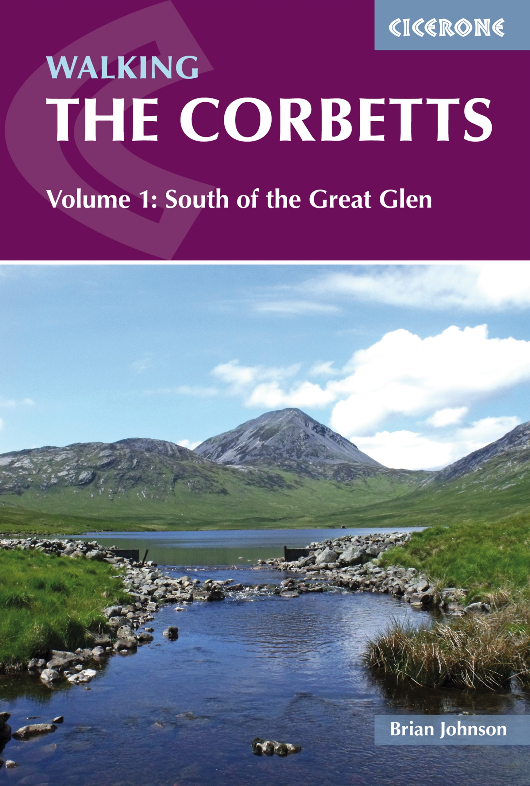
- Corbetts Walking Vol 1: South of the Great Glen
- Walking the Corbetts Volume 1: South of the Great Glen guide from Cicerone Press describes in 95 routes the most interesting ascents of the 112 peaks south of the Fort William - Loch Ness - Inverness line, including the Southern Highlands, Southern Uplands and the islands of Jura and Arran.The Corbetts are Scottish mountains between 2500 and... Leer más
- Also available from:
- The Book Depository, United Kingdom
- De Zwerver, Netherlands

The Book Depository
United Kingdom
2012
United Kingdom
2012
- Walking the Corbetts Vol 1 South of the Great Glen
- Walking the Corbetts describes routes up all 112 Scottish Corbetts (Scotland's 2500-2999ft mountains) south of the Great Glen, covering the Southern Uplands, Southern Highlands, Cairngorms, Jura and Arran. These Scottish hills are every bit as interesting as the Munros, and often clear when the Munros are in cloud. Leer más
De Zwerver
Netherlands
2019
Netherlands
2019
- Wandelgids Walking the Corbetts: Volume 1 | Cicerone
- Walking the Corbetts describes routes up all 112 Scottish Corbetts (Scotland's 2500-2999ft mountains) south of the Great Glen, covering the Southern Uplands, Southern Highlands, Cairngorms, Jura and Arran. These Scottish hills are every bit as interesting as the Munros, and often clear when the Munros are in cloud. Leer más


Stanfords
United Kingdom
United Kingdom
- Lochnagar, Glen Muick & Glen Clova - Ballater & Balmoral OS Explorer Active Map OL53(waterproof)
- Lochnagar, Glen Muick and Glen Clova area of the Cairngorms National Park on a detailed topographic and GPS compatible map OL53, waterproof version, from the Ordnance Survey’s 1:25,000 Explorer series. Coverage includes part of the Deeside and Lochnagar National Scenic Area, 11 Munro peaks including Broad Cairn, Mayar, and Tom Buidhe, Glen... Leer más
- Also available from:
- The Book Depository, United Kingdom


The Book Depository
United Kingdom
United Kingdom
- Bothies, Huts & Howffs in the Hills
- Cairngorms National Park Leer más


Stanfords
United Kingdom
United Kingdom
- Glen Esk & Glen Tanar - Aboyne & Mount Keen OS Explorer Active Map OL54 (waterproof)
- Glen Esk and Glen Tanar area the Scottish Highlands on a detailed topographic and GPS compatible map OL54, waterproof version, from the Ordnance Survey’s 1:25,000 Explorer series. Coverage includes part of the Cairngorms National Park with a Munro peak of Mount Keen, the Forest of Birse, Aboyne, a section of the Deeside Way, etc.MOBILE... Leer más
- Also available from:
- The Book Depository, United Kingdom

Más libros…

Mapas

Stanfords
United Kingdom
2022
United Kingdom
2022
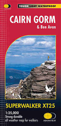
- Cairn Gorm & Ben Avon Harvey Superwalker XT25
- Cairn Gorm and Ben Avon area in the heart of the Scottish Highlands at 1:25,000 on a waterproof and tear-resistant map from Harvey Map Services in their Superwalker series. The peak of Cairn Gorm is on the eastern side of the map, with coverage extending north to Glanmore and the outskirts of Aviemore, west to Achlean and River Feshie and south... Leer más
- Also available from:
- De Zwerver, Netherlands
De Zwerver
Netherlands
2022
Netherlands
2022
- Wandelkaart Cairn Gorm | Harvey Maps
- The Cairn Gorm area in the heart of the Scottish Highlands at 1:25,000 on a waterproof and tear-resistant map from Harvey Map Services in their Superwalker series. The peak of Cairn Gorm is on the eastern side of the map, with coverage extending north to Glanmore and the outskirts of Aviemore, west to Achlean and River Feshie and south to the... Leer más

Stanfords
United Kingdom
2019
United Kingdom
2019
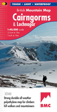
- Cairngorms & Lochnagar Harvey British Mountain Map XT40
- Waterproof mountain map of the Caingorms & Lochnagar from Harvey at 1:40,000, with a geological map of the region on the reverse, and advice on navigating the region safely.*MAIN MAP:* Topography is shown through clear altitude shading, spot heights, contours at 15m intervals, and index contours at 75m intervals. A variety of symbols are used... Leer más
- Also available from:
- De Zwerver, Netherlands
De Zwerver
Netherlands
2019
Netherlands
2019
- Wandelkaart Cairngorms & Lochnagar | Harvey Maps
- Waterproof mountain map of the Caingorms & Lochnagar from Harvey at 1:40,000, with a geological map of the region on the reverse, and advice on navigating the region safely.MAIN MAP: Topography is shown through clear altitude shading, spot heights, contours at 15m intervals, and index contours at 75m intervals. A variety of symbols are used to... Leer más

Stanfords
United Kingdom
United Kingdom
- Cairngorms Reference Map
- Cairngorm Mountains on an overview map from Colin Baxter presenting at 1:85,000 an area from Aviemore and Kincraig in the north-west to Braemar in the south-east. Bold colouring and relief shading shows the topography, with names of numerous peaks, glens, etc.The map indicates main paths in the mountains and facilities available in various... Leer más
Stanfords
United Kingdom
United Kingdom
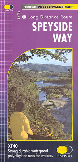
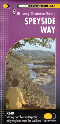
- Speyside Way Harvey National Trail XT40
- Speyside Way, a 123km / 77 miles trail between Buckie on the Moray coast and Aviemore in the Cairngorms National Park or alternatively to Tomintoul, presented at 1:40,000 on a light, waterproof and tear-resistant map from Harvey Map Services. The whole route is covered on five overlapping panels, with small street plans of Buckie, Charlestown... Leer más
- Also available from:
- The Book Depository, United Kingdom
- De Zwerver, Netherlands

The Book Depository
United Kingdom
United Kingdom
- Speyside Way
- Speyside Way, a 123km / 77 miles trail between Buckie on the Moray coast and Aviemore in the Cairngorms National Park or alternatively to Tomintoul, presented at 1:40,000 on a light, waterproof and tear-resistant map from Harvey Map Services. The whole route is covered on five overlapping panels, with small street plans of Buckie, Charlestown... Leer más
De Zwerver
Netherlands
Netherlands
- Wandelkaart Speyside Walk (Schotland) | Harvey Maps
- Speyside Way, a 123km / 77 miles trail between Buckie on the Moray coast and Aviemore in the Cairngorms National Park or alternatively to Tomintoul, presented at 1:40,000 on a light, waterproof and tear-resistant map from Harvey Map Services. The whole route is covered on five overlapping panels, with small street plans of Buckie, Charlestown... Leer más

Stanfords
United Kingdom
United Kingdom
- Rob Roy Way Harvey National Trail XT40
- Rob Roy Way, one of Scotland’s Great Trails from Drymen just north of Glasgow along Loch Tay to Pitlochry on the edge of the Cairngorms National Park presented at 1:40,000 on a light, waterproof and tear-resistant map from Harvey Map Services. The whole route, either 124km/77 miles or 151km/94 miles long depending on which variant one follows,... Leer más
- Also available from:
- The Book Depository, United Kingdom
- De Zwerver, Netherlands

The Book Depository
United Kingdom
United Kingdom
- Rob Roy Way
- Mooie, duidelijke kaart van de Rob Roy Way in Schotland. Geplastificeerd met veel extra informatie en uitsnedes van de route. One of Scotland's Great Trails Rob Roy Way is a walk across part of the Southern Highlands of Scotland taking in some of the most beautiful countryside in the UK. Starting from Drymen it goes north east to finish in... Leer más

De Zwerver
Netherlands
Netherlands
- Wandelkaart Rob Roy Way | Harvey Maps
- Mooie, duidelijke kaart van de Rob Roy Way in Schotland. Geplastificeerd met veel extra informatie en uitsnedes van de route. One of Scotland's Great Trails Rob Roy Way is a walk across part of the Southern Highlands of Scotland taking in some of the most beautiful countryside in the UK. Starting from Drymen it goes north east to finish in... Leer más
De Zwerver
Netherlands
2022
Netherlands
2022