
Munros
Descripción
A popular hobby in the UK is "Munro bagging", the climb of as many Munros as possible. A Munro is a mountain in Scotland over 3000 feet, 914 metres, and the first list was compiled by Sir Hugh Munro in 1891. Currently there are some 290 mountains on this list.
Enlaces
Datos
Informes
Guías y mapas
Hospedaje
Organizaciones
Operadores turísticos
GPS
Otro
Libros

Stanfords
United Kingdom
2004
United Kingdom
2004
- Western Highlands
- This guide features 40 circular walks in the mountain country of the West Highlands. The routes in this volume take from the Rough Bounds of Knoydart and the silver sands of Morar to the ridges of Kintail and the ancient forests of Glen Affric, covering all of the Munros and many other great hills. Each walk section contains a detailed route... Leer más

Stanfords
United Kingdom
2015
United Kingdom
2015
- Torridon Walking
- Walking in Torridon is a Cicerone guide to 52 day walks of differing grades in this area of the Scottish Highlands, including ascent routes for nine Munros, which will enable you to discover the best of remote Torridon and prepare you to range over heather, grass, rock and marsh, without paths or waymarks. Making Shieldaig its base, the book... Leer más

Stanfords
United Kingdom
United Kingdom
- Exploring the Nevis Range and Mamores Scotland: The Complete Guide
- Designed as the most comprehensive guide available for the hill walker exploring the Nevis and Mamore ranges in the Scottish Highlands around Fort William, this book describes in detail the best and most rewarding routes across the area, ranging from peaceful strolls through scenic glens to ascents of the principal Munros (peaks over 3000ft)... Leer más

- Also available from:
- De Zwerver, Netherlands
De Zwerver
Netherlands
2019
Netherlands
2019

Stanfords
United Kingdom
2021
United Kingdom
2021
- Walking the Munros Vol 1 - Southern, Central and Western Highlands
- Half of a two-volume set describing challenging and inspiring routes to climb Scotland`s 282 3000ft+ mountains, this guide covers the southern, central and western Highlands (south of the Great Glen), taking in stunning areas such as Glen Coe, Glen Shee, Lochaber and Mull. 69 demanding and inspiring routes are described, covering 139 Munro... Leer más
- Also available from:
- The Book Depository, United Kingdom
- De Zwerver, Netherlands

The Book Depository
United Kingdom
2021
United Kingdom
2021
- Walking the Munros Vol 1 - Southern, Central and Western Highlands
- Half of a two-volume set describing challenging and inspiring routes to climb Scotland`s 282 3000ft+ mountains, this guide covers the southern, central and western Highlands (south of the Great Glen), taking in stunning areas such as Glen Coe, Glen Shee, Lochaber and Mull. 69 demanding and inspiring routes are described, covering 139 Munro... Leer más
De Zwerver
Netherlands
2021
Netherlands
2021
- Wandelgids Walking The Munros Vol 1 Southern, Central and Western Highlands - Schotland | Cicerone
- Half of a two-volume set describing challenging and inspiring routes to climb Scotland`s 282 3000ft+ mountains, this guide covers the southern, central and western Highlands (south of the Great Glen), taking in stunning areas such as Glen Coe, Glen Shee, Lochaber and Mull. 69 demanding and inspiring routes are described, covering 139 Munro... Leer más

Stanfords
United Kingdom
2012
United Kingdom
2012
- Corbetts Walking Vol 1: South of the Great Glen
- Walking the Corbetts Volume 1: South of the Great Glen guide from Cicerone Press describes in 95 routes the most interesting ascents of the 112 peaks south of the Fort William - Loch Ness - Inverness line, including the Southern Highlands, Southern Uplands and the islands of Jura and Arran.The Corbetts are Scottish mountains between 2500 and... Leer más
- Also available from:
- The Book Depository, United Kingdom
- De Zwerver, Netherlands

The Book Depository
United Kingdom
2012
United Kingdom
2012
- Walking the Corbetts Vol 1 South of the Great Glen
- Walking the Corbetts describes routes up all 112 Scottish Corbetts (Scotland's 2500-2999ft mountains) south of the Great Glen, covering the Southern Uplands, Southern Highlands, Cairngorms, Jura and Arran. These Scottish hills are every bit as interesting as the Munros, and often clear when the Munros are in cloud. Leer más
De Zwerver
Netherlands
2019
Netherlands
2019
- Wandelgids Walking the Corbetts: Volume 1 | Cicerone
- Walking the Corbetts describes routes up all 112 Scottish Corbetts (Scotland's 2500-2999ft mountains) south of the Great Glen, covering the Southern Uplands, Southern Highlands, Cairngorms, Jura and Arran. These Scottish hills are every bit as interesting as the Munros, and often clear when the Munros are in cloud. Leer más

Stanfords
United Kingdom
2019
United Kingdom
2019
- Fannichs - Seana Bhraigh & Ben Wyvis Harvey Superwalker XT25
- Detailed map for hillwalkers of the Fannichs ridge at the popular 1:25,000 scale. This is an area located to the south of Ullapool and to the west of Dingwall. Includes the munros Sgurr Mor, Beinn Dearg and Seana Bhraigh.Includes an inset of the Munro, Ben Wyvis.Shows 17 Munros, 3 Corbetts and 3 Grahams.100% waterproof Leer más
- Also available from:
- The Book Depository, United Kingdom
- De Zwerver, Netherlands

De Zwerver
Netherlands
2019
Netherlands
2019
- Wandelkaart Fannichs Seana Bhraigh & Ben Wyvis | Harvey Maps
- Seana Bhraigh & Ben Wyvis Leer más


The Book Depository
United Kingdom
United Kingdom
- Munros and Corbetts Pocket Map
- Discover Scotland's Highest Peaks Leer más


- Also available from:
- De Zwerver, Netherlands

Stanfords
United Kingdom
2011
United Kingdom
2011
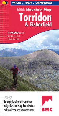
- Torridon & Fisherfield Harvey British Mountain Map XT40
- ”HARVEY British Mountain Maps are a joy to use. The detail and accuracy make them my first choice when I am researching a route or just out on the hills for fun”. Peter Macfarlane, outdoor writer and photographer.Detailed map of the giants of Torridon and the remote hills of Fisherfield on one sheet at 1:40,000 scale.Summit enlargements of... Leer más
- Also available from:
- The Book Depository, United Kingdom
- De Zwerver, Netherlands


- Also available from:
- De Zwerver, Netherlands
Mapas

Stanfords
United Kingdom
United Kingdom
- Loch Lomond & the Trossachs National Park Outdoor Atlas
- Lomond & the Trossachs National Park in an indexed, A5 size, spiral-bound recreational atlas at 1:40,000 from Harvey Map Services, with additional street plans, overview maps showing local peaks or the transport links, lists of Munros and lochs, etc. Topography is shown by contours at 15m intervals, with additional colouring and/or graphics for... Leer más

Stanfords
United Kingdom
United Kingdom
- Two Moors Way Harvey National Trail XT40
- Two Moors Way, a 150km / 93 mile long-distance trail between Lynmouth on the north coast of Devon and Ivybridge near Plymouth, crossing Exmoor and Dartmoor National Parks, presented at 1:40,000 on a light, waterproof and tear-resistant map from Harvey Map Services. The route is shown on six panels.Maps in the Harvey’s series covering Great... Leer más

Stanfords
United Kingdom
United Kingdom
- Bob Graham Round in the Lakeland Fells
- Bob Graham Round, a historic 106km / 66 mile circuit across the fells of the Lake District, presented at 1:40,000 on a light, waterproof and tear-resistant map from Harvey Map Services. First completed by Bob Graham in 1932 and now a popular challenge, the route which takes in 42 Lakeland summits is presented on four overlapping panels.Maps in... Leer más

Stanfords
United Kingdom
United Kingdom
- Nidderdale Way
- Nidderdale Way, an 85km / 53 mile circular long-distance trail in north Yorkshire, presented at 1:40,000 on a light, waterproof and tear-resistant map from Harvey Map Services.Maps in the Harvey’s series covering Great Britain’s national trails and other long-distance footpaths are printed on light, waterproof and tear-resistant synthetic paper... Leer más

Stanfords
United Kingdom
United Kingdom
- The Munros - The Complete Collection of Maps
- In this unique and colourful volume, the deep fascination of the Munros is revealed through Harvey`s beautiful and intricate mapping. From the far reaches of Ben Hope to the mysterious Lochnagar, from the extraordinary complexity of the Cuillin Ridge of Skye to the remate A`Mhaighdean, the fearsome ridges of Liathach and the gaunt towering... Leer más

Stanfords
United Kingdom
United Kingdom
- The Great Trossachs Path Harvey National Trail XT40
- The Great Trossachs Path, a 48km / 30 mile long spur off the West Highlight Way linking Inversnaid on Lomond with Callander presented at 1:40,000 on a GPS compatible, light, waterproof and tear-resistant map from Harvey Map Services. The route which runs along the shores of Loch Arklet, Loch Katrine, Loch Achray and Loch Venachar and links in... Leer más
- Also available from:
- The Book Depository, United Kingdom
- De Zwerver, Netherlands


De Zwerver
Netherlands
Netherlands
- Wandelkaart The Great Trossachs Path | Harvey Maps
- The Great Trossachs Path, a 48km / 30 mile long spur off the West Highlight Way linking Inversnaid on Lomond with Callander presented at 1:40,000 on a GPS compatible, light, waterproof and tear-resistant map from Harvey Map Services. The route which runs along the shores of Loch Arklet, Loch Katrine, Loch Achray and Loch Venachar and links in... Leer más

Stanfords
United Kingdom
United Kingdom
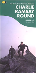
- Charlie Ramsay Round: Ben Nevis, Grey Corries and Mamores
- Charlie Ramsay Round, a route from the Ben Nevis Youth Hostel across the peak itself and 23 more summits including the Grey Corries and Mamores ranges, presented at 1:40,000 on a contoured, GPS compatible map from Harvey Map Services, printed on light, waterproof and tear-resistant paper. Contours are at 15m intervals enhanced by graphic relief... Leer más
- Also available from:
- The Book Depository, United Kingdom
The Book Depository
United Kingdom
United Kingdom
- Charlie Ramsay Round
- Charlie Ramsay Round, a route from the Ben Nevis Youth Hostel across the peak itself and 23 more summits including the Grey Corries and Mamores ranges, presented at 1:40,000 on a contoured, GPS compatible map from Harvey Map Services, printed on light, waterproof and tear-resistant paper. Contours are at 15m intervals enhanced by graphic relief... Leer más

Stanfords
United Kingdom
United Kingdom
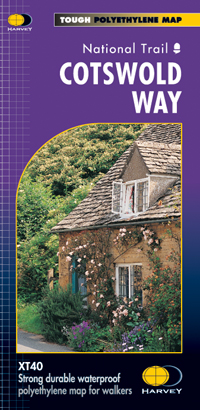
- Cotswold Way Harvey National Trail XT40
- The Cotswold Way, a 164km / 102 mile National Trail from Chipping Campden in the north to Bath in the south, presented at 1:40,000 on a light, waterproof and tear-resistant map from Harvey Map Services. The route is shown on nine panels, with additional small street plans of Chipping Campden and Bath.Maps in the Harvey’s series covering Great... Leer más
- Also available from:
- The Book Depository, United Kingdom
- De Zwerver, Netherlands

The Book Depository
United Kingdom
United Kingdom
- Cotswold Way
- The Cotswold Way, a 164km / 102 mile National Trail from Chipping Campden in the north to Bath in the south, presented at 1:40,000 on a light, waterproof and tear-resistant map from Harvey Map Services. The route is shown on nine panels, with additional small street plans of Chipping Campden and Bath.Maps in the Harvey Leer más
De Zwerver
Netherlands
Netherlands
- Wandelkaart Cotswold Way | Harvey Maps
- The Cotswold Way, a 164km / 102 mile National Trail from Chipping Campden in the north to Bath in the south, presented at 1:40,000 on a light, waterproof and tear-resistant map from Harvey Map Services. The route is shown on nine panels, with additional small street plans of Chipping Campden and Bath.Maps in the Harvey Leer más

Stanfords
United Kingdom
United Kingdom
- Rob Roy Way Harvey National Trail XT40
- Rob Roy Way, one of Scotland’s Great Trails from Drymen just north of Glasgow along Loch Tay to Pitlochry on the edge of the Cairngorms National Park presented at 1:40,000 on a light, waterproof and tear-resistant map from Harvey Map Services. The whole route, either 124km/77 miles or 151km/94 miles long depending on which variant one follows,... Leer más
- Also available from:
- The Book Depository, United Kingdom
- De Zwerver, Netherlands

The Book Depository
United Kingdom
United Kingdom
- Rob Roy Way
- Mooie, duidelijke kaart van de Rob Roy Way in Schotland. Geplastificeerd met veel extra informatie en uitsnedes van de route. One of Scotland's Great Trails Rob Roy Way is a walk across part of the Southern Highlands of Scotland taking in some of the most beautiful countryside in the UK. Starting from Drymen it goes north east to finish in... Leer más

De Zwerver
Netherlands
Netherlands
- Wandelkaart Rob Roy Way | Harvey Maps
- Mooie, duidelijke kaart van de Rob Roy Way in Schotland. Geplastificeerd met veel extra informatie en uitsnedes van de route. One of Scotland's Great Trails Rob Roy Way is a walk across part of the Southern Highlands of Scotland taking in some of the most beautiful countryside in the UK. Starting from Drymen it goes north east to finish in... Leer más

Stanfords
United Kingdom
United Kingdom
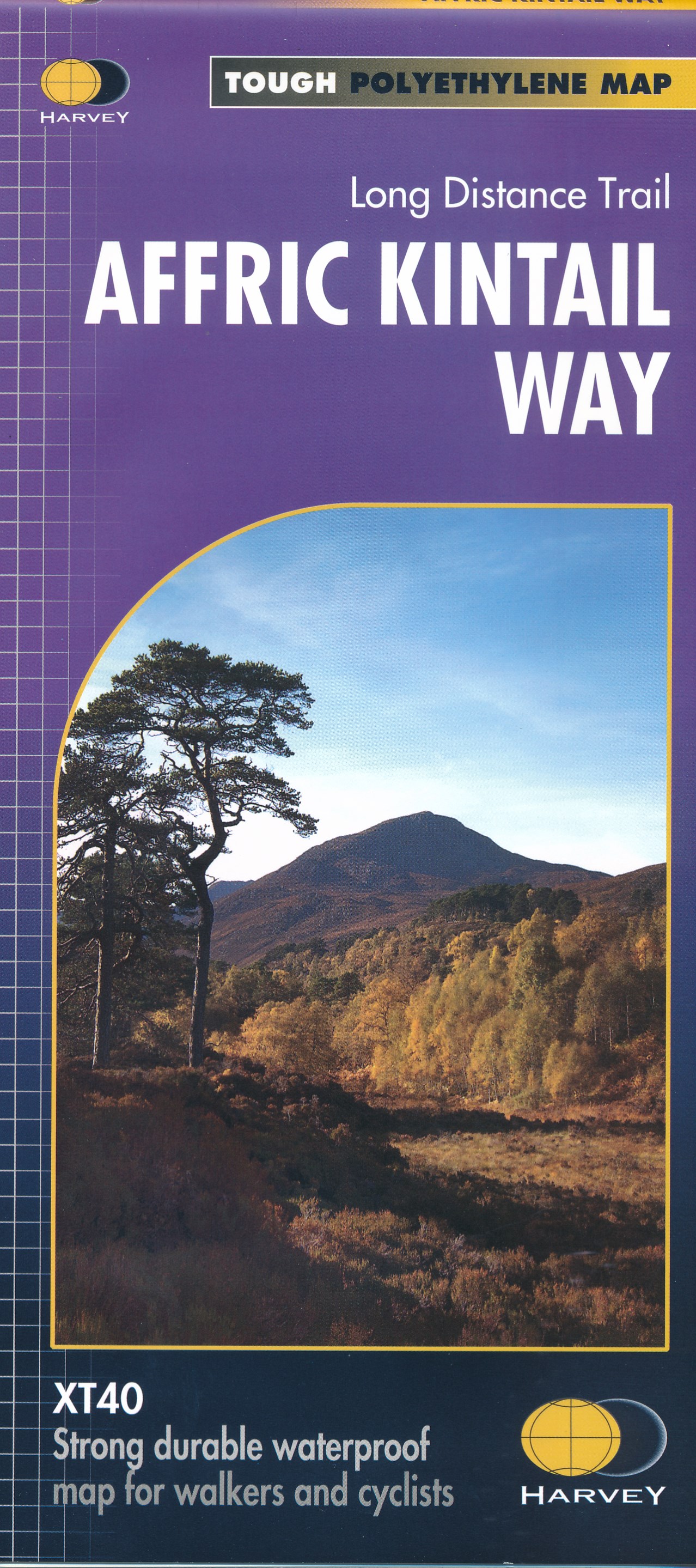
- Affric Kintail Way Harvey National Trail XT40
- The Affric Kintail Way in Scotland, a 71km / 44 mile long-distance trail leading westwards from Drumnadrochit by Loch Ness to Morvich in Kintail by Loch Duich, presented at 1:40,000 on a light, waterproof and tear-resistant map from Harvey Map Services. The route is shown on four panels.Maps in the Harvey’s series covering Great Britain’s... Leer más
- Also available from:
- The Book Depository, United Kingdom
- De Zwerver, Netherlands

The Book Depository
United Kingdom
United Kingdom
- Affric Kintail Way
- The Affric Kintail Way in Scotland, a 71km / 44 mile long-distance trail leading westwards from Drumnadrochit by Loch Ness to Morvich in Kintail by Loch Duich, presented at 1:40,000 on a light, waterproof and tear-resistant map from Harvey Map Services. The route is shown on four panels.Maps in the Harvey Leer más
De Zwerver
Netherlands
Netherlands
- Wandelkaart Affric Kintail Way | Harvey Maps
- The Affric Kintail Way in Scotland, a 71km / 44 mile long-distance trail leading westwards from Drumnadrochit by Loch Ness to Morvich in Kintail by Loch Duich, presented at 1:40,000 on a light, waterproof and tear-resistant map from Harvey Map Services. The route is shown on four panels.Maps in the Harvey Leer más

Stanfords
United Kingdom
United Kingdom
- Cumbria Way Harvey National Trail XT40
- Cumbria Way, a 112km / 70 mile route liking Ulverston and Carlisle across the heart of the Lake District, presented at 1:40,000 on a light, waterproof and tear-resistant map from Harvey Map Services. The route is shown on five overlapping panels, with additional street plans of Carlisle, Keswick, and Ulverston.Maps in the Harvey’s series... Leer más
- Also available from:
- The Book Depository, United Kingdom
- De Zwerver, Netherlands

The Book Depository
United Kingdom
United Kingdom
- Cumbria Way
- Cumbria Way, a 112km / 70 mile route liking Ulverston and Carlisle across the heart of the Lake District, presented at 1:40,000 on a light, waterproof and tear-resistant map from Harvey Map Services. The route is shown on five overlapping panels, with additional street plans of Carlisle, Keswick, and Ulverston.Maps in the Harvey Leer más

De Zwerver
Netherlands
Netherlands
- Wandelkaart Cumbria Way | Harvey Maps
- Cumbria Way, a 112km / 70 mile route liking Ulverston and Carlisle across the heart of the Lake District, presented at 1:40,000 on a light, waterproof and tear-resistant map from Harvey Map Services. The route is shown on five overlapping panels, with additional street plans of Carlisle, Keswick, and Ulverston.Maps in the Harvey Leer más
Stanfords
United Kingdom
United Kingdom
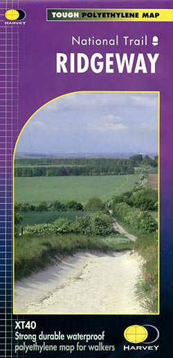
- Ridgeway Harvey National Trail XT40
- The Ridgway, a 139km / 87 mile national trail from Overton Hill in Wiltshire to Ivinghoe Beacon in Buckinghamshire, presented at 1:40,000 on a light, waterproof and tear-resistant map from Harvey Map Services. The route is shown on six overlapping panels.Maps in the Harvey’s series covering Great Britain’s national trails and other... Leer más
- Also available from:
- The Book Depository, United Kingdom
- De Zwerver, Netherlands

The Book Depository
United Kingdom
United Kingdom

De Zwerver
Netherlands
Netherlands
- Wandelkaart - Fietskaart Ridgeway | Harvey Maps
- The Ridgway, a 139km / 87 mile national trail from Overton Hill in Wiltshire to Ivinghoe Beacon in Buckinghamshire, presented at 1:40,000 on a light, waterproof and tear-resistant map from Harvey Map Services. The route is shown on six overlapping panels.Maps in the Harvey Leer más

Stanfords
United Kingdom
United Kingdom
- Dales Way Harvey National Trail XT40
- The Dales Way, a 135km / 85 mile route in the Yorkshire Dales and the Lake District National Parks, presented at 1:40,000 on a map from Harvey Map Services. The route itself, between Ilkley and Bowness-on-Windermere, is shown on six panels, with additional three panels covering the access to the start of the Dales Way in Ilkley from Leeds,... Leer más
- Also available from:
- The Book Depository, United Kingdom
- De Zwerver, Netherlands

The Book Depository
United Kingdom
United Kingdom
- Dales Way
- The Dales Way, a 135km / 85 mile route in the Yorkshire Dales and the Lake District National Parks, presented at 1:40,000 on a map from Harvey Map Services. The route itself, between Ilkley and Bowness-on-Windermere, is shown on six panels, with additional three panels covering the access to the start of the Dales Way in Ilkley from Leeds,... Leer más

De Zwerver
Netherlands
Netherlands
- Wandelkaart Dales Way | Harvey Maps
- The Dales Way, a 135km / 85 mile route in the Yorkshire Dales and the Lake District National Parks, presented at 1:40,000 on a map from Harvey Map Services. The route itself, between Ilkley and Bowness-on-Windermere, is shown on six panels, with additional three panels covering the access to the start of the Dales Way in Ilkley from Leeds,... Leer más

Stanfords
United Kingdom
2013
United Kingdom
2013
- South Loch Ness Trail Harvey National Trail XT40
- The South Loch Ness Trail, a 45km / 28 mile long hiking route from Loch Tarff near Fort Augustus on the southern tip of Loch Ness to Torbreck on the outskirts of Inverness at 1:40,000 on GPS compatible, light, waterproof and tear-resistant map from Harvey Map Services. The map also highlights the course of the Trail of the 7 Lochs, an 80km / 50... Leer más
- Also available from:
- The Book Depository, United Kingdom
- De Zwerver, Netherlands

The Book Depository
United Kingdom
2013
United Kingdom
2013
- South Loch Ness Trail
- The South Loch Ness Trail, a 45km / 28 mile long hiking route from Loch Tarff near Fort Augustus on the southern tip of Loch Ness to Torbreck on the outskirts of Inverness at 1:40,000 on GPS compatible, light, waterproof and tear-resistant map from Harvey Map Services. The map also highlights the course of the Trail of the 7 Lochs, an 80km / 50... Leer más

De Zwerver
Netherlands
2013
Netherlands
2013
- Wandelkaart South Loch Ness Trail | Harvey Maps
- The South Loch Ness Trail, a 45km / 28 mile long hiking route from Loch Tarff near Fort Augustus on the southern tip of Loch Ness to Torbreck on the outskirts of Inverness at 1:40,000 on GPS compatible, light, waterproof and tear-resistant map from Harvey Map Services. The map also highlights the course of the Trail of the 7 Lochs, an 80km / 50... Leer más

Stanfords
United Kingdom
2019
United Kingdom
2019
- Hadrian`s Wall Path Harvey National Trail XT40
- Hadrian’s Wall Path, a 135km / 84 mile national trail between Bowness-on-Solway and Wallsend on Tyne which for the greater part of its course shadows the historic line of the Roman wall, presented at 1:40,000 on a map from Harvey Map Services. The route is shown on seven panels, with enlargements for important sections with archaeological... Leer más
- Also available from:
- The Book Depository, United Kingdom
- De Zwerver, Netherlands

The Book Depository
United Kingdom
2019
United Kingdom
2019
- Hadrian's Wall
- Een bijzonder handige kaart van dit lange-afstands-wandelpad. Op waterafstotend papier met veel details. Het enige dat je eigenlijk een beetje mist is een overzicht. Verder uitstekend en voldoende voor de route. Compact and light - the map itself weighs just 60gms - a third of the weight of a laminated map, and much less bulky. And you can fold... Leer más

De Zwerver
Netherlands
2019
Netherlands
2019
- Wandelkaart Hadrian's Wall | Harvey Maps
- Een bijzonder handige kaart van dit lange-afstands-wandelpad. Op waterafstotend papier met veel details. Het enige dat je eigenlijk een beetje mist is een overzicht. Verder uitstekend en voldoende voor de route. Compact and light - the map itself weighs just 60gms - a third of the weight of a laminated map, and much less bulky. And you can fold... Leer más