Picos de Europa
Descripción
Senderos en región
Enlaces
Datos
Informes
Guías y mapas
Hospedaje
Organizaciones
Operadores turísticos
GPS
Otro
Libros

Stanfords
United Kingdom
2015
United Kingdom
2015
- Picos de Europa: Car Tours and Walks
- Picos de Europa is the Sunflower Landscapes guide to exploring the best walking and vehicular touring possibilities in the region. The guide covers a range of routes including walks in the southern valleys of Liebana and the northern reaches of Cabrales and Covadonga. A fold-out touring map at the back of the book gives an overview of the... Leer más

Stanfords
United Kingdom
United Kingdom
- DK Eyewitness Northern Spain
- Explore wild mountain terrain, vibrant cities and romantic coastline.Whether you want to trek the dramatic peaks of the Picos de Europa, appreciate contemporary art at Museo Guggenheim or hop from bar to bar in the side streets of San Sebastian, your DK Eyewitness travel guide makes sure you experience all that Northern Spain has to offer.Our... Leer más


Stanfords
United Kingdom
United Kingdom
- Spanish Trails - A Guide to Walking the Spanish Mountains - The Mountains of Madrid
- An English-language guide to walking in the mountains to the north of Madrid, mainly but not exclusively within the National Park of the Sierra de Guadarrama. In this book, the third one in the Spanish Trails series, Phil Lawler and Tim Price present descriptions and sketch maps of 32 walks in the mountain ranges to the north of Madrid.It will... Leer más
- Also available from:
- The Book Depository, United Kingdom

The Book Depository
United Kingdom
United Kingdom


The Book Depository
United Kingdom
United Kingdom

Stanfords
United Kingdom
2022
United Kingdom
2022
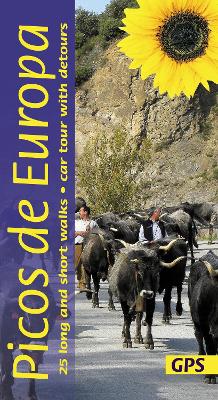
- Picos de Europa Guide: 25 long and short walks with detailed maps and GPS; car tour with pull-out map
- The go-to Picos de Europa travel guide for discovering the best walks and car tours. Strap on your boots and discover Picos de Europa on foot with the Sunflower Picos de Europa travel guide. And on the days when your feet may have had enough, enjoy some spectacular scenery on our recommended car tour. The Sunflower Picos de Europa guide is... Leer más
- Also available from:
- The Book Depository, United Kingdom
- De Zwerver, Netherlands
The Book Depository
United Kingdom
2022
United Kingdom
2022
- Picos de Europa Guide: 25 long and short walks with detailed maps and GPS; car tour with pull-out map
- The go-to Picos de Europa travel guide for discovering the best walks and car tours. Strap on your boots and discover Picos de Europa on foot with the Sunflower Picos de Europa travel guide. And on the days when your feet may have had enough, enjoy some spectacular scenery on our recommended car tour. The Sunflower Picos de Europa guide is... Leer más

De Zwerver
Netherlands
2022
Netherlands
2022
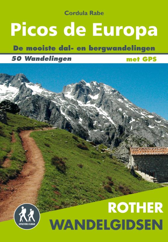
- Wandelgids Picos de Europa | Sunflower books
- The go-to Picos de Europa travel guide for discovering the best walks and car tours. Strap on your boots and discover Picos de Europa on foot with the Sunflower Picos de Europa travel guide. And on the days when your feet may have had enough, enjoy some spectacular scenery on our recommended car tour. The Sunflower Picos de Europa guide is... Leer más


The Book Depository
United Kingdom
United Kingdom

The Book Depository
United Kingdom
United Kingdom

Stanfords
United Kingdom
2017
United Kingdom
2017
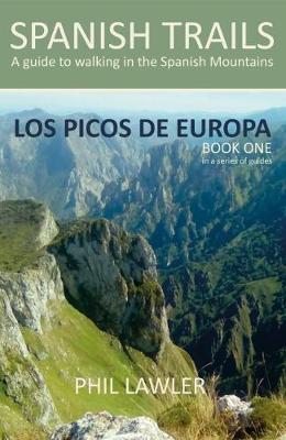
- Spanish Trails - A Guide to Walking the Spanish Mountains: Book one: Picos De Europa
- In this book Phil Lawler offers a wide selection of walks across the Picos de Europa in the majestic Cordillera Cantabrica, the Cantabrian Mountains, which run parallel with the Atlantic coastline in northern Spain. Phil has an intimate knowledge of this beautiful mountain range, as well as mountains in other parts of Spain. Many of the walks... Leer más
- Also available from:
- The Book Depository, United Kingdom
- De Zwerver, Netherlands

The Book Depository
United Kingdom
2017
United Kingdom
2017

Bol.com
Netherlands
Netherlands
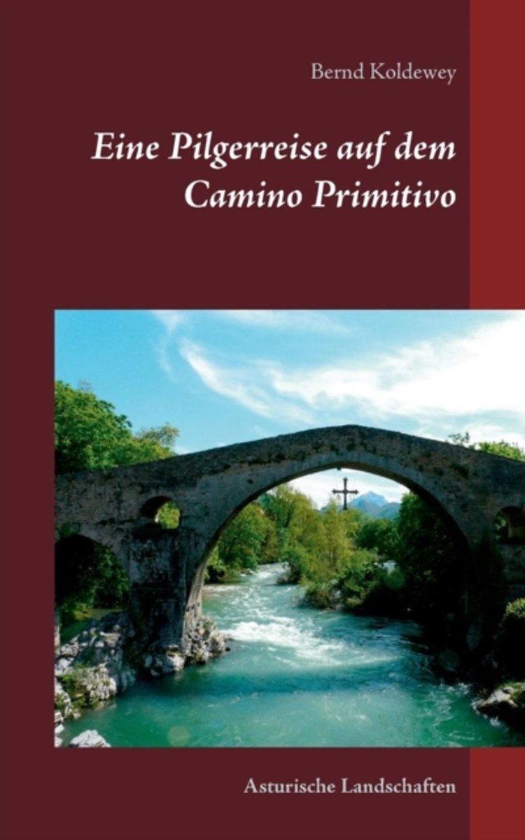
- Eine Pilgerreise Auf Dem Camino Primitivo
- Endlich war es wieder so weit, eine neue Pilgerreise in Spanien stand an. Anfang Mai 2013 machten wir uns auf den langen Weg nach Asturien. Von hier wollten wir den sogenannten ursprunglichen Jakobsweg den Camino Primitivo" erkunden. Er beginnt in Oviedo, der Hauptstadt des Furstentums Asturien und verlauft auf seinem 322 km langen Weg bis... Leer más
- Also available from:
- Bol.com, Belgium
Bol.com
Belgium
Belgium
- Eine Pilgerreise Auf Dem Camino Primitivo
- Endlich war es wieder so weit, eine neue Pilgerreise in Spanien stand an. Anfang Mai 2013 machten wir uns auf den langen Weg nach Asturien. Von hier wollten wir den sogenannten ursprunglichen Jakobsweg den Camino Primitivo" erkunden. Er beginnt in Oviedo, der Hauptstadt des Furstentums Asturien und verlauft auf seinem 322 km langen Weg bis... Leer más
Mapas
Stanfords
United Kingdom
United Kingdom
- Bachimala - Valles de Chistau y Bielsa Editorial Alpina
- Bachimala area of the High Pyrenees in Spain on a contoured and GPS compatible map at 1:25,000 from Editorial Alpina, with a booklet including English language descriptions of recommended walks, extensive accommodation list, etc. With the peak of Gran Bachimala towards the north-eastern corner of the map, coverage extends west to Bielsa and... Leer más

Stanfords
United Kingdom
United Kingdom
- Muntanya d’Alinyà Editorial Alpina
- Muntanya d’Alinyà, including Serra d’Aubenç and Serra de Turp, in an extensive and very popular series of walking maps from Editorial Alpina covering the Pyrenees, Catalonia and other selected hiking areas in Spain, including Picos de Europa, Sierra Nevada and parts of Andalucía, Majorca, etc. Scales vary from 1:50,000 to 1:10,000, with the... Leer más

Stanfords
United Kingdom
United Kingdom
- Montaña Palentina y Sur de la Liébana CNIG
- Montaña Palentina, just south-east of the Picos de Europa, on a contoured and GPS compatible map at 1:50,000 from IGN/CNIG with cartography from their topographic survey of Spain. The map has contours at 20m intervals enhanced by bold relief shading, plus colouring and graphics to show different types of vegetation. Mountain refuges are... Leer más

Stanfords
United Kingdom
United Kingdom
- Picos de Europa National Park - Anillo de Picos Adrados Map
- Picos de Europa National Park at 1:50,000 on an excellent, contoured and GPS compatible map from Adrados Ediciones highlighting three hiking routes which can be combined into a Tour of the Picos, plus English language descriptions of the routes and lists of mountain huts and refuges.The map covers the whole of the National Park area and extends... Leer más

Stanfords
United Kingdom
United Kingdom
- Landscapes along the River Ter Ed. Alpina 40K Map
- Landscapes along the River Ter map in an extensive and very popular series of walking maps from Editorial Alpina covering the Pyrenees, Catalonia and other selected hiking areas in Spain, including Picos de Europa, Sierra Nevada and parts of Andalucía, Majorca, etc. Scales vary from 1:50,000 to 1:10,000, with the majority of the titles at... Leer más

Stanfords
United Kingdom
United Kingdom
- Valles de Belagua y Roncal Editorial Alpina
- Valles de Belagua & Roncal in an extensive and very popular series of walking maps from Editorial Alpina covering the Pyrenees, Catalonia and other selected hiking areas in Spain, including Picos de Europa, Sierra Nevada and parts of Andalucía, Majorca, etc. Scales vary from 1:50,000 to 1:10,000, with the majority of the titles at 1:25,000. The... Leer más

Stanfords
United Kingdom
United Kingdom
- Picos de Europa National Park CNIG 3-Map/Guide Set SPANISH
- Picos de Europa, on a set of three double-sided, contoured and GPS-compatible maps at 1:25,000 from the Spanish civilian survey organization, prominently highlighting numerous hiking and sightseeing routes, plus a 240-page Spanish language guide with route descriptions, etc. Current edition of this title was published in 2015.The maps have... Leer más

Stanfords
United Kingdom
United Kingdom
- Vall de Barravés - Ribagorça Editorial Alpina
- Val de Barravés - Ribagorça at 1:25,000 in an extensive and very popular series of walking maps from Editorial Alpina covering the Pyrenees, Catalonia and other selected hiking areas in Spain, including Picos de Europa, Sierra Nevada and parts of Andalucía, Majorca, etc.Scales of maps in this series vary from 1:50,000 to 1:10,000, with the... Leer más

Stanfords
United Kingdom
United Kingdom
- Picos de Europa National Park CNIG 3-Map/Guide Set SPANISH
- Picos de Europa - English edition, on a set of three double-sided, contoured and GPS-compatible maps at 1:25,000 from the Spanish civilian survey organization, prominently highlighting numerous hiking and sightseeing routes, plus a 240-page English language guide with route descriptions, etc.The maps have cartography of Spain’s civilian... Leer más

Stanfords
United Kingdom
United Kingdom
- Picos de Europa National Park CNIG 3-Map/Guide Set ENGLISH
- Picos de Europa - English edition, on a set of three double-sided, contoured and GPS-compatible maps at 1:25,000 from the Spanish civilian survey organization, prominently highlighting numerous hiking and sightseeing routes, plus a 240-page English language guide with route descriptions, etc.The maps have cartography of Spain’s civilian... Leer más

Stanfords
United Kingdom
United Kingdom
- Val d`Aran by UTMB Editorial Alpina Trail running race Map
- Val d`Aran in an extensive and very popular series of walking maps from Editorial Alpina covering the Pyrenees, Catalonia and other selected hiking areas in Spain, including Picos de Europa, Sierra Nevada and parts of Andalucía, Majorca, etc. Scales vary from 1:50,000 to 1:10,000, with the majority of the titles at 1:25,000. The maps have... Leer más

Stanfords
United Kingdom
United Kingdom
- Picos de Europa - Central and East Massifs: Los Urrieles and Andara Adrados Map WATERPROOF
- Waterproof and tear-resistant edition of Picos de Europa Central and East: Massifs Los Urrieles and Andarra, a contoured and GPS compatible map at 1:25,000 from Adrados Ediciones with an exceptionally vivid presentation of the terrain, plus on the reverse a panorama drawing of the area, a list of summits and caves with GPS waypoints,... Leer más

Stanfords
United Kingdom
United Kingdom
- Spain North 500K CNIG 2
- The northern coast of Spain between Oviedo and Bilbao, with the Picos de Europa and extending inland to include León, Burgos and Palencia, at 1:500,000 in a series of regional road maps from the country’s civilian survey organization IGN-CNIG (Instituto Geográfico Nacional - Centro Nacional de Información Geográfica), vividly presenting the... Leer más
Stanfords
United Kingdom
United Kingdom
- Sant Llorenc del Munt i l`Obac Editorial Alpina
- Sant Llorenç del Munt i l`Obac area at 1:25,000 in an extensive and very popular series of walking maps from Editorial Alpina. Contours are at 10m intervals, enhanced by relief shading and vegetation colouring. The map has UTM grid and 1’ margin ticks. In addition to footpaths, the overprint shows various types of accommodation (hotels,... Leer más

Stanfords
United Kingdom
United Kingdom
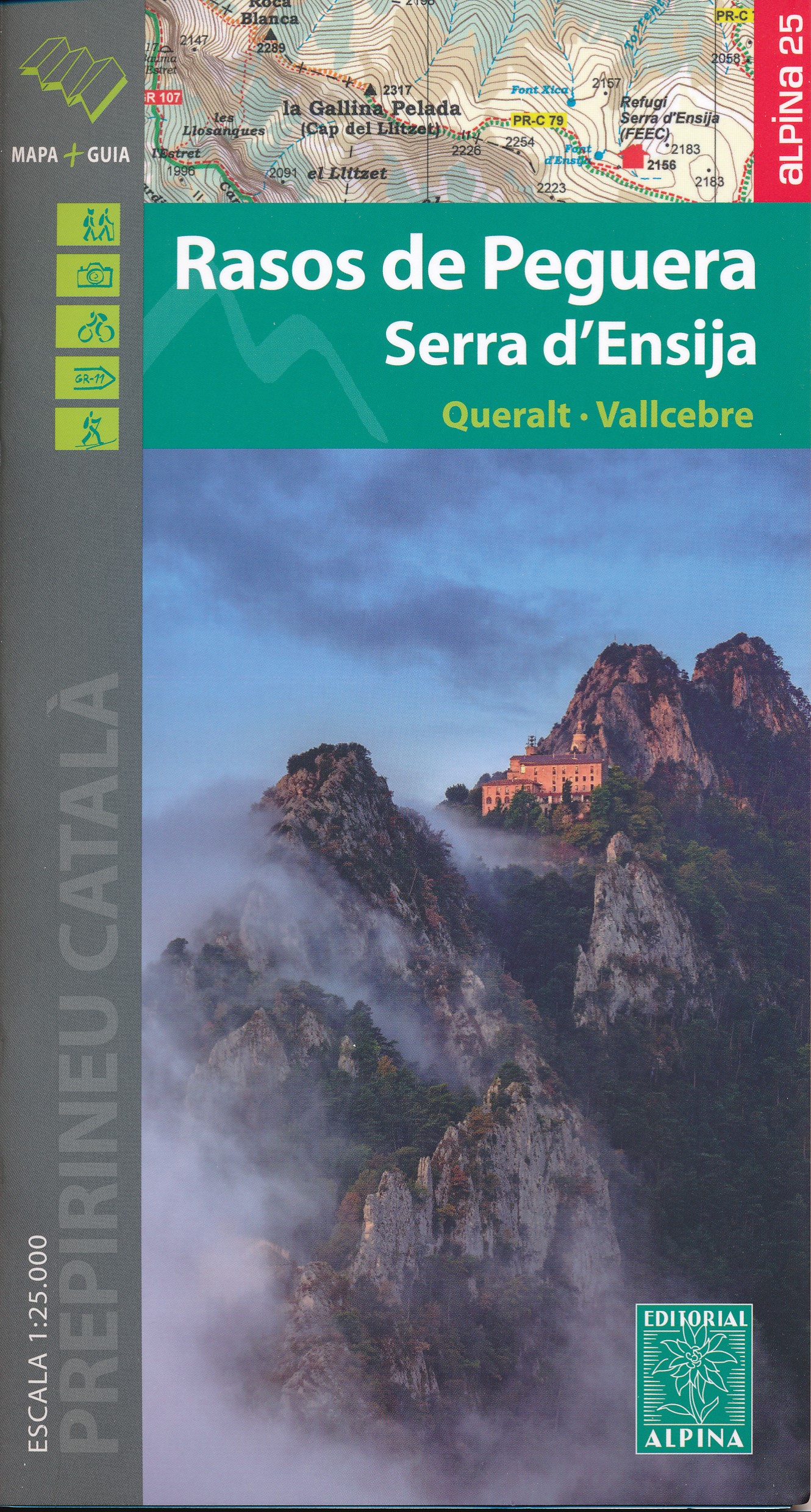
- Rasos de Peguera - Serra d`Ensija Editorial Alpina
- Rasos de Peguera - Serra d`Ensija in an extensive and very popular series of walking maps from Editorial Alpina covering the Pyrenees, Catalonia and other selected hiking areas in Spain, including Picos de Europa, Sierra Nevada and parts of Andalucía, Majorca, etc. Scales vary from 1:50,000 to 1:10,000, with the majority of the titles at... Leer más
- Also available from:
- The Book Depository, United Kingdom
- De Zwerver, Netherlands