
Hessen
Descripción
Senderos en estado
- Aar HöhenwegGPX
- AlemannenwegGPX
- Badener Weg
- Barbarossaweg GPX
- BonifatiuswegGPX
- BorgmannwegGPX
- Burgenweg Bergstrasse
- Burgundenweg
- BurgwaldpfadGPX
- Diemelsteig
- E1GPX
- E6GPX
- E8GPX
- Eder HöhenwegGPX
- ElisabethpfadGPX
- EselswegGPX
- Frankenweg Odenwald
- Frankfurter GrünGürtel Rundwanderweg
- Frau HollepfadGPX
- Fränkischer Rotwein WanderwegGPX
- FuldahöhenwegGPX
- HansawegGPX
- HerkuluswegGPX
- Hessenweg 1GPX
- Hessenweg 10GPX
- Hessenweg 11GPX
- Hessenweg 2GPX
- Hessenweg 3GPX
- Hessenweg 4GPX
- Hessenweg 5GPX
- Hessenweg 6GPX
- Hessenweg 7GPX
- Hessenweg 8GPX
- Hessenweg 9GPX
- KellerwaldsteigGPX
- Lahn Dill BerglandpfadGPX
- LöwenwegGPX
- LulluspfadGPX
- MärchenlandwegGPX
- RheinburgenwegGPX
- Rheingauer Riesling Routen
- RheinhöhenwegGPX
- RheinsteigGPX
- RothaarsteigGPX
- SchinderhannespfadGPX
- StudentenpfadGPX
- Taunus HöhenwegGPX
- Taunus-Rhön-WegGPX
- UplandsteigGPX
- Urwaldsteig EderseeGPX
- Vogelsberger Vulkansteig
- Vulkanring VogelsbergGPX
- Wanderweg der Deutschen EinheitGPX
- WesterwaldsteigGPX
- WildbahnGPX
Enlaces
Datos
Informes
Guías y mapas
Hospedaje
Organizaciones
Operadores turísticos
GPS
Otro
Libros

Stanfords
United Kingdom
United Kingdom
- Istria Kompass 238
- Istria at 1:75,000 on a double-sided, waterproof and tear-resistant, detailed contoured map from Kompass, with hiking and cycling routes, street plans of 10 main towns, plus tourist information. Coverage extends north beyond the Croatian border to include Trieste and the coast of Slovenia. Contours at 50m intervals and spot heights present the... Leer más

Stanfords
United Kingdom
United Kingdom
- Rhön Kompass 2-Map Set 460
- Rhön region of central Germany, straddling the borders between Bavaria, Hesse and Thuringia, in a set of two detailed, contoured and GPS compatible maps at 1:50,000 from Kompass with local and long-distance footpaths, cycling routes, accommodation, etc.KOMPASS HIKING & RECREATIONAL MAPS: this title is part of an extensive series covering... Leer más

Stanfords
United Kingdom
United Kingdom
- Spessart North - Bad Orb - Steinau - Burgsinn 35K Kümmerly + Frey Map No. 49
- Spessart North - Bad Orb - Steinau – Burgsinn area of Germany at 1:35,000 from Kümmerly+Frey in a series GPS compatible, double-sided maps printed on durable, waterproof and tear-resistant plastic paper; contoured, with hiking and cycle routes, other recreational activities, etc.Maps in this series are at a scale of either 1:50,000 or 1:35,000.... Leer más


De Zwerver
Netherlands
2015
Netherlands
2015
- Wandelgids Nibelungensteig | Conrad Stein Verlag
- OutdoorHandbuch. 1. Auflage. Leer más
De Zwerver
Netherlands
2010
Netherlands
2010
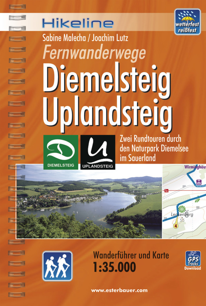
- Wandelgids Hikeline Diemelsteig, Uplandsteig | Esterbauer
- Handzame gids met een goede beschrijving van twee meerdaagse tochten in dit gebied. De gids is in spiraalbinding en elke pagina is op scheur- en watervast papier gedrukt. Daar is echt over nagedacht! Diemelsteig Der Diemelsteig als „jüngstes Kind“ in der Reihe der touristischen Attraktionen im Hochsauerland ist ein lohnender und prämierter... Leer más
De Zwerver
Netherlands
2016
Netherlands
2016
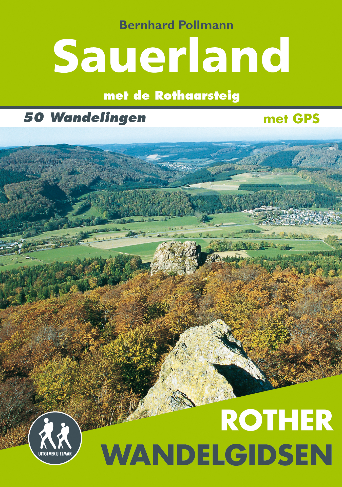
- Wandelgids Sauerland | Uitgeverij Elmar
- met de Rothaarsteig – 50 wandelingen Leer más
Bol.com
Netherlands
Netherlands
- Bayerische Rhön
- Die Mittelgebirgsregion im Grenzgebiet der Bundesländer Bayern, Hessen und Thüringen lockt insbesondere Naturliebhaber und Wanderer mit ihren einzigartigen Landschaften: Große Waldgebiete wechseln mit dunklen Hochmooren, klare Flüsse und einsame Hochflächen mit mächtigen Erhebungen wie dem Kreuzberg, dem heiligen Berg der Franken. Geschützt... Leer más
- Also available from:
- Bol.com, Belgium
Bol.com
Belgium
Belgium
- Bayerische Rhön
- Die Mittelgebirgsregion im Grenzgebiet der Bundesländer Bayern, Hessen und Thüringen lockt insbesondere Naturliebhaber und Wanderer mit ihren einzigartigen Landschaften: Große Waldgebiete wechseln mit dunklen Hochmooren, klare Flüsse und einsame Hochflächen mit mächtigen Erhebungen wie dem Kreuzberg, dem heiligen Berg der Franken. Geschützt... Leer más

Bol.com
Netherlands
Netherlands
- Hessens Schl sser und Burgen
- Die Landschaften Hessens zwischen Rhein, Schiefergebirge, Weserbergland, Werra, Rh n, Spessart und Odenwald k nnen auf eine lange Geschichte zur ckblicken. Im Verh ltnis zur Gr e des Bundeslandes ist die Anzahl der Burgruinen hier erstaunlich hoch, was darauf schlie en l sst, dass der Burgenbau in dieser Region bereits vom fr hen Mittelalter... Leer más
- Also available from:
- Bol.com, Belgium
Bol.com
Belgium
Belgium
- Hessens Schl sser und Burgen
- Die Landschaften Hessens zwischen Rhein, Schiefergebirge, Weserbergland, Werra, Rh n, Spessart und Odenwald k nnen auf eine lange Geschichte zur ckblicken. Im Verh ltnis zur Gr e des Bundeslandes ist die Anzahl der Burgruinen hier erstaunlich hoch, was darauf schlie en l sst, dass der Burgenbau in dieser Region bereits vom fr hen Mittelalter... Leer más
De Zwerver
Netherlands
2021
Netherlands
2021
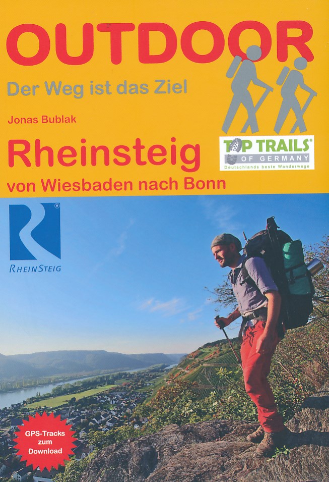
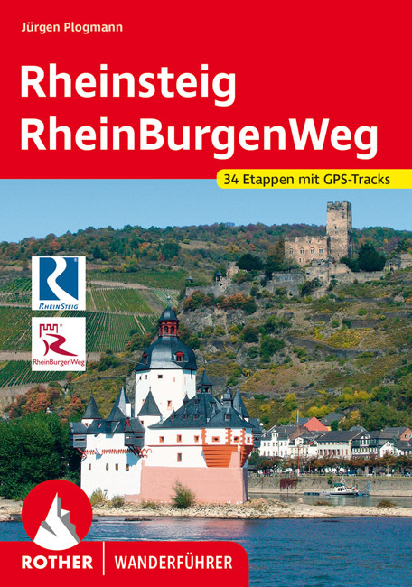
- Wandelgids Rheinsteig mit Rheinburgenweg und Rheinhöhenwegen | Rother Bergverlag
- Der romantische Mittelrhein zwischen Mainz/Wiesbaden und Bonn ist eine der spektakulärsten Landschaften Deutschlands und UNESCO-Welterbe. Neben dem Erleben der Natur trifft der Wanderer am Rhein auf viel Kultur, sehenswerte mittelalterliche Städte und die weltweit größte Burgendichte. In diesem Rother Wanderführer werden die wichtigsten... Leer más
De Zwerver
Netherlands
2016
Netherlands
2016
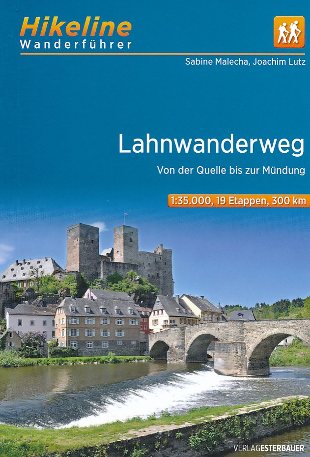
- Wandelgids Hikeline Lahnwanderweg | Esterbauer
- Handzame gids met een goede beschrijving van een groot aantal dagtochten in dit gebied. De gids is in spiraalbinding en elke pagina is op scheur- en watervast papier gedrukt. Daar is echt over nagedacht! Ein Wandertag auf dem Lahnwanderweg beginnt meist am Ufer der Lahn – oder an einem der zahlreichen Bahnhöfe entlang der Strecke. Der Wanderweg... Leer más
De Zwerver
Netherlands
2021
Netherlands
2021
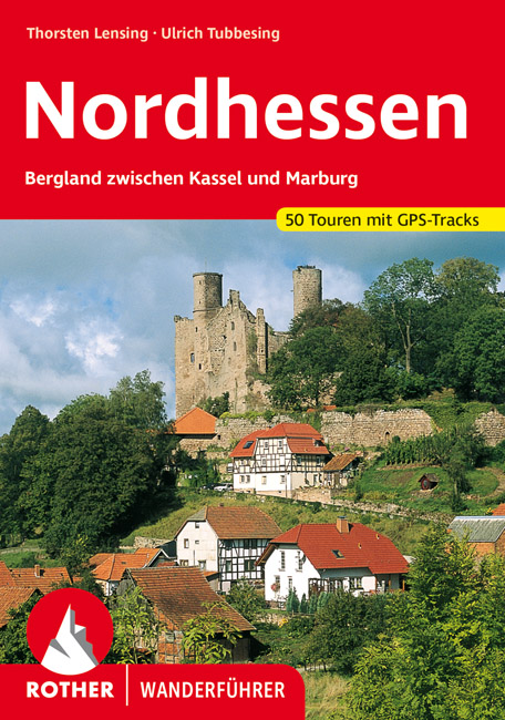
- Wandelgids Nordhessen | Rother Bergverlag
- Uitstekende wandelgids met een groot aantal dagtochten in dal en hooggebergte. Met praktische informatie en beperkt kaartmateriaal! Wandelingen in verschillende zwaarte weergegeven in rood/blauw/zwart. Im Herzen Deutschlands gelegen bildet das nordhessische Bergland zwischen Kassel und Marburg auf dem historischen Territorium des ehemaligen... Leer más
Bol.com
Netherlands
2019
Netherlands
2019
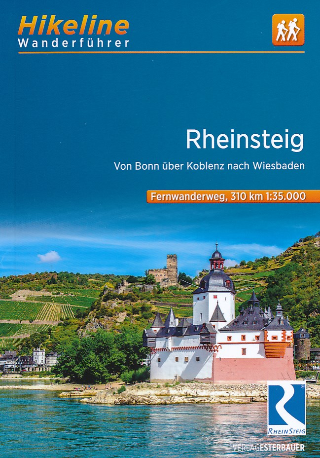
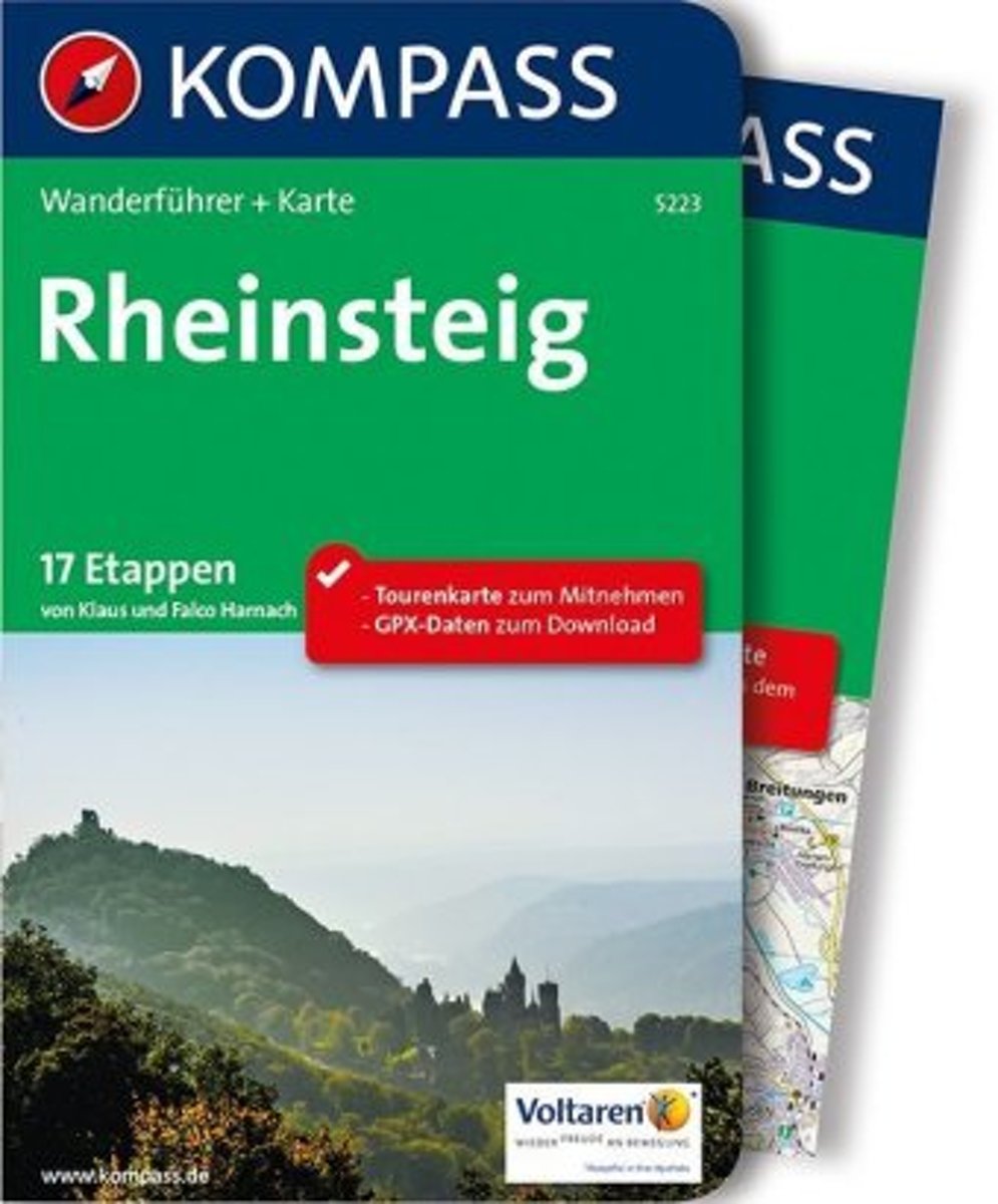
- WF5223 Rheinsteig Kompass
- De Kompass wandelgids + kaart geeft een overzicht van alle wandelroutes in het gebied met nauwkeurige routeaanwijzingen en hoogteaanduidingen, De extra grote kaart, schaal 1:35 000, is ideaal om van te voren uw route uit te stippelen en om onderweg te gebruiken • naast de bekende bestemmingen, worden ook de minder bekende vermeld • openbaar... Leer más
- Also available from:
- Bol.com, Belgium
- De Zwerver, Netherlands
Bol.com
Belgium
2019
Belgium
2019
- WF5223 Rheinsteig Kompass
- De Kompass wandelgids + kaart geeft een overzicht van alle wandelroutes in het gebied met nauwkeurige routeaanwijzingen en hoogteaanduidingen, De extra grote kaart, schaal 1:35 000, is ideaal om van te voren uw route uit te stippelen en om onderweg te gebruiken • naast de bekende bestemmingen, worden ook de minder bekende vermeld • openbaar... Leer más
De Zwerver
Netherlands
2019
Netherlands
2019
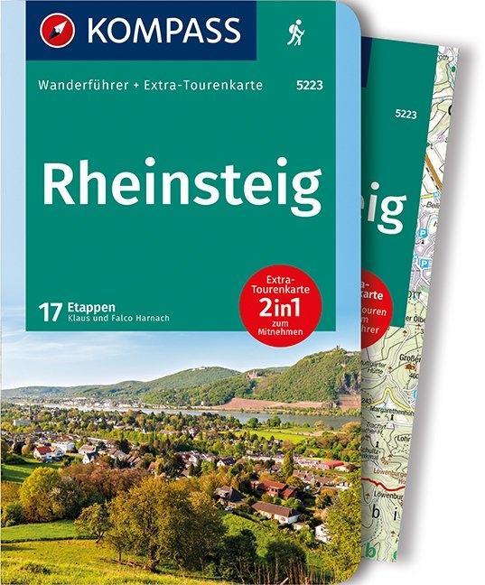
- Wandelgids 5223 Wanderführer Rheinsteig - Siebengebirge, Rheinisches Schiefergebirge, Taunus, Rheingau. | Kompass
- Wanderführer mit Extra Tourenkarte zum Mitnehmen. Leer más
Mapas

Stanfords
United Kingdom
United Kingdom
- Eastern Rhodopes / Rodopi Geopsis 131
- Eastern Rhodopes Mountains on the border of north-eastern Greece and Bulgaria on a waterproof and tear-resistant, contoured and GPS compatible map from Geopsis highlighting nine recommended hiking trails and the local section of the E6 cross-Europe long-distance route. All place names are in both Greek and Latin alphabet, with several villages... Leer más

Stanfords
United Kingdom
United Kingdom
- Western Rhodopes / Rodopi - Falakro Geopsis 133
- Central Rhodopes Mountains on the border of north-eastern Greece and Bulgaria on a waterproof and tear-resistant, contoured and GPS compatible map from Geopsis highlighting nine recommended hiking trails and the local section of the E6 cross-Europe long-distance route. All place names are in both Greek and Latin alphabet, with several villages... Leer más

Stanfords
United Kingdom
United Kingdom
- Central Rhodopes / Rodopi Geopsis 132
- Central Rhodopes Mountains on the border of north-eastern Greece and Bulgaria on a waterproof and tear-resistant, contoured and GPS compatible map from Geopsis highlighting nine recommended hiking trails and the local section of the E6 cross-Europe long-distance route. All place names are in both Greek and Latin alphabet, with several villages... Leer más

Stanfords
United Kingdom
United Kingdom
- Coburg - Upper Maintal
- Coburg - Upper Maintal on a waterproof, tear-resistant, GPS compatible cycling map at 1:75,000 from the ADFC (Allgemeiner Deutscher Fahrrad-Club - the official German cycling federation), in a series of maps with extensive overprint for long-distance and local cycling routes. GPS waypoints, route profiles, details of online links for... Leer más

Stanfords
United Kingdom
United Kingdom
- The Hochrhon Kompass 462
- Die Hochrhön area of the natural park straddling the border between Bavaria and Hesse on a detailed, GPS compatible map at 1:25,000 from Kompass with local and long-distance footpaths, cycling routes, accommodation, etc, printed on durable, waterproof and tear-resistant synthetic paper.KOMPASS HIKING & RECREATIONAL MAPS: this title is part of... Leer más

Stanfords
United Kingdom
United Kingdom
- Roman Border (Limes) in Rhineland-Palatinate: Rheinbrohl to Saalburg (Hessen)
- Hiking and cycling route along the ancient limes, the Upper Germanic-Rhaetian boundary of the Roman Empire, on a detailed, GPS compatible topographic map at 1:50,000 from the state survey of Rhineland-Palatinate. The route along the limes, one of the outstanding archaeological monuments in Central Europe and a UNESCO World Heritage site, is... Leer más

Stanfords
United Kingdom
United Kingdom
- Alta Valle del Lamone 22
- Map No. 22, Alta Valle del Lamone: Alto Appennino Faentino – Anello di Marradi, in series of contoured, GPS compatible hiking maps at 1:25,000 from the Istituto Geografico Adriatico, covering mainly the spine of the Apennines along the borders of Tuscany, Emilia-Romagna, Umbria and the Marches.Map in this series have contours at 25m intervals... Leer más

Stanfords
United Kingdom
United Kingdom
- Alta Valle del Santerno 23
- Map No. 22, Alta Valle del Lamone: Alto Appennino Faentino – Anello di Marradi, in series of contoured, GPS compatible hiking maps at 1:25,000 from the Istituto Geografico Adriatico, covering mainly the spine of the Apennines along the borders of Tuscany, Emilia-Romagna, Umbria and the Marches.Map in this series have contours at 25m intervals... Leer más

Stanfords
United Kingdom
2012
United Kingdom
2012
- Valia Kalda - Vasilitsa Anavasi 6.4
- Pindos: Valia Kalda - Vasilitsa area at 1:50,000in a series of waterproof and tear-resistant hiking maps from Anavasi with a UTM grid for GPS users. The map covers part of the northern Pindus highlands, extending northwards from Metsovo to well beyond Smixi, ski centre on the northern slpes of Mt. Vasilitsa. With Samarina on its western margin... Leer más

Stanfords
United Kingdom
United Kingdom
- Vogelsberg - North Wetterau 2-Map Set Kompass 846
- Vogelsberg - Nördliche Wetterau (No. 846), a detailed, GPS compatible map at 1:50,000 from Kompass with local and long-distance footpaths, cycling routes, accommodation, etc, printed on durable, waterproof and tear-resistant synthetic paper. KOMPASS HIKING & RECREATIONAL MAPS:This title is part of an extensive series covering Austria, much of... Leer más

Stanfords
United Kingdom
United Kingdom
- Colline di Forlí
- Map No. 127, Colline di Forlí, in a series of GPS compatible hiking maps at 1:50,000 from the Istituto Geografico Adriatico, covering parts of central Italy: eastern Tuscany, with northern Umbria and the Marches, plus the south-eastern of part of Emilia-Romagna.The maps have contours at 50m intervals with additional shading and numerous spot... Leer más

Stanfords
United Kingdom
United Kingdom
- Transrhodopi - Long distance hiking and biking trail From Trigrad to Ivaylovgrad
- Western Rhodope Mountains at 1:100,000 on a contoured GPS compatible map from Domino extending from just west of the Pirin National Park to Asenovgrad in the north-east. The map is double-sided with a good overlap between the sides. Topography is shown by contours at 50m intervals with relief shading and spot heights, plus colouring for... Leer más

Stanfords
United Kingdom
United Kingdom
- Istria K+F Outdoor Map
- Istria at 1:75,000 on a double-sided, durable, waterproof and tear-resistant, GPS compatible recreational map from Kümmerly + Frey, with street plans of Pula, Rovinj, Opatija, Umag, Novigrad, Porec and Vrsar. Topography is indicated by contours at 50m intervals, with relief shading and colouring for woodlands. Road network includes small local... Leer más

Stanfords
United Kingdom
United Kingdom
- Kassel - North Hesse Cycling Map
- Kassel - North Hesse on a waterproof, tear-resistant, GPS compatible cycling map at 1:75,000 from the ADFC (Allgemeiner Deutscher Fahrrad-Club - the official German cycling federation), in a series of maps with extensive overprint for long-distance and local cycling routes. GPS waypoints, route profiles, details of online links for information... Leer más
Stanfords
United Kingdom
United Kingdom
- Monte Fumaiolo - Monte Comero 18
- Map No. 18, Monte Fumaiolo - Alto Tevere, in series of contoured, GPS compatible hiking maps at 1:25,000 from the Istituto Geografico Adriatico, covering mainly the spine of the Apennines along the borders of Tuscany, Emilia-Romagna, Umbria and the Marches.Map in this series have contours at 25m intervals with additional shading and numerous... Leer más