
Allgäuer Alpen
Descripción

In the southernmost part of Germany, the Allgäuer Alps is a very popular hiking area. Here, Germany has a piece of beautiful alpine country. The region counts more than 40 huts, and numerous trails. The area is best accessible from the town of Oberstdorf. The Allgäuer Alps run into Austria, and border on the eastern side to the Lech Valley.
The Allgäuer Alps are green in nature, with plenty of alpine meadows (famous Allgäuer cheese). In the northwest lie the Allgäuer Voralpen, a beautiful and spacious area for those who do not want to walk too rough. The eastern ranges form the higher parts, with peaks up to 2600 meters. For those who like steep heights and some easy climbing, the Heilbronner Weg is recommended. This is a ridgewalk following the Austrian-German border.
Due to its popularity, you will find many (German) web sites specifically about this area.
Mapa


Senderos en región
Enlaces
Datos
Informes
Guías y mapas
Hospedaje
Organizaciones
Operadores turísticos
GPS
Otro
Libros

United Kingdom
2018
- Walking in the Bavarian Alps
- A comprehensive guidebook detailing walks in Germany`s Bavarian Alps. Lying along the German-Austrian border in a thin sliver of land roughly 300km long, this area contains some of the most spectacular walking and beautiful scenery that Germany has to offer. 70 graded walks explore mountain landscapes, wild mountain gorges and alpine meadows as... Leer más
- Also available from:
- The Book Depository, United Kingdom
- De Zwerver, Netherlands

United Kingdom
2018
- Walking in the Bavarian Alps
- 70 mountain walks and treks in southern Germany Leer más

Netherlands
2018
- Wandelgids Beieren - Walking in the Bavarian Alps | Cicerone
- Guidebook to mountain walks and treks in the Bavarian Alps, on the border of Germany and Austria, between Lake Constance and Berchtesgaden. Accessible from Munich, Salzburg and Innsbruck, these 70 routes range from half-day walks to 3-day hut-to-hut treks. Highlights include the Königssee and Breitach, Partnach and Höllental gorges. Leer más
Netherlands
2019
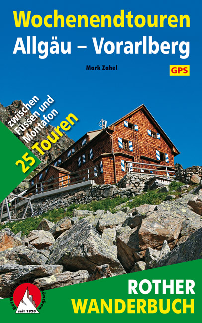
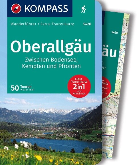
- Wandelgids Wochenendtouren Allgäu - Vorarlberg | Rother Bergverlag
- Een wandelgids met een mooie selectie van 25 twee-daagse tochten tussen Füssen en Montafon in Vorarlberg. Goed beschrijving met kaartmateriaal, hoogteprofielen, praktische informatie. Ein Kurzurlaub in den Bergen – wer denkt nicht ab und zu daran, sich eine kleine Auszeit in der Natur zu gönnen, und sei es nur für ein Wochenende! Da braucht es... Leer más

Netherlands
2022
- Wandelgids Maximiliansweg | Rother Bergverlag
- Bayerische Alpen - vom Bodensee zum Königssee. 21 Etappen. Mit GPS-Daten Rother Wanderführer. 1., Auflage. Leer más

Netherlands
2018
- Wandelgids Tourist route E4 in Bulgaria | Oilaripi
- Verrassend goede wandelgids van een deel van de E4 in Bulgarije. Goede kaarten, hoogteprofielen, prima beschrijvingen en praktische informatie maken het een volwaardige wandelgids die je in eerste instantie van dit gebied niet zou verwachten. Guidebook along the main ridge of the great alpine route E4 in Bulgaria, also known as �the fiv... Leer más

Netherlands
2019
- WF5966 Julische Alpen mit Karte Kompass
- De Kompass wandelgids + kaart geeft een overzicht van alle wandelroutes in het gebied met nauwkeurige routeaanwijzingen en hoogteaanduidingen, De extra grote kaart, schaal 1:35 000, is ideaal om van te voren uw route uit te stippelen en om onderweg te gebruiken; naast de bekende bestemmingen, worden ook de minder bekende vermeld; openbaar... Leer más
- Also available from:
- Bol.com, Belgium
Belgium
2019
- WF5966 Julische Alpen mit Karte Kompass
- De Kompass wandelgids + kaart geeft een overzicht van alle wandelroutes in het gebied met nauwkeurige routeaanwijzingen en hoogteaanduidingen, De extra grote kaart, schaal 1:35 000, is ideaal om van te voren uw route uit te stippelen en om onderweg te gebruiken; naast de bekende bestemmingen, worden ook de minder bekende vermeld; openbaar... Leer más
Netherlands
2015
- Allgäu
- Nicht nur die Allgäuer Alpen, auch das vorgelagerte Moränenland erfreut sich als Wanderregion großer Beliebtheit bei Einheimischen und Gästen. Es ist das Allgäu für Genießer, geprägt von einem sanften Tourismus; das Allgäu, wo sich Natur und Kultur begegnen. Eine Traumlandschaft mit vielen Facetten, in der man zur Ruhe kommt und Erholung tanken... Leer más
- Also available from:
- Bol.com, Belgium
- De Zwerver, Netherlands
Belgium
2015
- Allgäu
- Nicht nur die Allgäuer Alpen, auch das vorgelagerte Moränenland erfreut sich als Wanderregion großer Beliebtheit bei Einheimischen und Gästen. Es ist das Allgäu für Genießer, geprägt von einem sanften Tourismus; das Allgäu, wo sich Natur und Kultur begegnen. Eine Traumlandschaft mit vielen Facetten, in der man zur Ruhe kommt und Erholung tanken... Leer más
Netherlands
2021
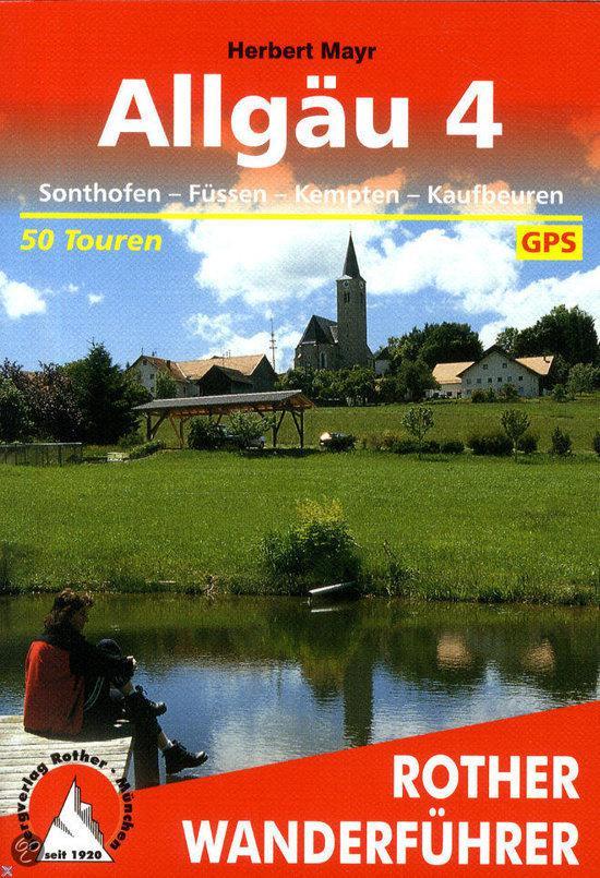
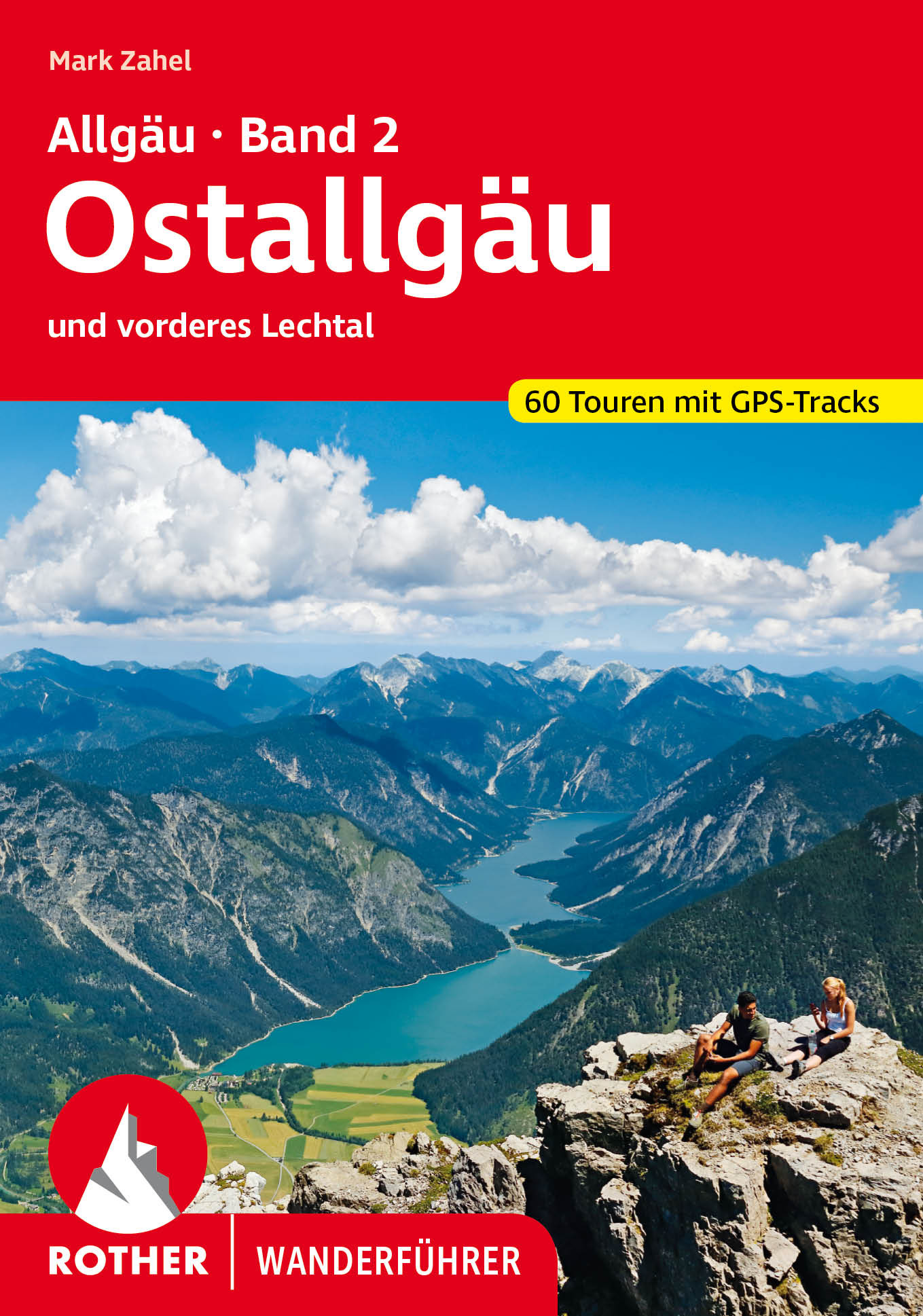
- Wandelgids 05 Allgäu 4 | Rother Bergverlag
- Uitstekende wandelgids met een groot aantal dagtochten in dal en hooggebergte. Met praktische informatie en beperkt kaartmateriaal! Wandelingen in verschillende zwaarte weergegeven in rood/blauw/zwart. Nicht nur die Allgäuer Alpen, auch das vorgelagerte Moränenland erfreut sich als Wanderregion großer Beliebtheit bei Einheimischen und Gästen.... Leer más
Netherlands
2023

Netherlands
2007
- Wandelgids Across the eastern alps: E5 | Cicerone
- From Lake Constance in Germany, this guidebook describes walking the E5 trek that runs 600km through a remarkable kaleidoscope of landscapes and culture in Switzerland, Austria and Italy, to its destination at Verona. It traverses the Allgauer, Lechtaler and Ötztaler Alps. There is a good network of alpine refuges and guesthouses on the route. Leer más

Netherlands
2022
- Wandelgids Munchen - Venetie, München - Venedig | Rother Bergverlag
- Beschrijving van een lange afstand pad dwars door de Alpen van Munchen naar Venetie: goede beschrijvingen van de etappes, kaarten redelijk. Die anspruchsvolle Alpenüberquerung von München nach Venedig verläuft auf einer der interessantesten aller möglichen Routen über das höchste Gebirge Europas. Im Herzen Münchens beginnt die Tour am... Leer más
Netherlands
- Winterwandern Allgäuer Alpen
- Winterwandern und Schneeschuhgehen - entspannende Freizeitaktivit ten, die sich zunehmender Beliebtheit erfreuen - bieten vor allem ein Erlebnis f r die Sinne. Harmonische Landschaftsformen in prickelnd klarer Luft, verzauberte Waldeinsamkeit, schweigende Gebirgst ler, heimelige Bergh tten, eins werden mit der Natur: Welches Gel nde k nnte sich... Leer más
- Also available from:
- Bol.com, Belgium
Belgium
- Winterwandern Allgäuer Alpen
- Winterwandern und Schneeschuhgehen - entspannende Freizeitaktivit ten, die sich zunehmender Beliebtheit erfreuen - bieten vor allem ein Erlebnis f r die Sinne. Harmonische Landschaftsformen in prickelnd klarer Luft, verzauberte Waldeinsamkeit, schweigende Gebirgst ler, heimelige Bergh tten, eins werden mit der Natur: Welches Gel nde k nnte sich... Leer más
Mapas

United Kingdom
- Styrian Winelands - Southwest Styria F&B WK411
- Styrian Winelands area south-eastern Austria presented at 1:50,000 in a series of contoured and GPS compatible outdoor leisure map from Freytag & Berndt with hiking and cycling routes, mountain huts, campsites and youth hostels, local bus stops, plus other tourist information. To see the list of currently available titles in this series please... Leer más

United Kingdom
- Goms - Aletsch
- Goms - Aletsch area of the Bernese Oberland at 1:50,000 in a series from Hallwag covering Switzerland’s popular hiking regions on light, waterproof and tear-resistant maps highlighting long-distance paths: the nine national routes plus special regional routes, as well as other local hiking trails.Cartography is similar to that used both in... Leer más

United Kingdom
- Transrhodopi - Long distance hiking and biking trail From Trigrad to Ivaylovgrad
- Western Rhodope Mountains at 1:100,000 on a contoured GPS compatible map from Domino extending from just west of the Pirin National Park to Asenovgrad in the north-east. The map is double-sided with a good overlap between the sides. Topography is shown by contours at 50m intervals with relief shading and spot heights, plus colouring for... Leer más

United Kingdom
- Cinque Terre - Golfo del Tigullio: La Spezia - Sestri Levante - Rapallo - Genoa 50K IGC Map No. 23
- Cinque Terre - Golfo del Tigullio area of the Italian Riviera from genoa to la Spezia including Sestri Levante and Rapallo in a series contoured hiking maps at 1:50,000 with local trails, long-distance footpaths, mountain accommodation, etc. from the Turin based Istituto Geografico Centrale.Maps in this series have contours at 50m intervals,... Leer más

United Kingdom
- Kempten - Allgau - Immenstadt - Bad Grönenbach K+F Outdoor Map 46
- Kempten - Allgau area of the German Alps at 1:35,000 from Kümmerly+Frey in a series GPS compatible, double-sided maps printed on durable, waterproof and tear-resistant plastic paper; contoured, with hiking and cycle routes, other recreational activities, etc.Maps in this series are at a scale of either 1:50,000 or 1:35,000. Contour interval... Leer más

United Kingdom
- Val Venosta / Vinschgau K+F Outdoor Map 1
- Val Venosta / Vinschgau area in the Dolomites at 1:50,000 in a series of waterproof and tear-resistant, GPS compatible and contoured recreational maps from Kümmerly + Frey with both local and long-distance hiking and cycling trails, ski routes, sites for other outdoor pursuits, accommodation, bus stops, etc. Coverage includes the Ortles/Ortler... Leer más

United Kingdom
- Allgau Alps UK50-47
- Allgäuer Alps, map No. UKL50-47 covering an area around Sonthofen, Oberstdorf, Kleinwalsertal and Lechtal, in a series of special contoured and GP-compatible recreational maps from the Bavarian state survey organization, with cartography of the German topographic survey at 1:50,000 and extensive additional tourist overprint highlighting... Leer más

United Kingdom
- Olympus Geopsis 139
- Mt Olympus in a series of waterproof and tear-resistant hiking maps at scales varying from 1:50,000 to 1:10,000, with a UTM grid for GPS users. Contour interval varies depending on the scale, on most maps it is 20m. Relief shading, spot heights, springs, seasonal streams and, in most titles, landscape/land-use variations, e.g. forests,... Leer más

United Kingdom
- Allgäu Cycling Map
- Allgau on a waterproof, tear-resistant, GPS compatible cycling map at 1:75,000 from the ADFC (Allgemeiner Deutscher Fahrrad-Club - the official German cycling federation), in a series of maps with extensive overprint for long-distance and local cycling routes. GPS waypoints, route profiles, details of online links for information about... Leer más

United Kingdom
- E4 Arquipelago de Cabo Verde
- Plans included:Porto Novo (Ilha de Santo Antão) (1:10 000)Mindelo (Porto Grande) (Ilha de São Vicente) (1:20 000)Ilha de Santa Luzia (1:not known)Porto de Tarrafal (Ilha de São Nicolau) (1:8500)Porto da Preguiça (Ilha de São Nicolau) (1:8500)Baía da Palmeira (Ilha do Sal) (1:15 000)Porto de Sal-Rei (Ilha da Boavista) (1:30 000)Porto da Praia... Leer más

United Kingdom
- Lake Maggiore - Lake Orta - Lake Varese K+F Outdoor Map 8
- Lake Maggiore - Lake Orta - Lake Varese area at 1:50,000 in a series of waterproof and tear-resistant, GPS compatible and contoured recreational maps from Kümmerly + Frey with both local and long-distance hiking and cycling trails, ski routes, sites for other outdoor pursuits, accommodation, bus stops, etc. An inset provides a small road map of... Leer más

United Kingdom
- Hungarian National Long-distance Blue Trail (E4): Visegrad to Irott-ko
- Hiking guide to the north-western section of Hungary’s National Blue Trail which forms part of the E4 European long-distance footpath. The guide covers the route from the historic town of Visegrád on the Danube, across the Buda Hills on the outskirts of Budapest and the Bakony Hills along the north-eastern shore of Lake Balaton, to Írott-ko in... Leer más

United Kingdom
- Allgäuer Voralpen Ost - Grünten - Wertacher Hörnle Alpenverein BY3
- Allgäuer Voralpen Ost - Grünten - Wertacher Hörnle area, map No. BY 3, in a series of highly detailed, GPS compatible hiking maps at 1:25,000 of the German Alps published by the Deutscher Alpenverein, the German Alpine Club, with cartography of the German topographic survey from the Bavarian state survey organization. The maps use the survey’s... Leer más

United Kingdom
- Peloponnese Anavasi Road Atlas
- Road Atlas of the Peloponnese from Anavasi, in an A4 paperback format, with contoured, GPS compatible mapping at 1:50,000, very detailed road classification, hiking paths, and place names in both Greek and Latin alphabets.The main section of the atlas has 178 pages of detailed maps with contours at 100m intervals, altitude colouring and relief... Leer más

United Kingdom
- Lake Como K+F Outdoor Map 9
- Lake Como area at 1:50,000 on a double-sided, waterproof and tear-resistant, GPS compatible and contoured recreational maps from Kümmerly + Frey with both local and long-distance hiking and cycling trails, ski routes, sites for other outdoor pursuits, accommodation, bus stops, etc. Coverage includes the northern part of Lake Lugano and extends... Leer más